SUMMARY
This is AI generated summarization, which may have errors. For context, always refer to the full article.
What’s the weather like in your area? Report the situation through Rappler’s Agos or tweet us at @rapplerdotcom.
MANILA, Philippines – The state weather bureau urged residents of areas in Tropical Depression Samuel’s path to prepare, as it is expected to bring heavy rain and intensify into a tropical storm.
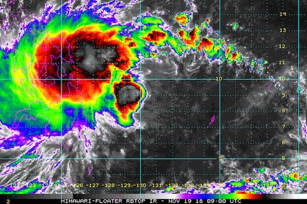
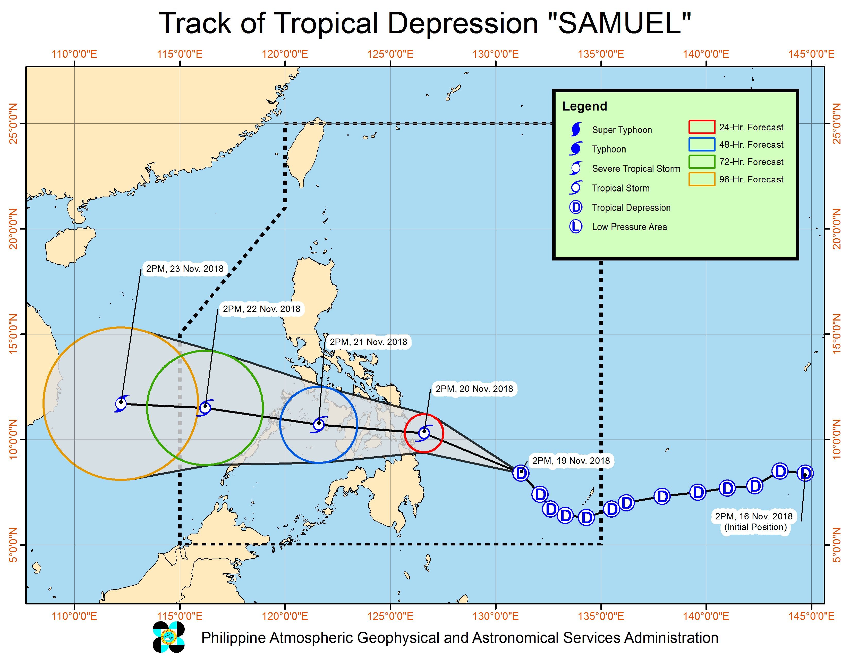
In a press briefing past 5 pm on Monday, November 19, the Philippine Atmospheric, Geophysical, and Astronomical Services Administration (PAGASA) said Samuel is already 505 kilometers east of Hinatuan, Surigao del Sur, still located over the Philippine Sea.
It is now moving northwest at a faster 25 kilometers per hour (km/h) from the previous 15 km/h.
The tropical depression continues to have maximum winds of 55 km/h and gustiness of up to 65 km/h. But it is expected to strengthen within the next 24 hours.
Signal No. 1 is now raised in:
- Masbate
- Samar
- Eastern Samar
- Biliran
- Leyte
- Southern Leyte
- Bohol
- Cebu
- Siquijor
- Negros Oriental
- Negros Occidental
- Surigao del Norte
- Surigao del Sur
- Agusan del Norte
- Agusan del Sur
- Dinagat Islands
- Misamis Oriental
- Camiguin

Samuel is expected to make landfall in the Eastern Visayas-Caraga area on Tuesday afternoon or evening, November 20.
PAGASA warned that moderate to heavy rain may trigger flash floods and landslides in Caraga, Eastern Visayas, Central Visayas, Negros Occidental, Davao Oriental, Compostela Valley, Bukidnon, Misamis Oriental, and Camiguin.
Residents of those areas should be on alert, especially if they live near rivers, in low-lying communities, or in mountainous regions. (READ: FAST FACTS: Tropical cyclones, rainfall advisories)
“Maaari pong hindi natin nakikita sa ngayon ‘yung eksaktong volume [of rainfall] pero may bagyo po tayong parating…. Madala na po tayo doon sa mga previous na nangyari, kaya kailangan po maging aktibo tayo at mag-monitor…. Huwag po natin itong balewalain,” said PAGASA Weather Division chief Esperanza Cayanan in the press briefing.
(We may not see the exact volume of rainfall now but we have an approaching tropical cyclone…. We should learn our lesson from what happened in the past, so we should be active now and we should monitor…. Don’t take this lightly.)
PAGASA Administrator Vicente Malano also emphasized in the press briefing that while winds may not be very fierce, the intense rain expected from Samuel could bring hazards.
“Nagwa-warning na nga tayo…. Nagbigay na po tayo ng flood advisories lalong-lalo na po doon sa Visayas at tsaka Caraga at Northern Mindanao,” Malano said.
(That’s why we’re issuing warnings…. We’ve given flood advisories especially in the Visayas, Caraga, and Northern Mindanao.)
Classes have been suspended in parts of the Visayas and Mindanao for Tuesday. (READ: #WalangPasok: Class suspensions, Tuesday, November 20)
Fishermen and others with small sea vessels are also advised not to set sail in areas under Signal No. 1 and in the eastern and southern seaboards of Mindanao.
A gale warning was issued at 5 pm on Monday for Davao Oriental and Davao Occidental.
Seas off those areas are rough to very rough, with wave heights reaching 2.6 meters to 4.5 meters.
If Samuel maintains its speed, it would exit the Philippine Area of Responsibility either on Thursday evening, November 22, or on Friday morning, November 23.
Samuel is the Philippines’ 19th tropical cyclone for 2018. The country usually gets an average of 20 tropical cyclones per year. (READ: LIST: PAGASA’s names for tropical cyclones in 2018)
Meanwhile, the northeast monsoon or hanging amihan will continue to trigger isolated light rains in the Ilocos Region, Cordillera Administrative Region, Cagayan Valley, and Central Luzon on Tuesday. But PAGASA said there will be “no significant impact.”
The rest of Luzon will only have localized thunderstorms on Tuesday. But flash floods and landslides are possible if the thunderstorms become severe.
PAGASA declared the start of the rainy season last June 8. – Rappler.com
Add a comment
How does this make you feel?
There are no comments yet. Add your comment to start the conversation.