SUMMARY
This is AI generated summarization, which may have errors. For context, always refer to the full article.
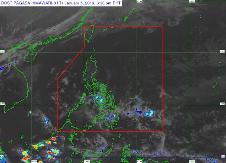
MANILA, Philippines – The tail-end of a cold front will affect Mindanao, while the northeast monsoon or hanging amihan will affect Luzon and Visayas on Sunday, January 6.
In a 4 pm bulletin on Saturday, January 5, the Philippine Atmospheric, Geophysical, and Astronomical Services Administration (PAGASA) said Mindanao will have scattered rainshowers and thunderstorms caused by both weather conditions.
The state weather bureau reminds residents in Mindanao to stay alert for possible flash floods or landslides brought by the rain.
Meanwhile, the northeast monsoon will bring light to moderate rain in Visayas and Palawan, and isolated light rains in Metro Manila and the rest of Luzon.
PAGASA does not expect any “significant impact” from the rain in these areas. (FAST FACTS: Tropical cyclones, rainfall advisories)
Due to the surge of the northeast monsoon, PAGASA issued a separate gale warning for Camarines Norte, Camarines Sur, Catanduanes, the eastern coast of Albay, the eastern coast of Sorsogon, Northern Samar, Eastern Samar, the eastern coast of Surigao del Norte including Siargao Island, Surigao del Sur, Davao Oriental, and Dinagat Islands.
Seas off those areas are rough to very rough, with wave heights reaching 2.8 meters to 4.5 meters.
PAGASA advised fishermen and others with small vessels not to set sail in areas covered by the gale warning. Larger vessels should watch out for big waves.
PAGASA is not monitoring any tropical cyclone at the moment. The forecast for January is zero to one tropical cyclone.
The Philippines gets an average of 20 tropical cyclones per year. – Rappler.com
Add a comment
How does this make you feel?
![[ANALYSIS] A new advocacy in race to financial literacy](https://www.rappler.com/tachyon/2024/04/advocacy-race-financial-literacy-April-19-2024.jpg?resize=257%2C257&crop_strategy=attention)


![[In This Economy] Can the PH become an upper-middle income country within this lifetime?](https://www.rappler.com/tachyon/2024/04/tl-ph-upper-income-country-04052024.jpg?resize=257%2C257&crop=295px%2C0px%2C720px%2C720px)
There are no comments yet. Add your comment to start the conversation.