SUMMARY
This is AI generated summarization, which may have errors. For context, always refer to the full article.
What’s the weather like in your area? Tweet us at @rapplerdotcom.
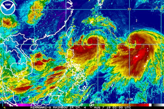
MANILA, Philippines – Typhoon Hanna (Lekima) strengthened further and slowed down late Wednesday morning, August 7, as it continued to enhance the southwest monsoon or hanging habagat.
In a briefing at 11 am on Wednesday, the Philippine Atmospheric, Geophysical, and Astronomical Services Administration (PAGASA) said Hanna now has maximum winds of 130 kilometers per hour (km/h) from the previous 120 km/h and gustiness of up to 160 km/h from the previous 150 km/h.
The typhoon is 630 kilometers east of Basco, Batanes, only a 5-kilometer shift from its previous location, since it is moving slowly in a north northwest direction – even slower than its previous speed of 10 km/h.
Hanna will not make landfall in the Philippines. Signal No. 1, however, remains raised in:
- Batanes
- Babuyan Group of Islands
PAGASA warned that Hanna’s outer rainbands will bring light to heavy rain and gusty winds to Batanes and the Babuyan Group of Islands on Wednesday and on Thursday, August 8.
The southwest monsoon enhanced by the typhoon will also trigger more rain. Below is the expected rainfall.
Wednesday, August 7
- Moderate to heavy monsoon rain
- northern part of Palawan including Calamian and Cuyo islands
- Occidental Mindoro
- Oriental Mindoro
- Romblon
- Zambales
- Bataan
- Aklan
- Antique
- Iloilo
- Guimaras
- Light to heavy rain
- rest of Luzon
- rest of Western Visayas
Thursday, August 8
- Moderate to heavy monsoon rain
- Metro Manila
- Ilocos Region
- Cordillera Administrative Region
- Zambales
- Bataan
- Rizal
- Cavite
- Laguna
- Batangas
- Occidental Mindoro
- Oriental Mindoro
- northern part of Palawan including Calamian and Cuyo islands
- Light to heavy rain
- rest of Luzon
- Western Visayas
“Bagamat magkakaron ng breaks in between…chances are may mga pag-ulan pa rin tayong inaasahan dito sa Metro Manila at dito nga sa natitirang bahagi ng Luzon at Visayas for the rest of the day,” said PAGASA Senior Weather Specialist Chris Perez.
(Though there will be breaks in between…chances are we’ll still have rain here in Metro Manila and in the rest of Luzon and the Visayas for the rest of the day.)
PAGASA advised residents to stay on alert for possible flash floods and landslides. (READ: FAST FACTS: Tropical cyclones, rainfall advisories)
It also warned that western sections of Luzon and the Visayas will experience occasional gusty conditions due to the enhanced southwest monsoon.
Classes were again suspended in some areas for Wednesday. (READ: #WalangPasok: Class suspensions, Wednesday, August 7, 2019)
PAGASA also warned fishermen and others with small vessels not to venture out into the seaboards of areas under Signal No. 1, seaboards of Luzon and the Visayas, and northern and eastern seaboards of Mindanao.
Based on Hanna’s latest forecast track, it is expected to leave the Philippine Area of Responsibility (PAR) on Friday, August 9.
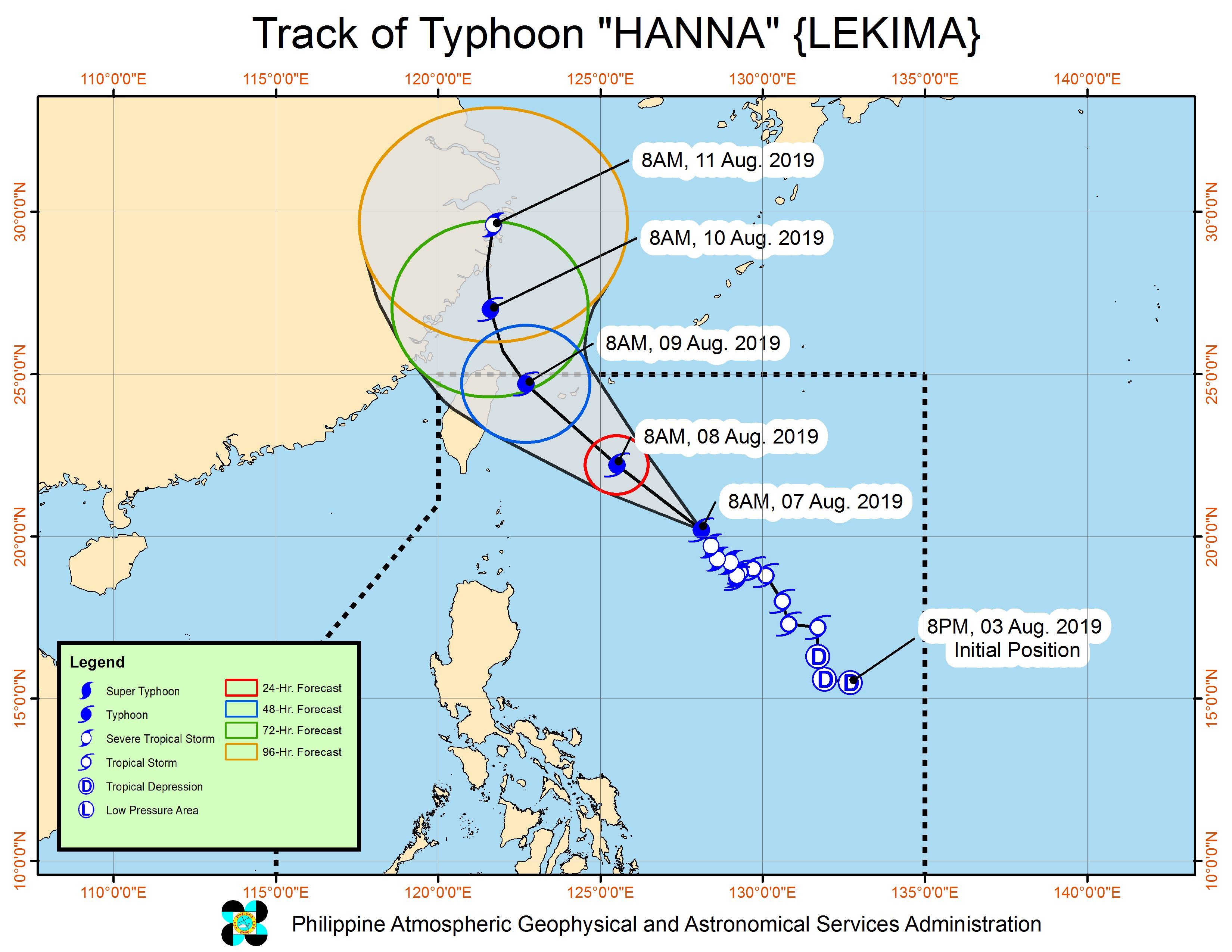
Hanna is the Philippines’ 8th tropical cyclone for 2019, and the 1st for the month of August. It is also the country’s 1st tropical cyclone to reach typhoon status in 2019. (READ: LIST: PAGASA’s names for tropical cyclones in 2019)
Aside from Hanna, PAGASA continues to monitor two other weather systems:
- low pressure area (LPA) inside PAR
- Severe Tropical Storm Krosa outside PAR
The LPA inside PAR is now 325 kilometers west of Dagupan City, Pangasinan. PAGASA said it is unlikely to develop into a tropical depression, at least within the next 24 hours.
Meanwhile, Krosa intensified from a tropical storm into a severe tropical storm. It now has maximum winds of 95 km/h from the previous 75 km/h and gustiness of up to 115 km/h from the previous 90 km/h.
Krosa is already 2,055 kilometers east of extreme Northern Luzon, moving north northwest at 15 km/h.
The severe tropical storm is unlikely to enter PAR, according to PAGASA.
“Pero posible na sa mga darating na araw, habang kumikilos ito pa-hilaga, and itong si Hanna, kapag nakalagpas na ng ating area of responsibility, posibleng ‘yung combined effect nito ay patuloy pa ring pag-ibayuhin ‘yung habagat na siyang makakaapekto sa ating bansa sa susunod na 3 to 5 days. So mag-antabay din po sa update natin,” said Perez.
(But it’s possible that in the coming days, while Krosa is moving north, and Hanna, once it is outside our area of responsibility, it’s possible that their combined effect would be to enhance the southwest monsoon which would affect our country in the next 3 to 5 days. So continue monitoring our updates.)
The country gets an average of 20 tropical cyclones annually, but since 2019 is an El Niño year, only 14 to 18 tropical cyclones are expected.
Below is the estimated number of tropical cyclones from August to December:
- August – 2 to 4
- September – 2 to 4
- October – 2 or 3
- November – 1 or 2
- December – 0 or 1
PAGASA declared the start of the rainy season last June 14. – Rappler.com
Add a comment
How does this make you feel?
There are no comments yet. Add your comment to start the conversation.