SUMMARY
This is AI generated summarization, which may have errors. For context, always refer to the full article.
What’s the weather like in your area? Tweet us at @rapplerdotcom.
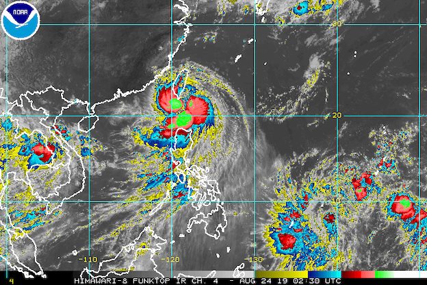
MANILA, Philippines – Severe Tropical Storm Ineng (Bailu) is now heading for the southern part of Taiwan after making a close approach to Batanes, but rain will still continue due to the weather system’s wide diameter.
In a briefing past 11 am on Saturday, August 24, the Philippine Atmospheric, Geophysical, and Astronomical Services Administration (PAGASA) said Ineng is already 140 kilometers north northwest of Basco, Batanes.
It continues to move west northwest at a relatively fast 30 kilometers per hour (km/h), crossing the Bashi Channel between the Philippines and Taiwan.
The severe tropical storm did not make landfall in the Philippines, but it is poised to hit Taiwan’s southern tip.
Ineng still has maximum winds of 100 km/h and gustiness of up to 125 km/h. It is not expected to intensify into a typhoon.
The following tropical cyclone wind signals remain raised:
Signal No. 2 (winds of 61 km/h to 120 km/h)
- Batanes
- Babuyan Group of Islands
Signal No. 1 (winds of 30 km/h to 60 km/h)
- Cagayan
- Isabela
- Apayao
- Kalinga
- northern part of Abra
- Ilocos Norte
Areas under Signal Nos. 1 and 2 have been experiencing strong winds and heavy rain.
Ineng is also enhancing the southwest monsoon or hanging habagat, which is another source of rain.
On Saturday, the following areas are experiencing rain from Ineng and/or the southwest monsoon:
Moderate to heavy rain
- Ilocos Region
- Cordillera Administrative Region
- Batanes
- Cagayan including Babuyan Group of Islands
- Zambales
- Bataan
- Occidental Mindoro
- Oriental Mindoro
- northern part of Palawan including Calamian and Cuyo islands
- Aklan
- Antique
Light to heavy rain
- Metro Manila
- Cavite
- Laguna
- Batangas
- Rizal
- rest of Cagayan Valley
- rest of Central Luzon
- Iloilo
- Guimaras
Residents of those areas must stay on alert for flash floods and landslides. Floods were already reported in some areas, such as in Ilocos Norte. (READ: FAST FACTS: Tropical cyclones, rainfall advisories)
Travel is also risky in the seaboards of areas under Signal Nos. 1 and 2, as well as in the seaboards of Luzon.
Based on its latest forecast track, Ineng will leave the Philippine Area of Responsibility (PAR) on Saturday afternoon.
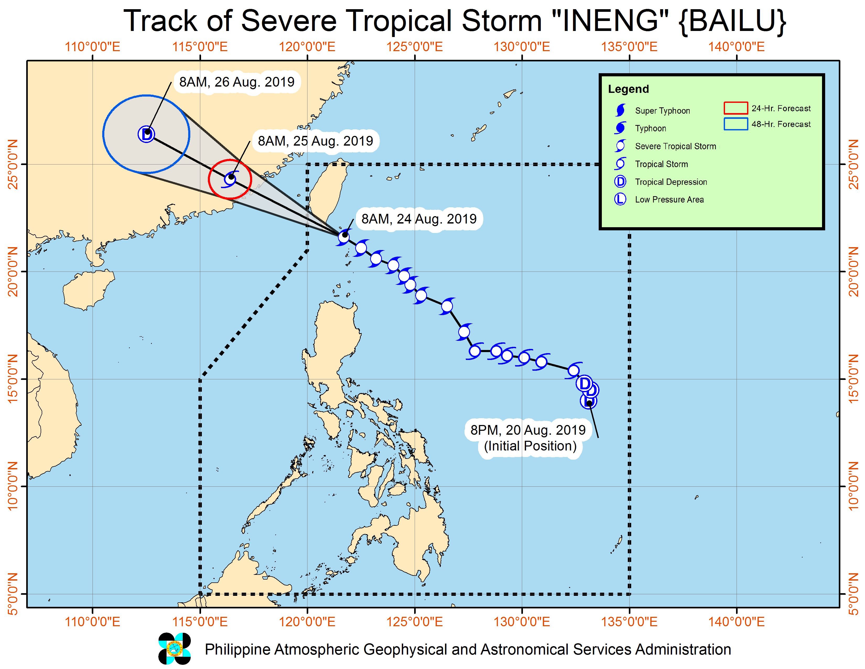
Meanwhile, PAGASA is also monitoring a low pressure area (LPA) outside PAR. This LPA is 1,835 kilometers east of Mindanao and could enter PAR by Monday, August 26. Updates will be given in the coming days.
Ineng is the Philippines’ 9th tropical cyclone for 2019 and the 2nd for August. (READ: LIST: PAGASA’s names for tropical cyclones in 2019)
The country gets an average of 20 tropical cyclones annually, but since 2019 is an El Niño year, only 14 to 18 tropical cyclones are expected.
Below is the estimated number of tropical cyclones from August to December:
- August – 2 to 4
- September – 2 to 4
- October – 2 or 3
- November – 1 or 2
- December – 0 or 1
PAGASA declared the start of the rainy season last June 14. – Rappler.com
Add a comment
How does this make you feel?
There are no comments yet. Add your comment to start the conversation.