SUMMARY
This is AI generated summarization, which may have errors. For context, always refer to the full article.
What’s the weather like in your area? Tweet us at @rapplerdotcom.
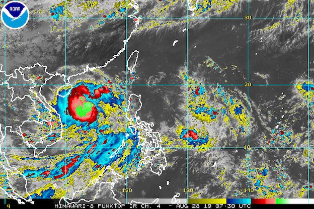
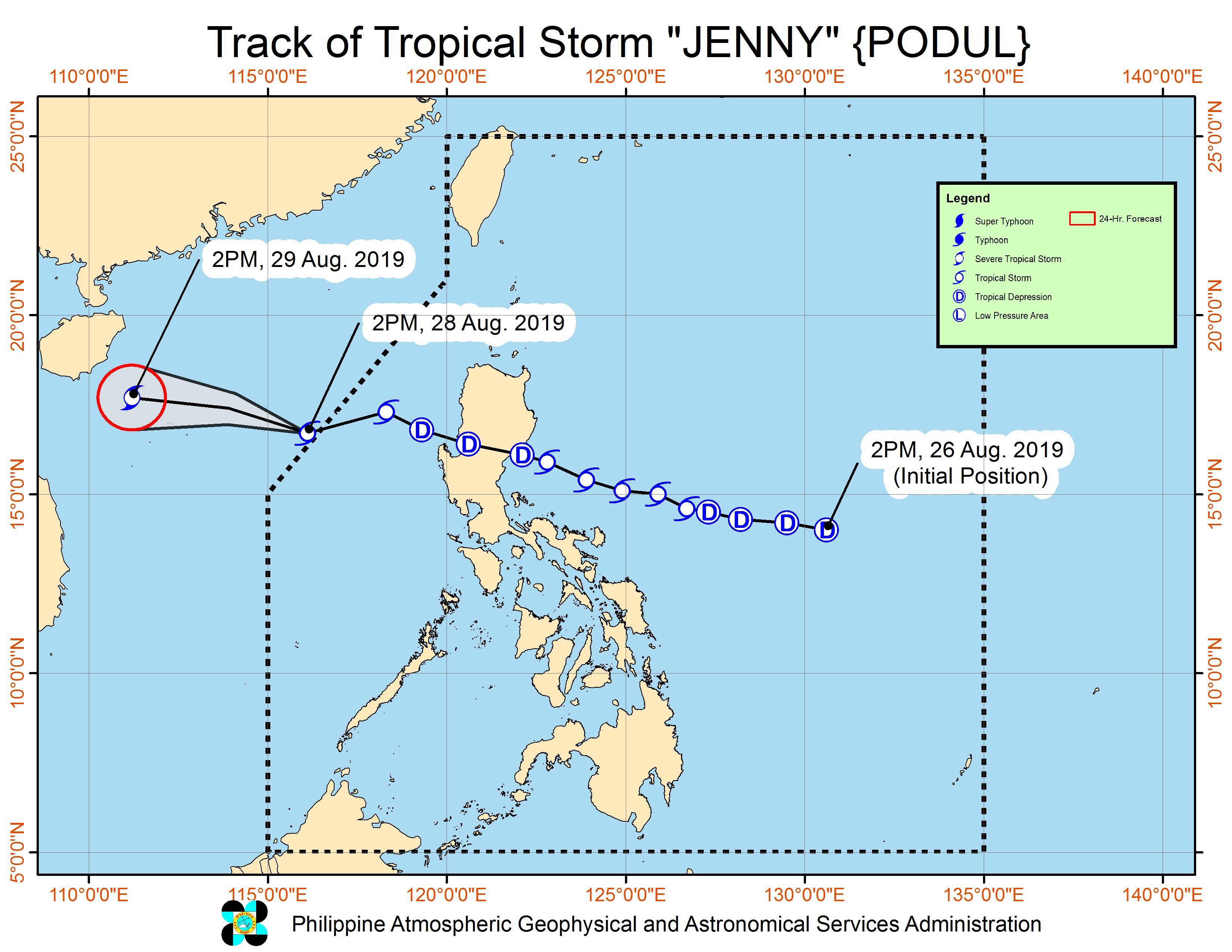
MANILA, Philippines – Jenny (Podul) left the Philippine Area of Responsibility (PAR) at 2 pm on Wednesday, August 28, a few hours after it re-intensified from a tropical depression into a tropical storm.
In a bulletin issued 5 pm on Wednesday, the Philippine Atmospheric, Geophysical, and Astronomical Services Administration (PAGASA) said Tropical Storm Jenny is already 510 kilometers west of Dagupan City, Pangasinan, outside PAR.
Jenny had made landfall in Casiguran, Aurora, at 10:40 pm on Tuesday, August 27. It weakened into a tropical depression as it hit land, then crossed Northern Luzon and left landmass at 3 am on Wednesday.
It was over the West Philippine Sea that Jenny became a tropical storm again.
Jenny was a particularly fast tropical cyclone. By the time it left PAR, it had accelerated further to 40 kilometers per hour (km/h) from the previous 35 km/h, moving west southwest.
The tropical storm had maximum winds of 75 km/h and gustiness of up to 90 km/h as it made its exit.
Tropical cyclone wind signals were earlier lifted at 11 am on Wednesday.
Though Jenny is outside PAR, however, it is still slightly enhancing the southwest monsoon or hanging habagat.
The southwest monsoon is affecting western parts of Luzon and the Visayas. Scattered rainshowers and thunderstorms are expected in the following areas in the next 24 hours:
- Metro Manila
- Central Luzon
- Calabarzon
- Mimaropa
- Benguet
- Pangasinan
- Western Visayas
- Negros Oriental
- Zamboanga Peninsula
Areas affected by the southwest monsoon should watch out for possible flash floods or landslides. (READ: FAST FACTS: Tropical cyclones, rainfall advisories)
Travel also remains risky in the seaboards of Luzon and the western seaboard of the Visayas.
Meanwhile, PAGASA is monitoring a cloud cluster east of the Visayas, along the PAR boundary. PAGASA Weather Specialist Benison Estareja said the chance of this cloud cluster developing into a tropical depression is slim at the moment.
Jenny was the Philippines’ 10th tropical cyclone for 2019, and the 3rd for August. (READ: LIST: PAGASA’s names for tropical cyclones in 2019)
The country gets an average of 20 tropical cyclones annually, but since 2019 is an El Niño year, only 14 to 18 tropical cyclones are expected.
Below is the estimated number of tropical cyclones from August to December:
- August – 2 to 4
- September – 2 to 4
- October – 2 or 3
- November – 1 or 2
- December – 0 or 1
PAGASA declared the start of the rainy season last June 14. – Rappler.com
Add a comment
How does this make you feel?
There are no comments yet. Add your comment to start the conversation.