SUMMARY
This is AI generated summarization, which may have errors. For context, always refer to the full article.
What’s the weather like in your area? Tweet us at @rapplerdotcom.
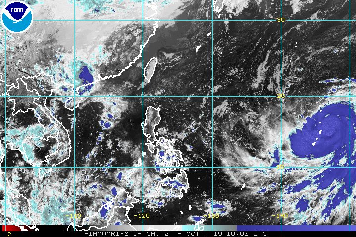
MANILA, Philippines – Typhoon Hagibis, which is located outside the Philippine Area of Responsibility (PAR), gained more strength on Monday afternoon, October 7.
In a briefing at 4 pm on Monday, the Philippine Atmospheric, Geophysical, and Astronomical Services Administration (PAGASA) said Hagibis now has maximum winds of 175 kilometers per hour (km/h) from the previous 120 km/h and gustiness of up to 215 km/h from the previous 150 km/h.
The typhoon is already 2,630 kilometers east of Southern Luzon, moving west northwest at 25 km/h.
If its speed and direction do not change, it could enter PAR by Friday, October 11.
When Hagibis enters PAR, it will be given the local name Perla. (READ: LIST: PAGASA’s names for tropical cyclones in 2019)
PAGASA Weather Specialist Ana Clauren said the chance of the typhoon making landfall in the Philippines remains low.
Meanwhile, fair weather will persist in the entire country on Tuesday, October 8. But there may still be isolated rainshowers or thunderstorms, especially in the afternoon or evening. (READ: FAST FACTS: Tropical cyclones, rainfall advisories)
The Philippines has had 15 tropical cyclones in 2019.
The country gets an average of 20 tropical cyclones annually, but since 2019 is an El Niño year, only 14 to 18 tropical cyclones are expected.
Below is the estimated number of tropical cyclones from October to December:
- October – 2 or 3
- November – 1 or 2
- December – 0 or 1
PAGASA declared the start of the rainy season last June 14. – Rappler.com
Add a comment
How does this make you feel?
There are no comments yet. Add your comment to start the conversation.