SUMMARY
This is AI generated summarization, which may have errors. For context, always refer to the full article.
What’s the weather like in your area? Tweet us at @rapplerdotcom.
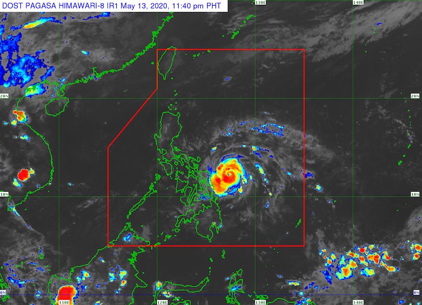
MANILA, Philippines – Ambo (Vongfong) rapidly intensified from a severe tropical storm into a typhoon at 8 pm on Wednesday, May 13.
In an online briefing past 11 pm on Wednesday, the Philippine Atmospheric, Geophysical, and Astronomical Services Administration (PAGASA) said Ambo now has maximum winds of 130 kilometers per hour (km/h) from the previous 95 km/h and gustiness of up to 160 km/h from the previous 115 km/h.
PAGASA added that Ambo “is forecast to continuously intensify in the next 24 hours.” (READ: FAST FACTS: Tropical cyclones, rainfall advisories)
At the moment, the typhoon is located 245 kilometers east northeast of Borongan City, Eastern Samar, or 325 kilometers east of Catarman, Northern Samar.
It slightly accelerated, now moving west at 15 km/h from the previous 10 km/h, but remains generally slow.
Signal No. 2 is now raised for the first time due to Ambo, and there are also more areas under Signal No. 1. Below is the latest list of areas under tropical cyclone wind signals. (READ: Why is it now called tropical cyclone ‘wind’ – and not ‘warning’ – signals?)
Signal No. 2 (winds of 61 to 120 km/h)
- Northern Samar
- northern part of Eastern Samar (Jipapad, Arteche, Maslog, Dolores, Oras, San Policarpio, Can-avid, Taft)
- northern part of Samar (Calbayog City, Sta Margarita, Gandara, Pagsanghan, San Jorge, Matuguinao, San Jose de Buan)
Signal No. 1 (winds of 30 to 60 km/h)
- Camarines Norte
- Camarines Sur
- Albay
- Sorsogon
- Catanduanes
- Masbate
- rest of Eastern Samar
- rest of Samar
- Biliran
In particular, this is what to expect when it comes to wind:
Strong to near-gale force winds
- Samar, Northern Samar, Eastern Samar, Biliran – beginning Thursday morning, May 14
- Catanduanes, Albay, Sorsogon, Masbate – beginning Thursday evening
- Camarines Norte, Camarines Sur – beginning early Friday morning, May 15
Damaging gale to storm force winds
- areas under Signal No. 2 – beginning Thursday afternoon
Aside from strong winds, the typhoon will also bring heavy rainfall to parts of Luzon and the Visayas.
Thursday, May 14
Moderate to heavy rain, with at times intense rain
- Eastern Visayas
- Catanduanes
- Albay
- Sorsogon
- Masbate
Friday, May 15
Heavy to intense rain, with at times torrential rain
- Bicol
- Northern Samar
Moderate to heavy rain
- Calabarzon
- Aurora
- Marinduque
- Romblon
- Occidental Mindoro
- Oriental Mindoro
Floods, landslides, and even lahar from Mayon Volcano are possible. The Philippine Institute of Volcanology and Seismology issued an advisory on Wednesday, warning that rainfall from Ambo might mix with volcanic deposits from Mayon’s 2018 eruption, which could result in lahar or volcanic mudflows.
PAGASA also warned that sea travel is risky for all vessels in the seaboards of areas under tropical cyclone wind signals.
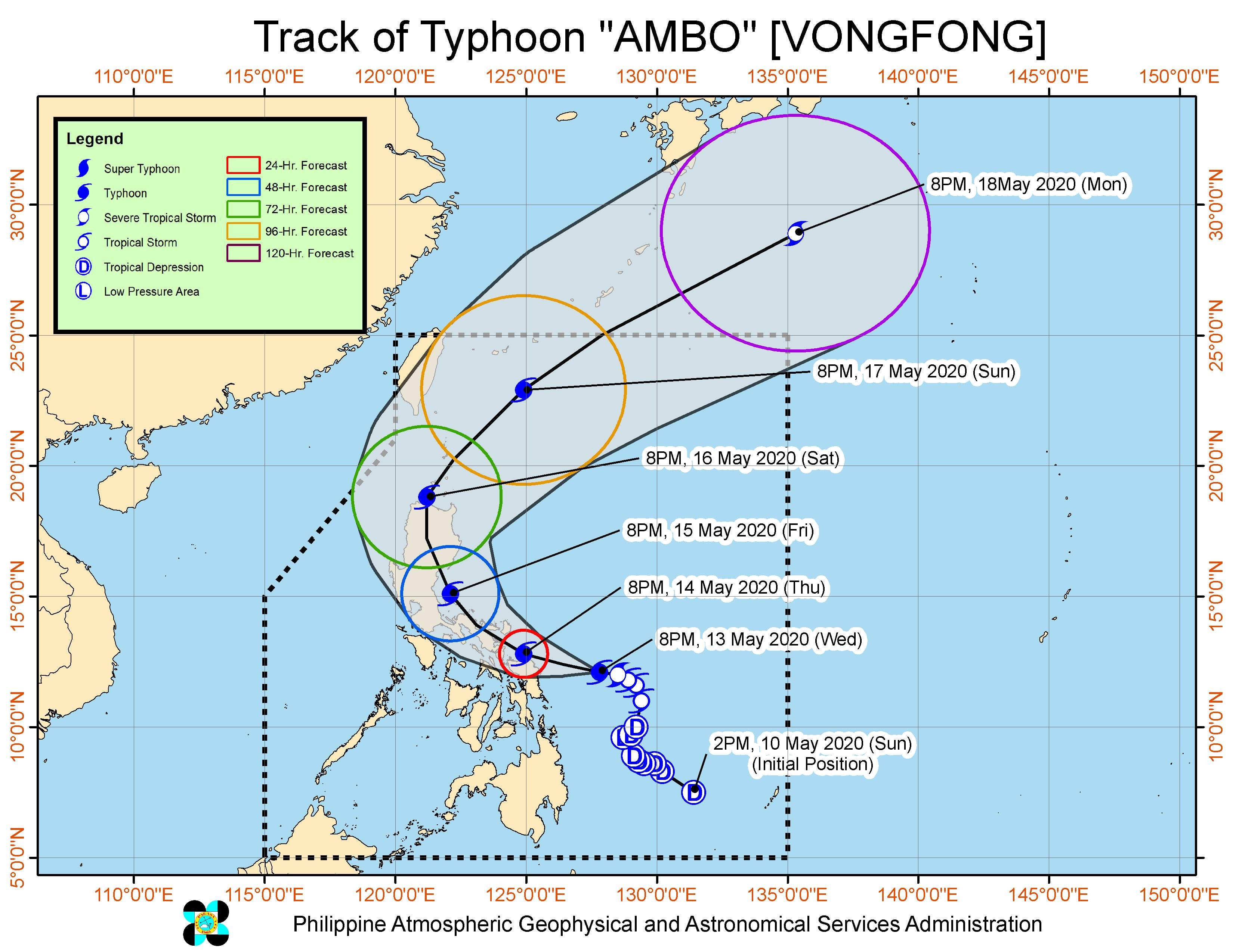
Based on Ambo’s latest forecast track, said PAGASA, the typhoon might pass close to Northern Samar on Thursday evening before making landfall in the Albay-Sorsogon area early Friday morning.
Ambo is the Philippines’ first tropical cyclone for 2020. The country gets an average of 20 tropical cyclones per year. (READ: LIST: PAGASA’s names for tropical cyclones in 2020)
In PAGASA’s climate outlook, it gave the following estimates for the number of tropical cyclones in the next 6 months:
- May – 1 or 2
- June – 1 or 2
- July – 2 to 4
- August – 2 or 3
- September – 2 or 3
- October – 2 or 3
While bracing for Ambo, the Philippines is also combating the coronavirus outbreak. The number of COVID-19 cases in the country climbed to 11,618 on Wednesday. – Rappler.com
Add a comment
How does this make you feel?
There are no comments yet. Add your comment to start the conversation.