SUMMARY
This is AI generated summarization, which may have errors. For context, always refer to the full article.

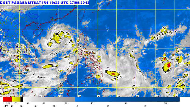
MANILA, Philippines – Tropical storm Paolo exited the Philippine Area of Responsibility, according to state weather bureau PAGASA’s 5 pm update on Friday, September 27.
Still, those living in west of central and southern Luzon should watch out for light to moderate rains and thunderstorms as Paolo will continue to enhance the southwest monsoon.
As of 4 pm, Paolo was estimated to be 435 km northwest of Iba, Zambales, with maximum sustained winds of 65 km/h near the center and gustiness of up to 80 km/h.
Paolo is moving west northwest at 15 km/h and will be 740 kilometers west of Iba, Zambales, by Saturday afternoon.
Meanwhile, a low pressure area was spotted 925 kilometers east of northern Mindanao. – Rappler.com
Add a comment
How does this make you feel?
There are no comments yet. Add your comment to start the conversation.