SUMMARY
This is AI generated summarization, which may have errors. For context, always refer to the full article.
What’s the weather like in your area? Tweet us the situation: Use #weatheralert and tag @rapplerdotcom
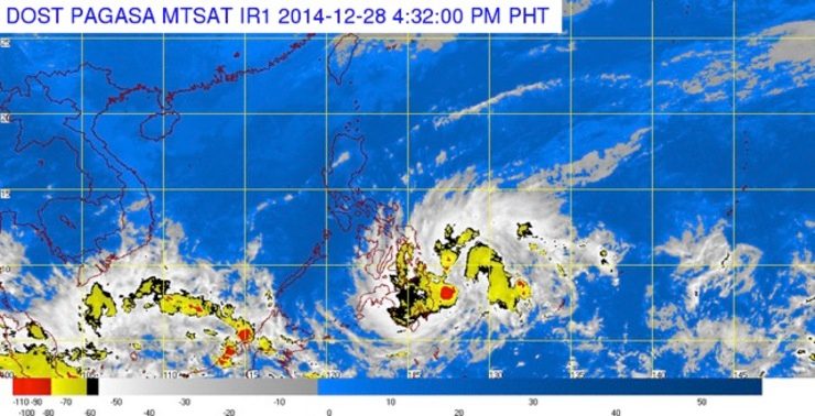
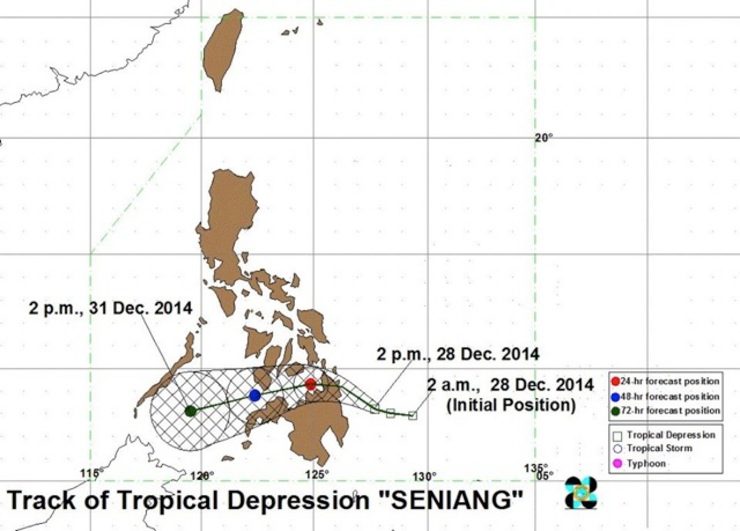
MANILA, Philippines – Tropical Depression Seniang has slightly intensified as it continues to move closer toward northeastern Mindanao, state weather bureau PAGASA said.
As of 4 pm Sunday, December 28, the center of Seniang was estimated at 150 km east of Hinatuan, Surigao del Sur.
It will move west northwest at 13 km/h, with maximum winds of 55 km/h near the center and moderate to heavy rainfall (7 to 15 mm/h) within its 300-km diameter.
- Leyte
- Southern Leyte
- Camotes Island
- Cebu
- Bohol
- Negros Oriental
- Negros Occidental
- Siquijor
Mindanao:
- Dinagat Province
- Surigao del Norte
- Surigao del Sur
- Siargao Island
- Agusan del Norte
- Agusan del Sur
- Compostela Valley
- Northern part of Davao Oriental
- Davao del Norte
- Misamis Oriental
- Bukidnon
- Lanao del Norte
- Misamis Occidental
- Zamboanga del Norte
- Camiguin

Tropical Depression Seniang is expected to make landfall in the vicinity of Tandag, Surigao del Sur by Monday morning, December 29.
For provinces under storm signals (including Eastern Visayas, Caraga Region, and the rest of Mindanao), PAGASA warned residents in low-lying and mountainous areas against possible flashfloods and landslides.
Ocean waves may also reach up to 4 meters, the bureau said. Fisherfolks must avoid venturing out over the eastern seaboards of Luzon, the seaboard of the Visayas, and the northern and eastern seaboards of Mindanao.
The next bulletin on Seniang will be issued at 11 pm Sunday. – Rappler.com
Add a comment
How does this make you feel?
There are no comments yet. Add your comment to start the conversation.