SUMMARY
This is AI generated summarization, which may have errors. For context, always refer to the full article.
What’s the weather like in your area? Tweet us the situation: Use #weatheralert and tag @rapplerdotcom
MANILA, Philippines – A typhoon is likely to enter the Philippine Area of Responsibility on Tuesday, July 7 as Tropical Storm Egay makes its way out of the country, said the Philippine state weather bureau.
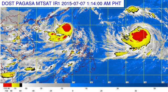
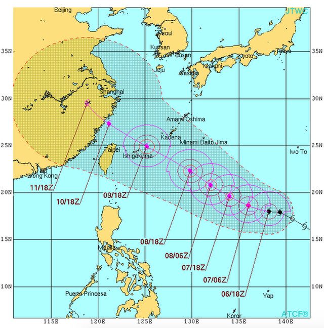
In its Tuesday morning advisory, the Philippine Atmospheric Geophysical and Astronomical Services Administration (PAGASA) said Typhoon Chan-Hom was 1,715 kilometers east of Luzon at 5 am.
Chan-Hom is forecasted to enter PAR by this afternoon or evening at which time it will be given the local name, Falcon.
The typhoon was packing winds of 120 kilometers/hour (km/h) and gusts of up to 150 km/h when it was spotted by PAGASA this morning.
It is predicted to move west northwest at a speed of 20 km/h. By Wednesday morning, it will be 1,200 kilometers east of Basco, Batanes.
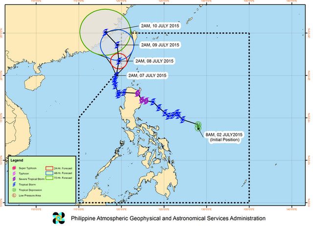
Chan-Hom’s forecasted entry comes the same day Tropical Storm Egay is expected to exit PAR.
Egay has slightly intensified, registering wind speeds of 85 km/h and gusts of up to 100 km/h. It will continue moving northward at a speed of 7 km/h, says PAGASA’s Tuesday morning update.
Public Storm Warning Signal No 1 remains hoisted over 4 areas:
- Ilocos Norte
- Batanes, Calayan, and Babuyan group of islands
- Northwest of Cagayan
- Apayao
The next Egay and Chan-Hom update will be released by PAGASA at 11 am. – Rappler.com
Add a comment
How does this make you feel?
There are no comments yet. Add your comment to start the conversation.