SUMMARY
This is AI generated summarization, which may have errors. For context, always refer to the full article.
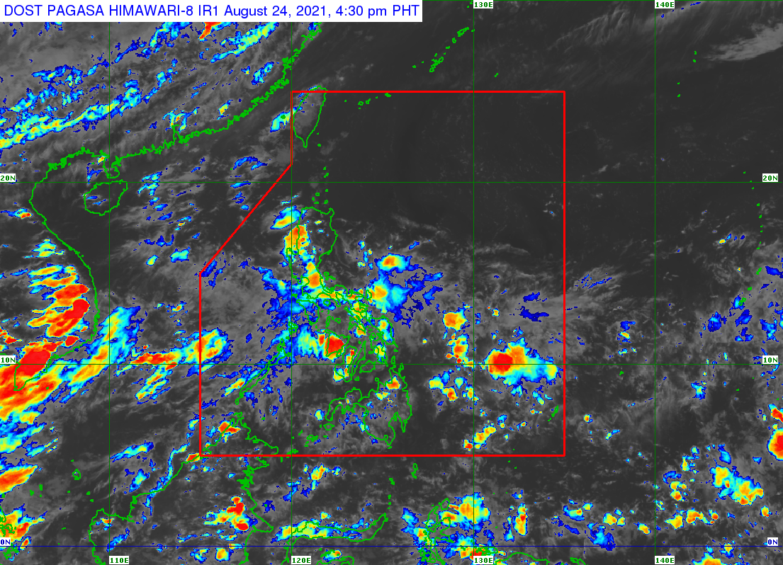
Several areas in the Philippines saw scattered rain showers and thunderstorms on Tuesday, August 24, due to the intertropical convergence zone (ITCZ).
The Philippine Atmospheric, Geophysical, and Astronomical Services Administration (PAGASA) said in a bulletin on Tuesday afternoon that the ITCZ will continue to affect Southern Luzon, the Visayas, and Mindanao.
In particular, scattered rain and thunderstorms will persist in the following areas on Tuesday evening:
- Metro Manila
- Calabarzon
- Mimaropa
- Bicol
- Visayas
- Zamboanga Peninsula
- Northern Mindanao
- Caraga
PAGASA warned that severe thunderstorms may cause flash floods or landslides.
The ITCZ is a belt near the equator where the trade winds of the Northern Hemisphere and Southern Hemisphere meet, usually causing low pressure areas or thunderstorms.
Meanwhile, PAGASA Weather Specialist Ariel Rojas said no tropical cyclone is expected inside the Philippine Area of Responsibility in the next two to three days. (READ: FAST FACTS: Tropical cyclones, rainfall advisories)
The Philippines has had nine tropical cyclones in 2021. Three of those tropical cyclones were in August – the maximum number estimated by PAGASA for the month.
The three August tropical cyclones were Tropical Depression Gorio, Tropical Storm Huaning (Lupit), and Severe Tropical Storm Isang (Omais).
None of the three affected the country. (READ: LIST: PAGASA’s names for tropical cyclones in 2021) – Rappler.com
Add a comment
How does this make you feel?
There are no comments yet. Add your comment to start the conversation.