SUMMARY
This is AI generated summarization, which may have errors. For context, always refer to the full article.
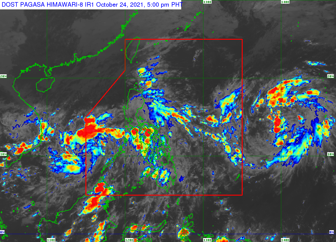
A low pressure area (LPA) and the intertropical convergence zone (ITCZ) will continue to trigger rain in five regions in Luzon as well as the Visayas on Sunday evening, October 24.
The LPA was last spotted 165 kilometers east of Kalayaan Islands, Palawan, still embedded along the ITCZ, said the Philippine Atmospheric, Geophysical, and Astronomical Services Administration (PAGASA) on Sunday afternoon.
The ITCZ, meanwhile, is also affecting Southern Luzon, the Visayas, and Mindanao.
Scattered rain showers and thunderstorms are expected to persist in these areas:
- Metro Manila
- Central Luzon
- Calabarzon
- Mimaropa
- Bicol
- Visayas
PAGASA reiterated that flash floods and landslides are possible.
The LPA could develop into a tropical depression within 36 hours, according to the weather bureau.
But it is also seen to leave the Philippine Area of Responsibility (PAR) either Sunday evening or Monday morning, October 25. (READ: FAST FACTS: Tropical cyclones, rainfall advisories)
Meanwhile, Cagayan Valley and the Cordillera Administrative Region could see rain from the northeasterly surface windflow on Sunday evening.
PAGASA also continues to monitor a tropical depression outside PAR, located 1,650 kilometers east of the Visayas on Sunday afternoon.
PAGASA Weather Specialist Ana Clauren said the chances of the tropical depression entering PAR are slim.
The Philippines gets around 20 tropical cyclones per year. There have been 14 in 2021, so far. (READ: LIST: PAGASA’s names for tropical cyclones in 2021)
The weather bureau declared the start of La Niña in mid-October, which means more rain is expected in the coming months. La Niña is seen to last until the first quarter of 2022. – Rappler.com
Add a comment
How does this make you feel?
There are no comments yet. Add your comment to start the conversation.