SUMMARY
This is AI generated summarization, which may have errors. For context, always refer to the full article.
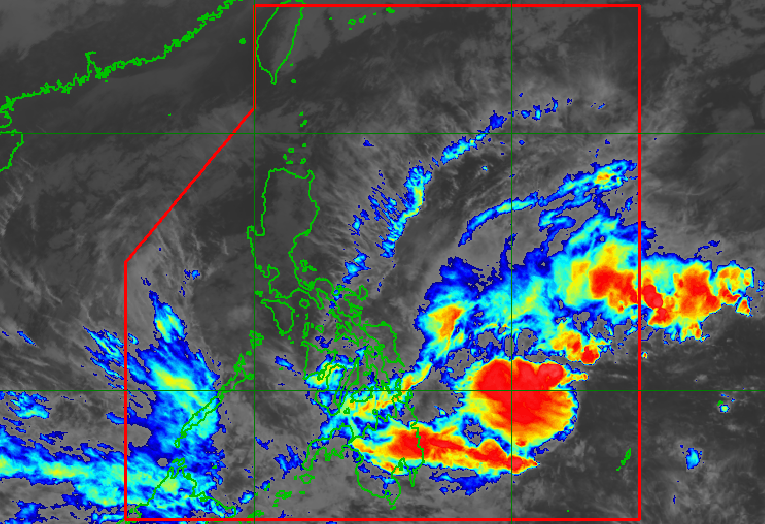
MANILA, Philippines – The shear line is no longer expected to trigger heavy rain, but a low pressure area (LPA) formed inside the Philippine Area of Responsibility on Tuesday afternoon, December 27.
The LPA was last spotted 735 kilometers east of Surigao City, Surigao del Norte, said the Philippine Atmospheric, Geophysical, and Astronomical Services Administration (PAGASA).
The trough or extension of the LPA is causing scattered rain showers and thunderstorms in the following areas:
- Palawan
- Visayas
- Zamboanga Peninsula
- Northern Mindanao
- Caraga
- Davao Region
PAGASA warned that floods and landslides are possible during periods of moderate to heavy rain.
Parts of the Visayas and Mindanao are still reeling from floods and landslides caused by rain from the shear line in the past few days. The National Disaster Risk Reduction and Management Council put the death toll at 17 as of 6 pm on Tuesday.
PAGASA Weather Forecaster Rhea Torres said the weather bureau is not ruling out the possibility of the LPA developing into a tropical cyclone.
It could move northwest toward the Visayas-Southern Luzon area, added Torres. More detailed forecasts are expected in the coming days.
Meanwhile, the northeast monsoon or amihan is still affecting Luzon. It may bring moderate to heavy rain to these areas:
- Cagayan Valley
- Cordillera Administrative Region
- Bicol
- Aurora
- Quezon
- Oriental Mindoro
The rest of Luzon may also have light rain due to the northeast monsoon, but PAGASA sees “no significant impact.” – Rappler.com
Add a comment
How does this make you feel?
There are no comments yet. Add your comment to start the conversation.