SUMMARY
This is AI generated summarization, which may have errors. For context, always refer to the full article.
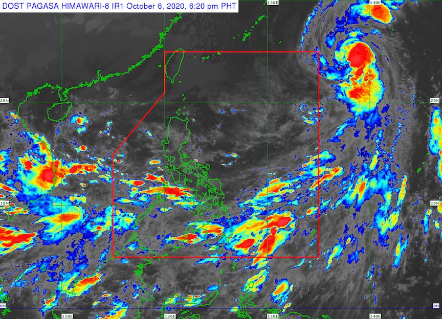
The state weather bureau continues to monitor a low pressure area (LPA) inside the Philippine Area of Responsibility (PAR) and a tropical storm located outside.
The Philippine Atmospheric, Geophysical, and Astronomical Services Administration (PAGASA) said in a bulletin issued 4 pm on Tuesday, October 6, that the LPA is now 480 kilometers east of Infanta, Quezon.
It only has a slim chance of developing into a tropical depression and could just dissipate in the next 48 hours, according to PAGASA Weather Specialist Ariel Rojas.
But Rojas said the LPA will affect the eastern sections of Northern Luzon, Central Luzon, and Southern Luzon.
The southwest monsoon or hanging habagat, meanwhile, is affecting the western parts of Southern Luzon, the Visayas, and Mindanao.
In particular, the following areas will have scattered rain showers and thunderstorms in the next 24 hours either due to the LPA or the southwest monsoon:
- Palawan
- Isabela
- Nueva Ecija
- Quirino
- Nueva Vizcaya
- Aurora
- Quezon
- Camarines Norte
- Zamboanga Peninsula
- Basilan
- Sulu
- Tawi-Tawi
The tropical storm outside PAR, which has the international name Chan-hom, is now 1,720 kilometers east northeast of extreme Northern Luzon.
Tropical Storm Chan-hom is slowly moving northwest. It is seen to cross the northeastern PAR boundary on Wednesday, October 7, then immediately exit the same day.
At the moment, Chan-hom has maximum winds of 85 kilometers per hour (km/h) and gustiness of up to 105 km/h, but it is likely to intensify into a severe tropical storm before entering PAR. (READ: FAST FACTS: Tropical cyclones, rainfall advisories)
When Chan-hom enters, it will be given the local name Nika, as the Philippines’ 14th tropical cyclone for 2020. (READ: LIST: PAGASA’s names for tropical cyclones in 2020)
An average of 20 tropical cyclones form within or enter PAR each year.
For the next 6 months, or from October 2020 to March 2021, PAGASA expects 5 to 8 tropical cyclones.
The state weather bureau had issued an advisory on October 2, warning Filipinos to expect more rain in the coming months due to the onset of La Niña. – Rappler.com
Add a comment
How does this make you feel?
There are no comments yet. Add your comment to start the conversation.