SUMMARY
This is AI generated summarization, which may have errors. For context, always refer to the full article.
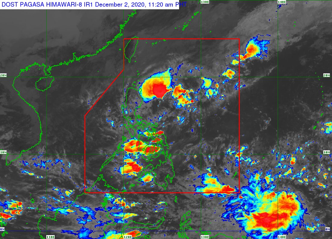
The low pressure area (LPA) inside the Philippine Area of Responsibility (PAR) was moving closer to the Northern Samar-Bicol area on Wednesday morning, December 2.
The Philippine Atmospheric, Geophysical, and Astronomical Services Administration (PAGASA) said in an 11 am advisory on Wednesday that the LPA is now 105 kilometers east northeast of Catarman, Northern Samar, or 180 kilometers east of Juban, Sorsogon.
It remains unlikely to develop into a tropical depression in the next 24 hours. (READ: FAST FACTS: Tropical cyclones, rainfall advisories)
Aside from the LPA, the tail-end of a frontal system also continues to affect the eastern parts of Northern Luzon and Central Luzon, while the surge of the northeast monsoon or hanging amihan is affecting the rest of Northern Luzon and Central Luzon.
PAGASA warned that rain from the LPA and the tail-end of a frontal system will persist in parts of Luzon and the Visayas. Floods and landslides are still possible.
Wednesday, December 2
Moderate to heavy rain
- Cagayan
- Isabela
- Apayao
- Kalinga
Light to moderate rain, with at times heavy rain
- Aurora
- Quezon
- Marinduque
- Romblon
- Bicol
- Visayas
Occasional to frequent light to moderate rain
- rest of Cagayan Valley
- rest of Cordillera Administrative Region
Thursday, December 3
Moderate to heavy rain
- Cagayan
- Isabela
- Apayao
- Kalinga
Light to moderate rain, with at times heavy rain
- Bicol
- Aurora
- Quezon
- Marinduque
Occasional to frequent light to moderate rain
- Ilocos Norte
- rest of Cagayan Valley
- rest of Cordillera Administrative Region
So far, the Philippines has had 21 tropical cyclones in 2020, already above the yearly average of 20. (READ: LIST: PAGASA’s names for tropical cyclones in 2020)
For the next 6 months, these are PAGASA’s estimates for tropical cyclones inside PAR:
- December 2020 – 1 or 2
- January 2021 – 0 or 1
- February 2021 – 0 or 1
- March 2021 – 0 or 1
- April 2021 – 0 or 1
- May 2021 – 0 or 1
La Niña has been underway since October, causing more rain than usual in the country.
The cold temperatures from the northeast monsoon are expected to persist until February 2021. – Rappler.com
Add a comment
How does this make you feel?
There are no comments yet. Add your comment to start the conversation.