SUMMARY
This is AI generated summarization, which may have errors. For context, always refer to the full article.
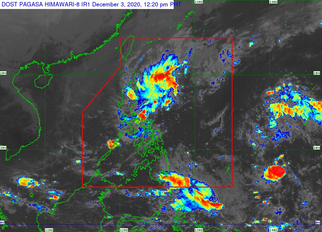
The low pressure area (LPA) bringing rain this week was located off the province of Camarines Norte on Thursday morning, December 3.
In an advisory issued 11 am on Thursday, the Philippine Atmospheric, Geophysical, and Astronomical Services Administration (PAGASA) said the LPA was 105 kilometers east northeast of Daet, Camarines Norte.
“This LPA remains less likely to develop into a tropical depression and may dissipate once it is over land,” PAGASA said.
But the state weather bureau added it is not ruling out the possibility that the LPA could cross Southern Luzon. (READ: FAST FACTS: Tropical cyclones, rainfall advisories)
The tail-end of a frontal system also continues to affect the eastern parts of Northern Luzon and Central Luzon.
The LPA and the tail-end of a frontal system will both trigger more rain on Thursday. The affected areas, listed below, must stay on alert for possible floods and landslides.
Moderate to heavy rain
- Cagayan
- Isabela
- Apayao
- Kalinga
Light to moderate rain, with at times heavy rain
- rest of Cagayan Valley
- Aurora
- Quezon
- Camarines Norte
- Capiz
- Aklan
- Romblon
Occasional to frequent light to moderate rain
- rest of Cordillera Administrative Region
- Ilocos Norte
The Philippines has been tropical cyclone-free since Typhoon Ulysses (Vamco), the country’s 21st tropical cyclone for 2020, left the Philippine Area of Responsibility (PAR) last November 13.
The number of tropical cyclones that formed inside or entered PAR for 2020 already exceeded the yearly average of 20. (READ: LIST: PAGASA’s names for tropical cyclones in 2020)
For the next 6 months, these are PAGASA’s estimates for tropical cyclones inside PAR:
- December 2020 – 1 or 2
- January 2021 – 0 or 1
- February 2021 – 0 or 1
- March 2021 – 0 or 1
- April 2021 – 0 or 1
- May 2021 – 0 or 1
La Niña has been underway since October, causing more rain than usual in the country.
The northeast monsoon or hanging amihan also began in November, which explains the cold temperatures, especially during early mornings. – Rappler.com
Add a comment
How does this make you feel?
There are no comments yet. Add your comment to start the conversation.