SUMMARY
This is AI generated summarization, which may have errors. For context, always refer to the full article.
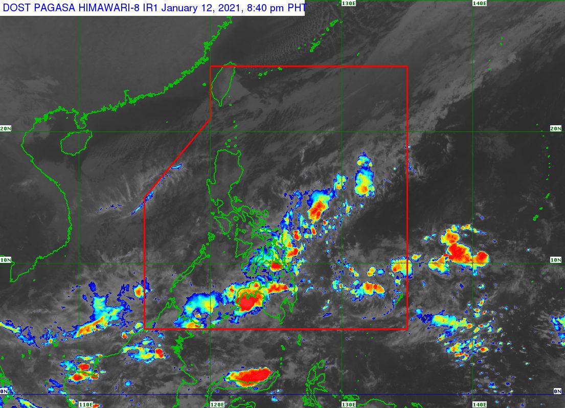
A low pressure area (LPA) and the tail-end of a frontal system are still affecting the Visayas and Mindanao, warned the state weather bureau on Tuesday, January 12.
The Philippine Atmospheric, Geophysical, and Astronomical Services Administration (PAGASA) said the LPA was last spotted 160 kilometers southeast of General Santos City on Tuesday afternoon.
PAGASA said the LPA is “less likely” to develop into a tropical depression, but it is nonetheless triggering moderate to heavy rain.
Floods and landslides remain possible in the Visayas and Mindanao due to both the LPA and the tail-end of a frontal system or shear line.
The tail-end of a frontal system is the boundary between the easterlies and the northeast monsoon or hanging amihan. The easterlies refer to warm, moist air coming from the Pacific Ocean, while the northeast monsoon brings cold, dry air.
As of 8:25 pm on Tuesday, PAGASA issued a red rainfall warning for Surigao del Norte – the highest – which means “serious flooding is expected in low-lying areas” and there may be landslides in mountainous areas.
An orange rainfall warning, meanwhile, was raised for the Dinagat Islands, Lanao del Sur, Maguindanao, Cotabato City, and Zamboanga Sibugay, where floods are “threatening” low-lying areas and landslides may occur, too.
A yellow rainfall warning is also in effect for Zamboanga del Sur, Lanao del Norte, Misamis Oriental, Bukidnon, Agusan del Sur, and Sultan Kudarat. Floods and landslides could hit these areas as well.
Meanwhile, Luzon is affected by the northeast monsoon, so there may be isolated rain. But the weather is generally fair.
The Philippines has yet to have its first tropical cyclone of 2021. (READ: FAST FACTS: Tropical cyclones, rainfall advisories)
For the first 6 months of the year, these are PAGASA’s estimates for the number of tropical cyclones inside the Philippine Area of Responsibility:
- January – 0 or 1
- February – 0 or 1
- March – 0 or 1
- April – 0 or 1
- May – 0 or 1
- June – 1 or 2
The state weather bureau earlier said La Niña is likely to continue until March. This means above normal rainfall would persist. – Rappler.com
Add a comment
How does this make you feel?
There are no comments yet. Add your comment to start the conversation.