SUMMARY
This is AI generated summarization, which may have errors. For context, always refer to the full article.
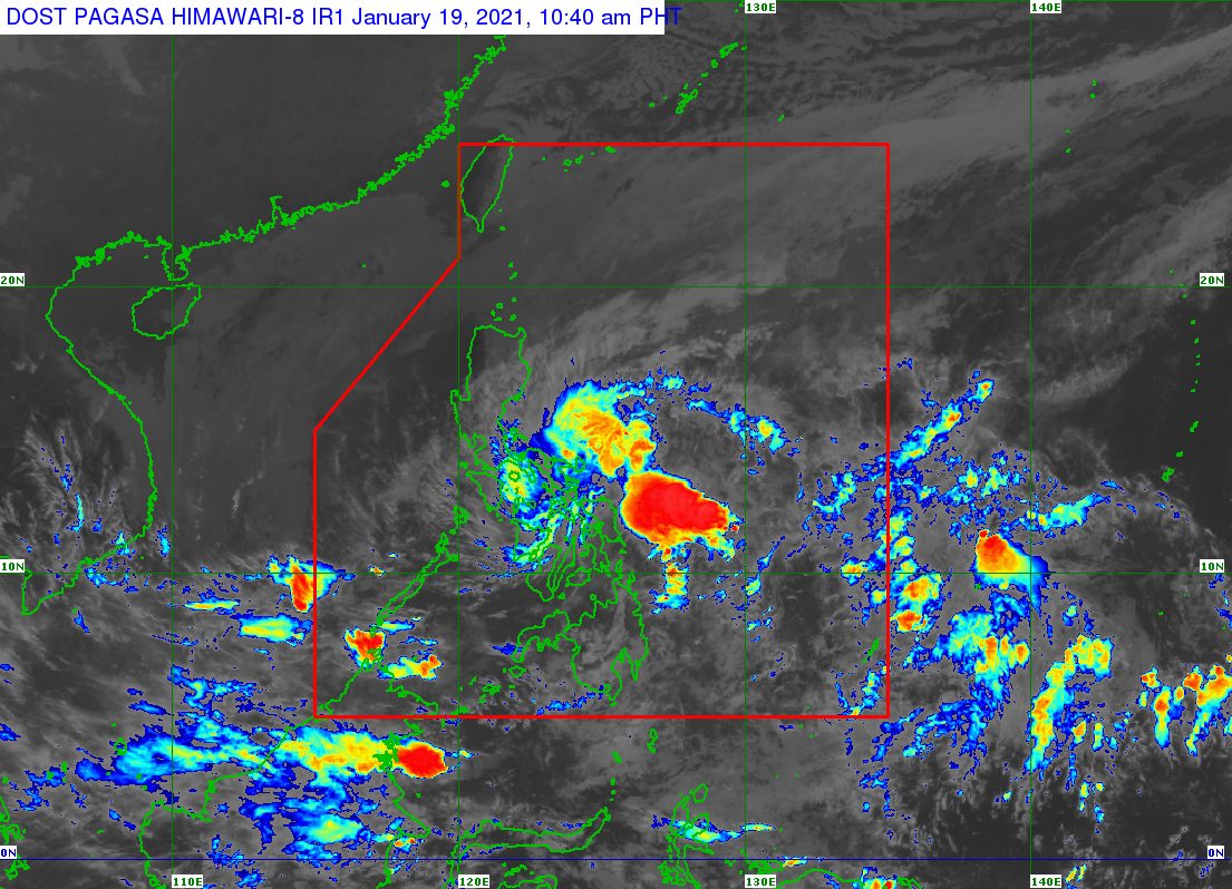
A low pressure area (LPA) inside the Philippine Area of Responsibility (PAR) and the tail-end of a frontal system are affecting parts of Luzon and the Visayas on Tuesday, January 19.
The Philippine Atmospheric, Geophysical, and Astronomical Services Administration (PAGASA) said in its 11 am advisory on Tuesday that the LPA is now in the vicinity of Borongan City, Eastern Samar.
The weather disturbance is expected to move northwest and may cross the Southern Luzon-Visayas area, according to PAGASA.
At the moment, the LPA “remains less likely to develop into a tropical depression in the next 48 hours.” (READ: FAST FACTS: Tropical cyclones, rainfall advisories)
Aside from the LPA, the tail-end of a frontal system is also causing rain in the eastern part of Southern Luzon.
The tail-end of a frontal system is the boundary between the easterlies and the northeast monsoon or hanging amihan. The easterlies refer to warm, moist air coming from the Pacific Ocean, while the northeast monsoon brings cold, dry air.
PAGASA warned of the combined effects of the LPA and the tail-end of a frontal system in the next 24 hours.
Moderate to heavy rain, with at times intense rain
- Eastern Samar
- Northern Samar
- Catanduanes
- northeastern part of Camarines Sur
Moderate to heavy rain
- rest of Eastern Visayas
- rest of Bicol
- Marinduque
- Romblon
- southern part of Quezon
Light to moderate rain, with at times heavy rain
- rest of Quezon
- Occidental Mindoro
- Oriental Mindoro
- Western Visayas
- northern part of Cebu
The rain may trigger floods and landslides, especially in hazard-prone areas.
“Adjacent or nearby areas may also experience flooding in the absence of such rainfall occurrence due to surface runoff or swelling of river channels,” added PAGASA.
Surface runoff refers to excess rainwater, which is unable to be absorbed by the already saturated soil. Rivers could also overflow.
The Philippines has been free of tropical cyclones in the first month of 2021, so far.
For the first 6 months of the year, these are PAGASA’s estimates for the number of tropical cyclones inside PAR:
- January – 0 or 1
- February – 0 or 1
- March – 0 or 1
- April – 0 or 1
- May – 0 or 1
- June – 1 or 2
La Niña is still ongoing, causing above normal rainfall. – Rappler.com
Add a comment
How does this make you feel?
There are no comments yet. Add your comment to start the conversation.