SUMMARY
This is AI generated summarization, which may have errors. For context, always refer to the full article.
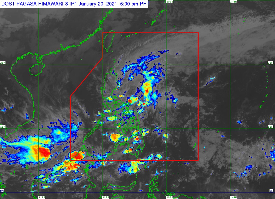
Rain from a low pressure area (LPA) and the tail-end of a frontal system will continue in parts of Luzon and even some areas in the Visayas, warned the state weather bureau on Wednesday afternoon, January 20.
The Philippine Atmospheric, Geophysical, and Astronomical Services Administration (PAGASA) said in its 4 pm bulletin on Wednesday that the LPA is already 100 kilometers east of Baler, Aurora.
The tail-end of a frontal system, meanwhile, is now affecting the eastern part of Northern Luzon.
Due to the LPA and the tail-end of a frontal system, scattered to widespread rain showers and thunderstorms are being experienced in these areas:
- Cagayan Valley
- Aurora
- northern part of Quezon
Scattered rain showers and thunderstorms, caused by the LPA, are also hitting the following areas:
- rest of Calabarzon
- Metro Manila
- Bulacan
- Nueva Ecija
- Cordillera Administrative Region
- Mimaropa
- Bicol
- Eastern Visayas
PAGASA warned that floods and landslides may occur, as the rain will be moderate to heavy at times.
For now, the LPA only has a slim chance of developing into a tropical depression, according to PAGASA Weather Specialist Benison Estareja.
Estareja said the LPA could just move off the coasts of Aurora, Isabela, and Cagayan, then dissipate by Thursday, January 21. (READ: FAST FACTS: Tropical cyclones, rainfall advisories)
The Philippines gets an average of 20 tropical cyclones per year. It has yet to have its first tropical cyclone for 2021.
For the first 6 months of the year, these are PAGASA’s estimates for the number of tropical cyclones inside the Philippine Area of Responsibility:
- January – 0 or 1
- February – 0 or 1
- March – 0 or 1
- April – 0 or 1
- May – 0 or 1
- June – 1 or 2
La Niña is still ongoing, causing above normal rainfall. – Rappler.com
Add a comment
How does this make you feel?
There are no comments yet. Add your comment to start the conversation.