SUMMARY
This is AI generated summarization, which may have errors. For context, always refer to the full article.
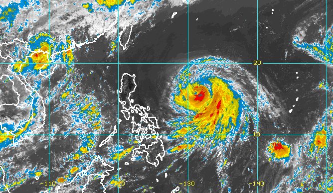
MANILA, Philippines – Severe Tropical Storm Chedeng (Guchol) slightly intensified as it continued moving over the Philippine Sea on Thursday morning, June 8.
In its 11 am bulletin on Thursday, the Philippine Atmospheric, Geophysical, and Astronomical Services Administration (PAGASA) said Chedeng now has maximum sustained winds of 100 kilometers per hour from the previous 95 km/h.
The severe tropical storm’s gustiness increased to 125 km/h from 115 km/h.
PAGASA expects Chedeng to keep strengthening in the next two to three days. It could be upgraded to a typhoon by Thursday night or Friday, June 9, then reach its peak intensity by Saturday, June 10.
Chedeng also slightly accelerated on Thursday morning, heading west northwest at 15 km/h from 10 km/h.
It was last spotted 1,070 kilometers east of Central Luzon, still too far to have a direct effect on the country.
PAGASA said Chedeng remains unlikely to directly bring rain to any part of the country in the next three to five days.
The raising of tropical cyclone wind signals is also still unlikely, and coastal waters are not affected.
But Chedeng might enhance the southwest monsoon or habagat in the next few days. The southwest monsoon could bring gusts, or sudden and strong winds, to these areas:
Friday, June 9
- Visayas, Romblon, Occidental Mindoro, northern part of Palawan including Kalayaan, Calamian, and Cuyo islands, Surigao del Norte, Dinagat Islands, Camiguin
Saturday, June 10
- Visayas, Calabarzon, Mimaropa, Bicol, Camiguin, Dinagat Islands
As for potential monsoon rain, the timing and intensity would depend on how Chedeng enhances the southwest monsoon. The severe tropical storm’s movement and intensity will be taken into account.
If PAGASA sees “an increasing chance” of heavy monsoon rain in the next three days, a weather advisory would be released.
For now, the southwest monsoon will continue causing scattered rain showers and thunderstorms in Palawan. The rest of the country will only have isolated rain showers or localized thunderstorms.
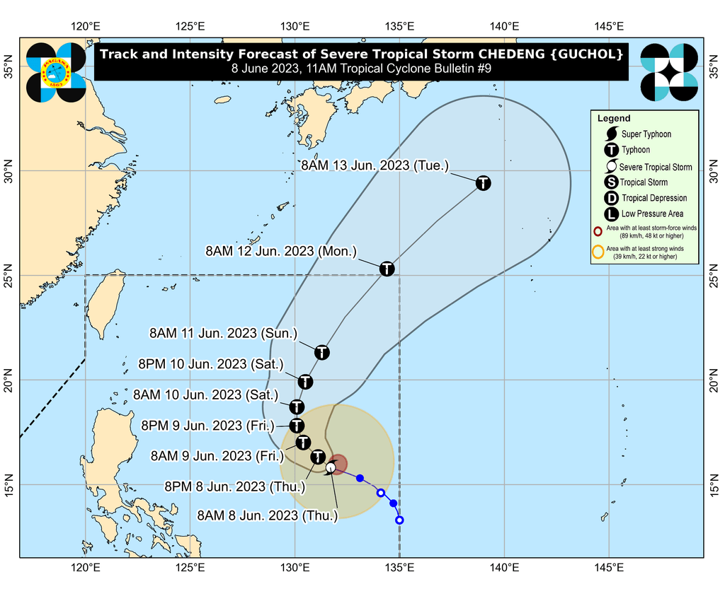
Chedeng is projected to move west northwest to northwest from Thursday to Friday, before shifting more toward the north on Friday evening.
Afterwards, it is expected to be slow-moving until Saturday, followed by acceleration toward the north northeast or northeast on Sunday, June 11.
At that rate, it would exit the Philippine Area of Responsibility by Monday morning, June 12.
Chedeng is the Philippines’ third tropical cyclone for 2023 and the first for June. PAGASA earlier estimated there would be one or two tropical cyclones during the month.
The weather bureau announced the start of the rainy season last Friday, June 2. – Rappler.com
Add a comment
How does this make you feel?


There are no comments yet. Add your comment to start the conversation.