SUMMARY
This is AI generated summarization, which may have errors. For context, always refer to the full article.
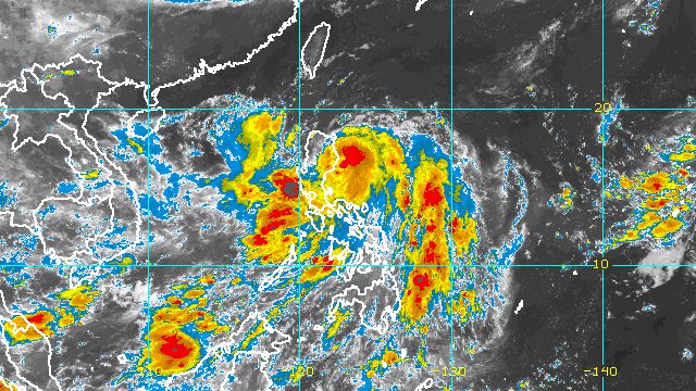
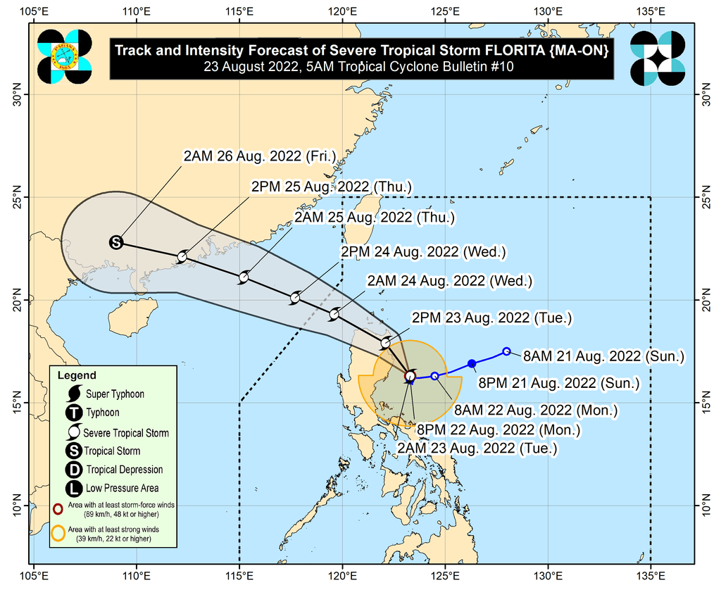
MANILA, Philippines – Florita (Ma-on) intensified from a tropical storm into a severe tropical storm before dawn on Tuesday, August 23, as it headed for the Isabela-Cagayan area.
Florita now has maximum sustained winds of 95 kilometers per hour from the previous 85 km/h and gustiness of up to 115 km/h from 105 km/h, the Philippine Atmospheric, Geophysical, and Astronomical Services Administration (PAGASA) said in its 5 am bulletin on Tuesday.
The severe tropical storm was last spotted 120 kilometers east northeast of Casiguran, Aurora. PAGASA said it has shifted north northwest, moving at 10 km/h, after being almost stationary in the early hours of Tuesday and inching west on Monday evening, August 22.
It could make landfall in Cagayan or Isabela on Tuesday morning or early afternoon, depending on its speed.
“Due to the slight shift in the track forecast, a slight intensification prior to landfall is not ruled out,” PAGASA said.
Since Florita strengthened into a severe tropical storm, Signal No. 3 has been raised in parts of Cagayan and Isabela. These are the areas under tropical cyclone wind signals as of 5 am on Tuesday:
Signal No. 3
Storm-force winds (89 to 117 km/h), moderate to significant threat to life and property
- northern and eastern parts of mainland Cagayan (Santa Praxedes, Claveria, Sanchez-Mira, Pamplona, Abulug, Ballesteros, Lal-lo, Baggao, Peñablanca, Gattaran, Aparri, Camalaniugan, Buguey, Santa Ana, Gonzaga, Santa Teresita)
- eastern part of Isabela (Maconacon, Divilacan, Palanan)
Signal No. 2
Gale-force winds (62 to 88 km/h), minor to moderate threat to life and property
- rest of Cagayan including Babuyan Islands
- rest of Isabela
- Quirino
- eastern and central parts of Nueva Vizcaya (Kayapa, Ambaguio, Solano, Villaverde, Bagabag, Diadi, Quezon, Bayombong, Bambang, Aritao, Dupax del Sur, Dupax del Norte, Kasibu, Alfonso Castañeda)
- Apayao
- Abra
- Kalinga
- Mountain Province
- Ifugao
- northern part of Benguet (Bakun, Kibungan, Buguias, Kabayan, Mankayan, Bokod, Atok)
- Ilocos Norte
- Ilocos Sur
- northern and central parts of Aurora (Dilasag, Casiguran, Dinalungan, Dipaculao, Baler, Maria Aurora)
Signal No. 1
Strong winds (39 to 61 km/h), minimal to minor threat to life and property
- Batanes
- rest of Nueva Vizcaya
- rest of Benguet
- La Union
- Pangasinan
- eastern part of Tarlac (San Clemente, Camiling, Moncada, San Manuel, Anao, Santa Ignacia, Gerona, Paniqui, Ramos, Pura, Victoria, La Paz, Tarlac City, Concepcion)
- Nueva Ecija
- rest of Aurora
- eastern part of Pampanga (Magalang, Arayat, Candaba)
- eastern part of Bulacan (San Ildefonso, San Miguel, Doña Remedios Trinidad, San Rafael, Angat, Norzagaray, San Jose del Monte City)
- eastern part of Rizal (Rodriguez, San Mateo, Antipolo City, Tanay, Baras)
- northern part of Quezon (General Nakar, Infanta, Real, Mauban, Perez, Alabat, Quezon, Calauag) including Polillo Islands
- northern part of Laguna (Santa Maria, Famy, Siniloan, Pangil, Pakil, Paete)
- Camarines Norte
PAGASA added that gusts may be experienced in the following areas on Tuesday:
- Metro Manila
- Zambales
- Bataan
- Occidental Mindoro
- Oriental Mindoro
- Marinduque
- Romblon
- Northern Samar
- Antique
- Aklan
- rest of Calabarzon
- rest of Bicol
Rain from Florita will also worsen on Tuesday, especially in Northern Luzon. Floods and landslides are expected.
Tuesday, August 23
Heavy to intense rain, with at times torrential rain
- Cagayan
- Isabela
- Cordillera Administrative Region
- Ilocos Region
- Zambales
Moderate to heavy rain, with at times intense rain
- northern part of Aurora
- Bataan
- Tarlac
- rest of Cagayan Valley
Light to moderate rain, with at times heavy rain
- Metro Manila
- Calabarzon
- rest of Central Luzon
- Camarines Norte
Early Wednesday morning to afternoon, August 24
Heavy to intense rain, with at times torrential rain
- Ilocos Region
Moderate to heavy rain, with at times intense rain
- Benguet
- Abra
Light to moderate rain, with at times heavy rain
- rest of Cordillera Administrative Region
Florita also continues to enhance the southwest monsoon or hanging habagat, which will bring rain to Western Visayas, Mimaropa, and other parts of Bicol on Tuesday.

PAGASA warned of dangerous coastal conditions due to Florita and the southwest monsoon.
- seaboards of Northern Luzon – rough to high seas, with waves 3.5 to 7 meters high
- eastern seaboards of Central Luzon and Southern Luzon – rough to very rough seas, with waves 2.8 to 4.5 meters high
- western seaboards of Central Luzon, Southern Luzon, and Visayas – rough seas, with waves 2.8 to 4 meters high
- remaining seaboards of Southern Luzon and Visayas – moderate to rough seas, with waves 1.2 to 2.8 meters high
The weather bureau said rough to high seas are risky for all vessels, while small vessels should not sail if seas are rough to very rough.
Moderate to rough seas may also be risky for small vessels.
Florita is projected to cross Northern Luzon on Tuesday and emerge over the West Philippine Sea in the evening.
It is expected to leave the Philippine Area of Responsibility on Wednesday morning, August 24.
Florita is the country’s sixth tropical cyclone for 2022. – Rappler.com
Add a comment
How does this make you feel?


There are no comments yet. Add your comment to start the conversation.