SUMMARY
This is AI generated summarization, which may have errors. For context, always refer to the full article.
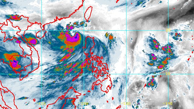
MANILA, Philippines – Severe Tropical Storm Florita (Ma-on) exited the Philippine Area of Responsibility (PAR) before dawn on Wednesday, August 24, but Signal No. 1 remains raised in parts of Northern Luzon and rain will continue until afternoon.
The Philippine Atmospheric, Geophysical, and Astronomical Services Administration (PAGASA) said in its 5 am bulletin on Wednesday that Florita was already 335 kilometers west of Calayan, Cagayan, over the West Philippine Sea.
The severe tropical storm accelerated as it left PAR, moving west northwest at 30 kilometers per hour from the previous 25 km/h.
It is heading for the southern part of China, where it is expected to make landfall on Thursday morning or early afternoon, August 25.
At the time of Florita’s exit, it had maximum sustained winds of 95 km/h and gustiness of up to 115 km/h. Inside PAR, its peak intensity was 110 km/h.
By Wednesday evening, Florita might re-intensify and reach typhoon status, PAGASA said.
Florita made landfall in Maconacon, Isabela, at 10:30 am on Tuesday, August 23, bringing torrential rain and strong winds. It then crossed Isabela, Cagayan, Apayao, and Ilocos Norte, before emerging over the West Philippine Sea on the same day.
PAGASA warned that rain from Florita will persist in the following areas:
Wednesday morning
Moderate to heavy rain
- Ilocos Region
- Abra
- Benguet
Light to moderate rain, with at times heavy rain
- rest of Cordillera Administrative Region
Wednesday afternoon
Light to moderate rain, with at times heavy rain
- Ilocos Region
The weather bureau added that while the rain will “gradually weaken throughout the day,” scattered floods and landslides remain possible.
The southwest monsoon or hanging habagat, which is still being enhanced by Florita, will also affect the western parts of Central Luzon and Southern Luzon on Wednesday. Scattered rain and thunderstorms are likely in these areas:
- Bataan
- Zambales
- Oriental Mindoro
- Occidental Mindoro
- Metro Manila

Meanwhile, here are the areas under Signal No. 1 as of 5 am on Wednesday, still experiencing strong winds:
- Batanes
- Babuyan Islands
- western part of mainland Cagayan (Claveria, Santa Praxedes, Sanchez-Mira, Pamplona, Abulug, Ballesteros, Allacapan, Aparri, Lasam, Santo Niño, Rizal)
- Apayao
- Abra
- western part of Kalinga (Balbalan, Pasil, Tinglayan)
- western part of Mountain Province (Bauko, Tadian, Besao, Sagada, Sabangan, Bontoc, Sadanga)
- northern and western parts of Benguet (Mankayan, Bakun, Kibungan, Kapangan, Tublay, La Trinidad, Sablan, Tuba, Baguio City, Atok)
- Ilocos Norte
- Ilocos Sur
- La Union
The highest tropical cyclone wind signal that had been raised due to Florita was Signal No. 3.
Gusts are also expected on Wednesday in these areas:
- Mimaropa
- Metro Manila
- Cavite
- Quezon
- Bulacan
- Pampanga
- Pangasinan
- Aurora
- areas in Cordillera Administrative Region and Cagayan Valley not under Signal No. 1

PAGASA also issued a new gale warning at 5 am on Wednesday, saying that waters are rough to very rough in the seaboards listed below. Waves will be 2.8 to 5 meters high.
- northern, western, and eastern seaboards of Northern Luzon
- seaboards of Central Luzon
The weather bureau advised fishing boats and other small vessels not to sail, and larger vessels to watch out for big waves.
Florita was the Philippines’ sixth tropical cyclone for 2022. It hit the country during the first week of classes for public schools. – Rappler.com
Add a comment
How does this make you feel?


There are no comments yet. Add your comment to start the conversation.