SUMMARY
This is AI generated summarization, which may have errors. For context, always refer to the full article.
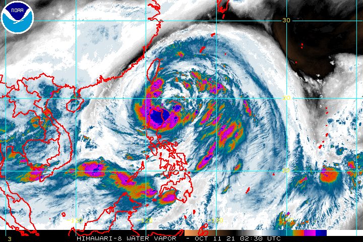
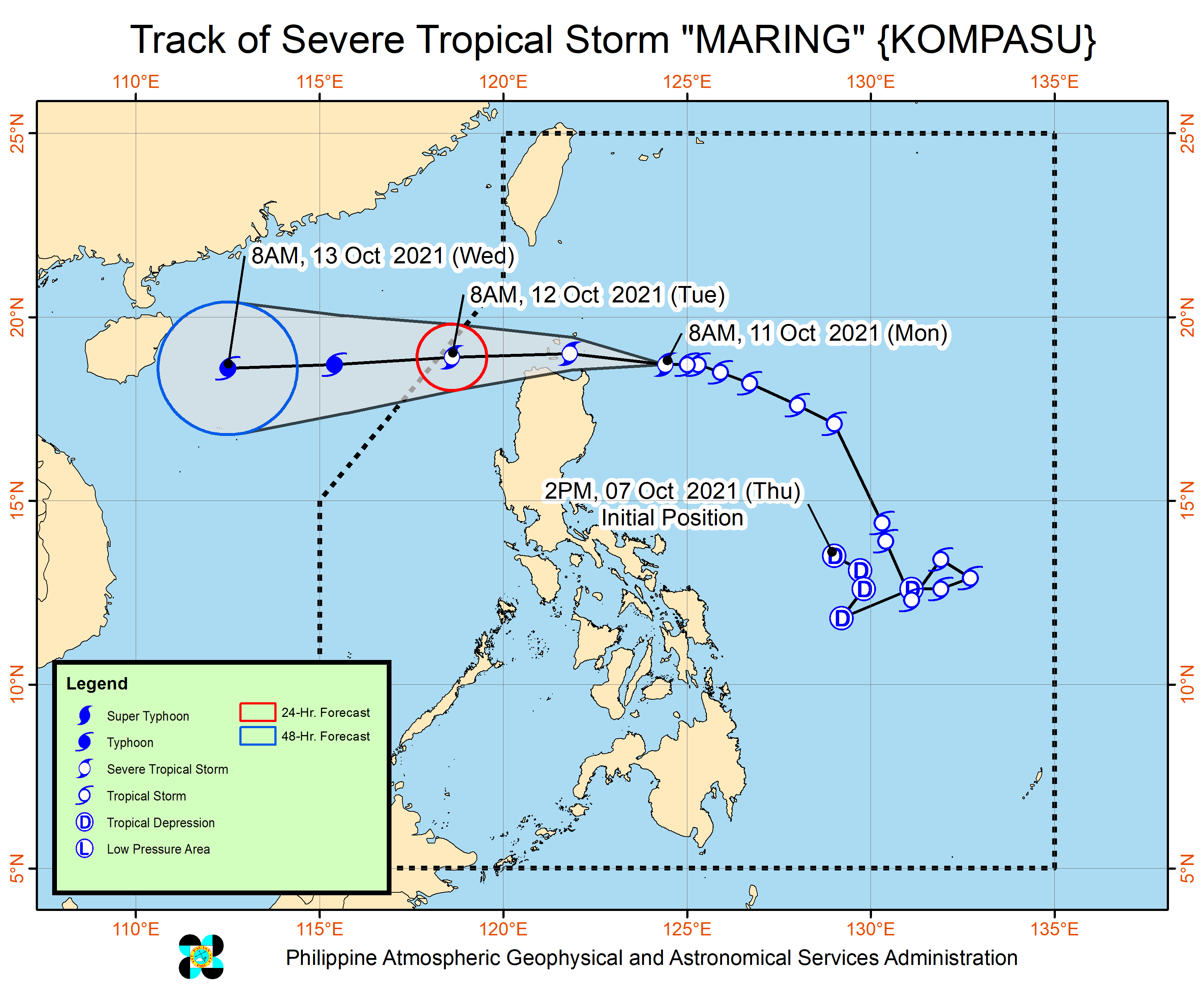
Maring (Kompasu) strengthened from a tropical storm into a severe tropical storm at 8 am on Monday, October 11, and by late morning, was already moving toward the Babuyan Islands.
Maring’s maximum sustained winds increased from 85 kilometers per hour to 95 km/h, while its gustiness rose from 105 km/h to 115 km/h.
The severe tropical storm was already 240 kilometers east of Aparri, Cagayan, or 265 kilometers east southeast of Calayan, Cagayan, said the Philippine Atmospheric, Geophysical, and Astronomical Services Administration (PAGASA) in a briefing past 11 am on Monday.
Maring is moving west at a relatively slow 15 km/h. (READ: FAST FACTS: Tropical cyclones, rainfall advisories)
If the severe tropical storm maintains its speed and direction, it would move over the Luzon Strait between Monday afternoon and early Tuesday morning, October 12, and pass very close to or over the Babuyan Islands on Monday evening.
PAGASA reiterated that there is also a chance of landfall in mainland northern Cagayan or a close approach to Batanes.
As of 11 am on Monday, PAGASA maintained its rainfall forecast for Maring. Areas affected by the severe tropical storm must stay on alert for flash floods and landslides.
Moderate to heavy rain, with at times intense rain
- Batanes
- Cagayan including Babuyan Islands
- Cordillera Administrative Region
- Ilocos Region
Light to moderate rain, with at times heavy rain
- rest of Cagayan Valley
- Central Luzon
The southwest monsoon or hanging habagat, being enhanced by Maring, is also triggering rain in more areas.
Monsoon rain
- Visayas
- Zamboanga Peninsula
- Palawan
- Occidental Mindoro
- Oriental Mindoro
Tropical cyclone wind signals remain raised in the same areas as of 11 am on Monday.
Signal No. 2 (damaging gale-force to storm-force winds)
- Batanes
- Cagayan including Babuyan Islands
- northern part of Isabela (Palanan, Divilacan, Maconacon, Ilagan City, Tumauini, Cabagan, San Pablo, Santa Maria, Santo Tomas, Delfin Albano, Quirino, Gamu, Roxas, Mallig, Quezon)
- Apayao
- Kalinga
- Mountain Province
- Abra
- Ilocos Norte
- Ilocos Sur
Signal No. 1 (strong winds)
- rest of Isabela
- Nueva Vizcaya
- Quirino
- Ifugao
- Benguet
- La Union
- Pangasinan
- Aurora
- Nueva Ecija
- Tarlac
- Zambales
- Pampanga
- Bulacan
- northern part of Bataan (Samal, Morong, Dinalupihan, Abucay, Orani, Hermosa)
- northern part of Quezon (General Nakar, Infanta) including Polillo Islands
- Calaguas Islands
Occasional gusts remain possible in island, coastal, and mountainous areas of most places in the country due to Maring’s “expansive wind field” and the enhanced southwest monsoon.
- rest of Luzon
- Visayas
- Dinagat Islands
- Surigao del Norte
- Agusan del Norte
- Misamis Oriental
- Misamis Occidental
- Camiguin
- Zamboanga del Norte
Meanwhile, the weather bureau updated warnings for the country’s coastal waters.
Rough to high seas
Conditions risky for all vessels
- seaboards of areas under Signal Nos. 1 and 2 (waves 2.5 to 7.5 meters high)
Rough to very rough seas
Small vessels advised not to sail, larger vessels alerted against big waves
- seaboards of Southern Luzon and Western Visayas (waves 2.8 to 4.5 meters high)
- western seaboard of Central Luzon not under a tropical cyclone wind signal (waves 2.8 to 4.5 meters high)
Moderate to rough seas
Conditions risky for small vessels
- remaining seaboards of Luzon and Visayas (waves 1.2 to 2.8 meters high)
- northern, eastern, and western seaboards of Mindanao (waves 1.2 to 2.8 meters high)
Maring is seen to exit the Philippine Area of Responsibility (PAR) on Tuesday morning.
Outside PAR, it could intensify into a typhoon on Tuesday afternoon or evening.
It may make landfall in the Chinese island province of Hainan on Wednesday morning or afternoon, October 13, and then start weakening.
Maring is the Philippines’ 13th tropical cyclone for 2021 and the second for October.
On Sunday morning, October 10, Maring had completed its merger with the remnant low that was formerly Tropical Depression Nando. The two tropical cyclones had interacted over the Philippine Sea, resulting in the merger.
Nando, the Philippines’ 14th tropical cyclone for 2021, had no impact on weather in the country.
An average of 20 tropical cyclones form within or enter PAR each year. (READ: LIST: PAGASA’s names for tropical cyclones in 2021)
These are PAGASA’s latest estimates for the next six months:
2021
- October – 2 or 3
- November – 2 or 3
- December – 1 or 2
2022
- January – 0 or 1
- February – 0 or 1
- March – 0 or 1
The weather bureau is also monitoring the possible emergence of La Niña in the fourth quarter of 2021. – Rappler.com
Add a comment
How does this make you feel?


There are no comments yet. Add your comment to start the conversation.