SUMMARY
This is AI generated summarization, which may have errors. For context, always refer to the full article.
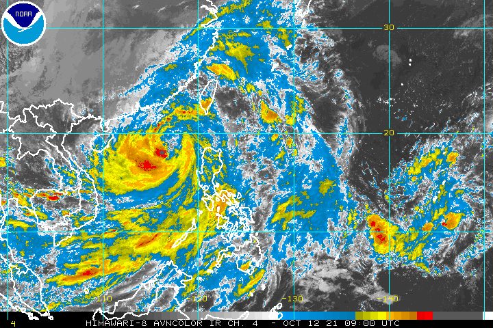
Severe Tropical Storm Maring (Kompasu) left the Philippine Area of Responsibility (PAR) at 11 am on Tuesday, October 12, but its effects continued to be felt in the country even after its exit.
The Philippine Atmospheric, Geophysical, and Astronomical Services Administration (PAGASA) said in a briefing past 5 pm on Tuesday that Maring was already 505 kilometers west of Calayan, Cagayan.
The severe tropical storm accelerated over the West Philippine Sea, now moving west at 30 kilometers per hour from the previous 20 km/h.
It still has maximum sustained winds of 100 km/h and gustiness of up to 125 km/h. (READ: FAST FACTS: Tropical cyclones, rainfall advisories)
Maring had made landfall in Cagayan’s Fuga Island at 8:10 pm on Monday, October 11. It caused floods and landslides in parts of Cagayan Valley, the Ilocos Region, and the Cordillera Administrative Region (CAR).
From Tuesday evening to Wednesday morning, October 13, light to heavy rain is likely to persist in these regions:
- Ilocos Region
- Cordillera Administrative Region
- Cagayan Valley
- Central Luzon
Maring also continues to enhance the southwest monsoon or hanging habagat. Monsoon rain is possible here in the next 24 hours:
- Metro Manila
- Mimaropa
- Calabarzon
There are still areas under tropical cyclone wind signals as of 5 pm on Tuesday.
Signal No. 2 (gale-force to storm-force winds)
- Batanes
- Babuyan Islands
Signal No. 1 (strong winds)
- mainland Cagayan
- western part of Isabela (Maconacon, San Pablo, Santa Maria, Cabagan, Santo Tomas, Delfin Albano, Quezon, Naguilian, Echague, Aurora, Ramon, Burgos, Tumauini, Cordon, San Mateo, Jones, Angadanan, San Manuel, San Agustin, Roxas, Benito Soliven, Mallig, Cauayan City, Ilagan City, Luna, San Isidro, Quirino, Reina Mercedes, San Mariano, Alicia, Cabatuan, Gamu, Santiago City, San Guillermo)
- Quirino
- Nueva Vizcaya
- Apayao
- Abra
- Kalinga
- Mountain Province
- Ifugao
- Benguet
- Ilocos Norte
- Ilocos Sur
- La Union
- Pangasinan
- Nueva Ecija
- Pampanga
- Tarlac
- Zambales
- northern part of Bataan (Hermosa, Dinalupihan, Morong, Orani, Samal, Abucay)
PAGASA added that gusty conditions will continue in the following areas due to Maring’s “expansive wind field” and the enhanced southwest monsoon:
- rest of Luzon
- Visayas
- Zamboanga del Norte
There are no more storm surge warnings in place, but sea travel remains dangerous.
Rough to very rough seas (waves 2.8 to 5.5 meters high)
Conditions risky for all vessels
- seaboards of areas under Signal Nos. 1 and 2
Rough to very rough seas (waves 2.8 to 4.5 meters high)
Small vessels advised not to sail, larger vessels alerted against big waves
- seaboards of Luzon (not under a tropical cyclone wind signal)
- western seaboard of Visayas
Moderate to rough seas (waves 1.2 to 2.5 meters high)
Conditions risky for small vessels
- remaining seaboards of the country
Maring is expected to make landfall in Hainan, China, on Wednesday evening.
It could intensify in the next 24 hours and reach a peak intensity of 110 km/h before hitting Hainan.
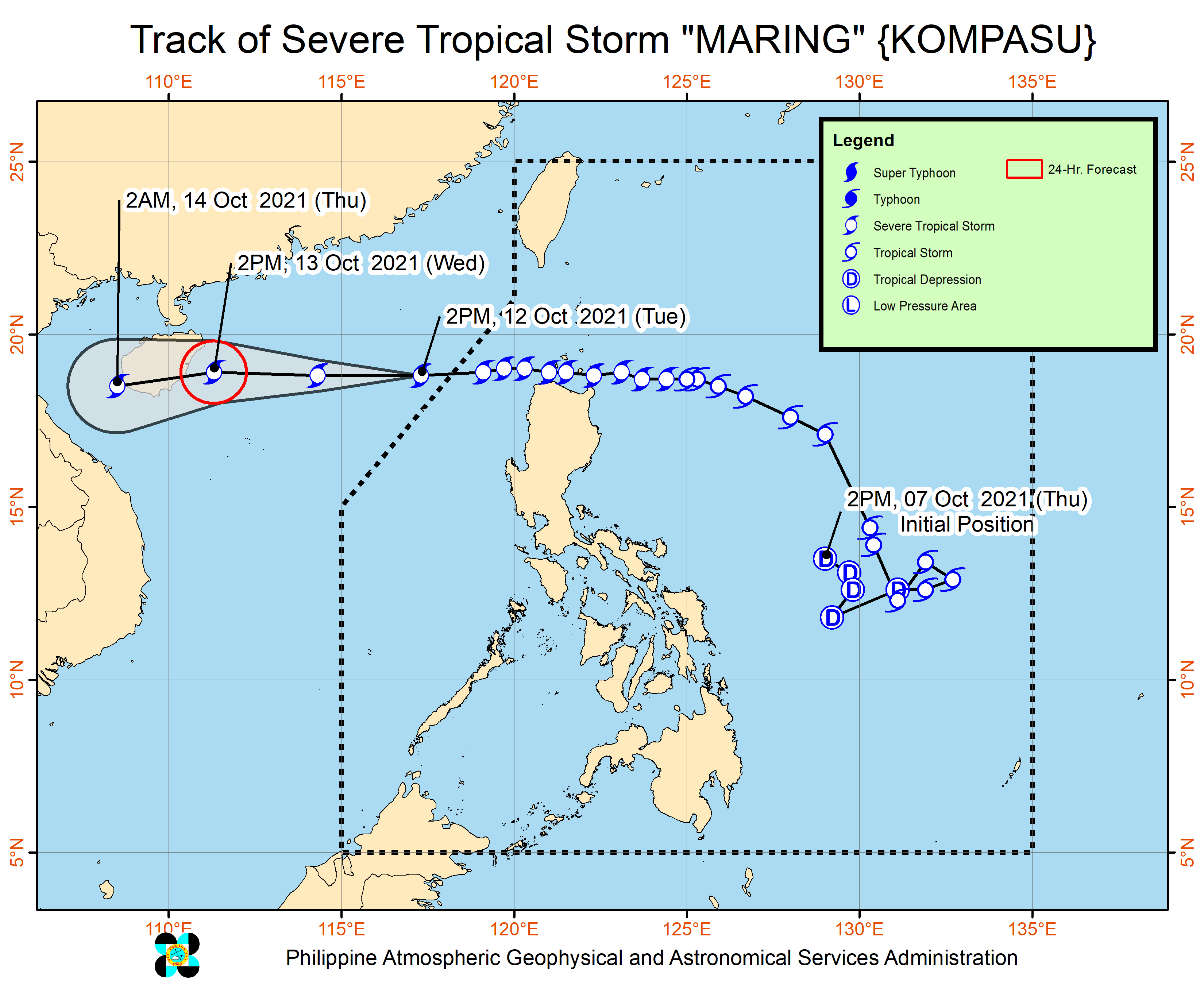
Maring is the Philippines’ 13th tropical cyclone for 2021 and the second for October.
On Sunday morning, October 10, Maring had completed its merger with the remnant low that was formerly Tropical Depression Nando. The two tropical cyclones had interacted over the Philippine Sea, resulting in the merger.
Nando, the Philippines’ 14th tropical cyclone for 2021, had no impact on weather in the country.
An average of 20 tropical cyclones form within or enter PAR each year. (READ: LIST: PAGASA’s names for tropical cyclones in 2021)
These are PAGASA’s latest estimates for the next six months:
2021
- October – 2 or 3
- November – 2 or 3
- December – 1 or 2
2022
- January – 0 or 1
- February – 0 or 1
- March – 0 or 1
The weather bureau is also monitoring the possible emergence of La Niña in the fourth quarter of 2021. – Rappler.com
Add a comment
How does this make you feel?


There are no comments yet. Add your comment to start the conversation.