SUMMARY
This is AI generated summarization, which may have errors. For context, always refer to the full article.
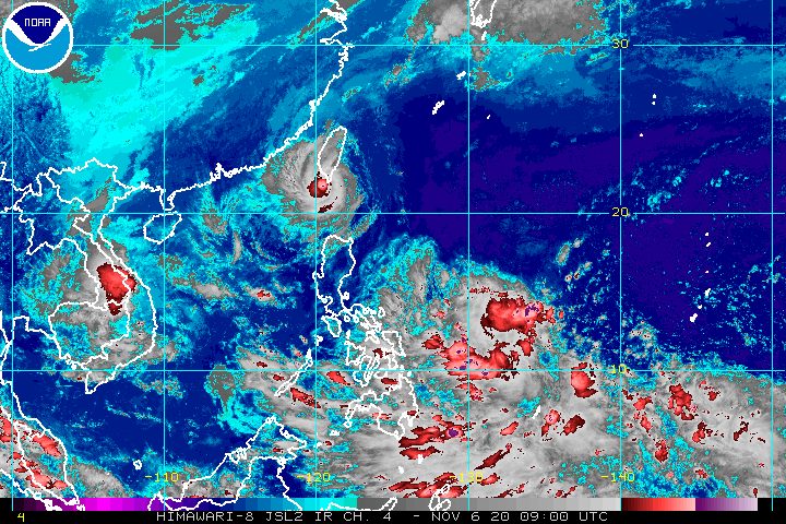
Severe Tropical Storm Siony (Atsani) is on its way out of the Philippine Area of Responsibility (PAR), but a new low pressure area (LPA) just entered on Friday afternoon, November 6.
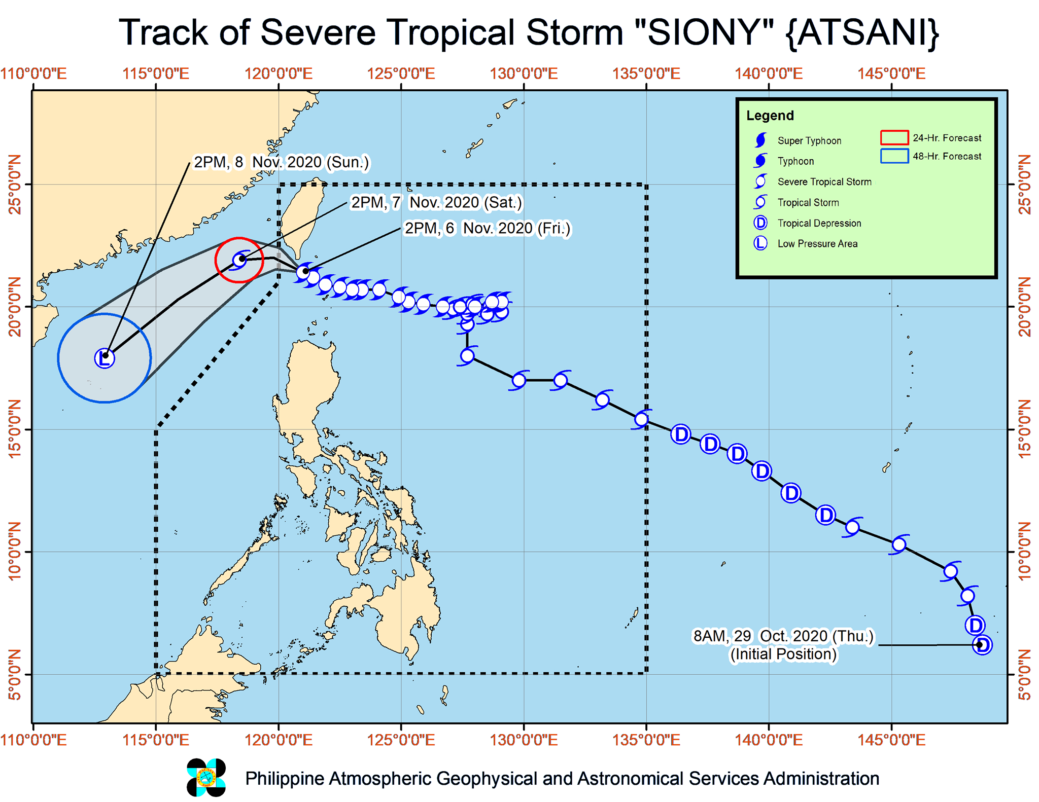
In an online briefing past 5 pm on Friday, the Philippine Atmospheric, Geophysical, and Astronomical Services Administration (PAGASA) said Siony is already 145 kilometers west northwest of Itbayat, Batanes, located over the Bashi Channel.
The severe tropical storm is moving west northwest at 20 kilometers per hour (km/h). If it maintains its speed, it would exit PAR on Friday evening. (READ: FAST FACTS: Tropical cyclones, rainfall advisories)
So far, Siony continues to have maximum sustained winds of 95 km/h and gustiness of up to 115 km/h.
PAGASA said Siony is forecast to maintain its strength in the next 12 hours, then significantly weaken over the West Philippine Sea due to the northeasterlies or winds from the northeast. By Sunday afternoon, November 8, it could already be downgraded to an LPA.
The only remaining area under a tropical cyclone wind signal is the province of Batanes, which is under Signal No. 1 as of 5 pm on Friday, downgraded from Signal No. 2. “Strong breeze to near gale conditions” are being experienced there, according to PAGASA.
Siony will also continue to bring mostly light to moderate rain to Batanes and the Babuyan Islands on Friday evening. PAGASA warned that the rain could be heavy at times.
Travel remains risky in certain seaboards in the next 24 hours.
- coastal waters of Batanes – rough to high seas (waves 3 to 8 meters high), risky for all vessels
- northern seaboard of Northern Luzon – rough to very rough seas (waves 3 to 4.5 meters high), risky for small vessels
Moderate to rough seas, with waves 1.5 to 3 meters high, will also persist in the following seaboards:
- western seaboard of Luzon
- eastern seaboards of Southern Luzon, Visayas, and Mindanao
PAGASA advised small vessels to take precautionary measures, and “inexperienced mariners” to avoid such waters.
As for the new LPA inside PAR, it entered at 2 pm on Friday, and is now located 955 kilometers east of the Visayas.
PAGASA said the LPA is moving toward Eastern Visayas and could reach the area on Saturday afternoon, November 7.
But in the next 24 hours, the LPA’s trough or extension will already bring scattered rain to Eastern Visayas, Central Visayas, Mindanao, and Bicol, which is still reeling from Super Typhoon Rolly (Goni).
The state weather bureau said the rain will mostly be light to moderate, but may be heavy at times.
The LPA could also develop into a tropical depression within 36 hours. If it does, it would be given the local name Tonyo.
Updates are expected in the coming days.
Siony is already the Philippines’ 19th tropical cyclone for 2020.
An average of 20 tropical cyclones form within or enter PAR each year. (READ: LIST: PAGASA’s names for tropical cyclones in 2020)
These are PAGASA’s latest estimates for the number of tropical cyclones inside PAR in the next 6 months:
- November 2020 – 1 to 3
- December 2020 – 2 or 3
- January 2021 – 0 or 1
- February 2021 – 0 or 1
- March 2021 – 0 or 1
- April 2021 – 0 or 1
In early October, the state weather bureau warned Filipinos to expect more rain in the coming months due to the onset of La Niña. – Rappler.com
Add a comment
How does this make you feel?


There are no comments yet. Add your comment to start the conversation.