SUMMARY
This is AI generated summarization, which may have errors. For context, always refer to the full article.
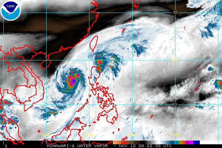
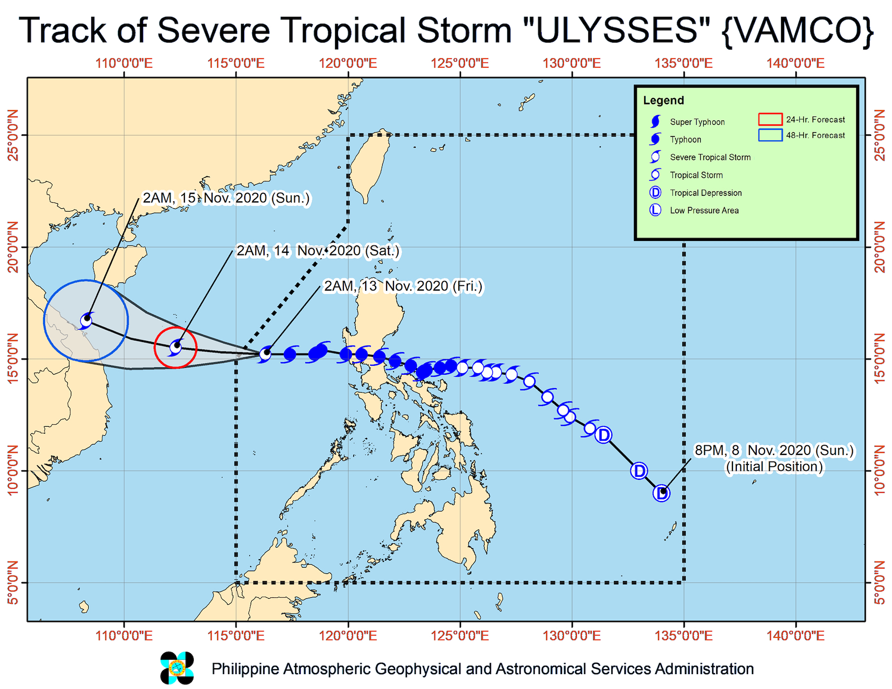
Ulysses (Vamco), which battered parts of Luzon as a powerful typhoon, weakened into a severe tropical storm as it was about to leave the Philippine Area of Responsibility (PAR).
The Philippine Atmospheric, Geophysical, and Astronomical Services Administration (PAGASA) said in its 5 am bulletin on Friday, November 13, that Ulysses now has maximum sustained winds of 110 kilometers per hour (km/h) and gustiness of up to 135 km/h.
When Ulysses first made landfall late Wednesday evening, November 11, it had maximum sustained winds of 150 km/h. A typhoon has maximum sustained winds of 118 to 220 km/h. (READ: FAST FACTS: Tropical cyclones, rainfall advisories)
The severe tropical storm was located 415 kilometers west of Iba, Zambales, before dawn on Friday, moving west at 20 km/h.
It is expected to leave PAR on Friday morning.
There have been no more areas under tropical cyclone wind signals since 11 pm on Thursday, November 12.
But PAGASA said Ulysses and the surge of the northeast monsoon or hanging amihan will continue bringing gusty conditions to the following areas on Friday:
- Batanes
- Babuyan Islands
- Cordillera Administrative Region
- Ilocos Region
- Zambales
- Bataan
- northern part of Occidental Mindoro including Lubang Island
Rain will also continue in parts of Northern Luzon, Central Luzon, and Quezon until Friday afternoon due to the tail-end of a cold front, according to the state weather bureau.
Moderate to heavy rain, with at times intense rain
- Batanes
- Babuyan Islands
- northern and eastern parts of mainland Cagayan
- eastern part of Isabela
- Aurora
- Nueva Vizcaya
- Quirino
- Apayao
Light to moderate rain, with at times heavy rain
- Ilocos Region
- rest of Cordillera Administrative Region
- rest of Cagayan Valley
- northern part of Quezon including Polillo Island
- Zambales
- Bataan
PAGASA warned that floods, landslides, and lahar flows remain possible, especially in high-risk areas and given that many parts of Luzon have already received significant rainfall in the past weeks, making the soil saturated.
Within the next 24 hours, travel for all types of vessels in certain seaboards will stay risky due to Ulysses and the surge of the northeast monsoon combined.
Rough to very rough seas (waves 2.5 to 5.5 meters high)
- seaboards of Batanes, Babuyan Islands, Ilocos Norte, Ilocos Sur, La Union, Pangasinan, and Zambales
- northern seaboard of mainland Cagayan
- western seaboards of Bataan, Batangas, Occidental Mindoro (including Lubang Island), and Palawan (including Calamian and Kalayaan Islands)
Meanwhile, PAGASA said small vessels should take precautionary measures in the eastern seaboards of Luzon, due to moderate to rough seas. Waves will be 2 to 3.5 meters high.
Ulysses left at least 13 people dead and 20 others injured in the Philippines. The Philippine National Police said 6 of the fatalities were from Cagayan Valley, 2 each from Metro Manila and Bicol, and 1 each from Central Luzon, Calabarzon, and the Cordillera Administrative Region.
More than 350,000 people fled their homes. (WATCH: Rappler reporter, family evacuate from Antipolo home to SM Masinag)
Ulysses first passed very close to Bicol on Wednesday, causing massive floods in the region.
It then made landfall thrice in Quezon province:
- Patnanungan – 10:30 pm on Wednesday, November 11
- Burdeos – 11:20 pm on Wednesday, November 11
- General Nakar – 1:40 am on Thursday, November 12
After hitting Quezon, Ulysses crossed Central Luzon. Nearby regions Metro Manila and Calabarzon also felt the wrath of the typhoon. (READ: #ReliefPH: Help communities recover from Typhoon Ulysses)
In Marikina City, residents were reminded of the deadly onslaught of Tropical Storm Ondoy (Ketsana) in September 2009, as thousands of homes were submerged in roof-level floods. (READ: As Filipino resilience gets exploited, netizens slam gov’t disaster response)
Classes are suspended in parts of Luzon for Friday, as floods have yet to subside in some areas and cleanup operations continue for others. Power and communication lines have also yet to be fully restored.
Ulysses is the Philippines’ 21st tropical cyclone for 2020 – already above the yearly average of 20 – and the 3rd for November. (READ: LIST: PAGASA’s names for tropical cyclones in 2020)
For the next 6 months, these are PAGASA’s estimates for tropical cyclones inside PAR:
- November 2020 – 1 to 3
- December 2020 – 2 or 3
- January 2021 – 0 or 1
- February 2021 – 0 or 1
- March 2021 – 0 or 1
- April 2021 – 0 or 1
Since October, La Niña has been underway, which means there is more rain than usual.
Then in November, the northeast monsoon began, signaling “surges of cold temperatures.”
PAGASA warned that La Niña may enhance the northeast monsoon, which could trigger floods and landslides. – Rappler.com
Add a comment
How does this make you feel?


There are no comments yet. Add your comment to start the conversation.