SUMMARY
This is AI generated summarization, which may have errors. For context, always refer to the full article.
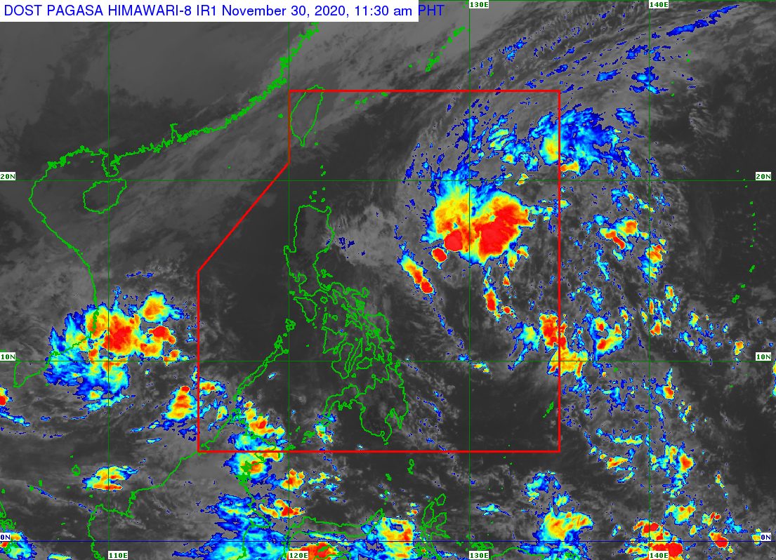
The Philippine Atmospheric, Geophysical, and Astronomical Services Administration (PAGASA) continues to monitor the effects of the tail-end of a frontal system, the northeast monsoon or hanging amihan, and a low pressure area (LPA).
The LPA inside the Philippine Area of Responsibility (PAR) was located 835 kilometers east northeast of Hinatuan, Surigao del Sur, or 850 kilometers east of Guiuan, Eastern Samar, as of Monday morning, November 30.
PAGASA said the LPA “remains less likely to become a tropical depression in the next 24 hours.”
But it is seen to move toward the Southern Luzon-Visayas area, where it would begin to trigger rain by Tuesday, December 1. (READ: FAST FACTS: Tropical cyclones, rainfall advisories)
For Monday, the sources of rain are the tail-end of a frontal system or shear line and the northeast monsoon.
PAGASA provided the following rainfall forecast in an advisory issued 11 am on Monday:
Monday, November 30, until Tuesday noon, December 1
Light to moderate rain, with at times heavy rain (tail-end of a frontal system)
- Bicol
- Eastern Visayas
Occasional light to moderate rain (northeast monsoon)
- Cagayan Valley
- Cordillera Administrative Region
- Aurora
- Quezon
Tuesday afternoon until late evening, December 1
Moderate rain, with at times heavy rain (tail-end of a frontal system and LPA)
- Bicol
- Eastern Visayas
Light to moderate rain, with at times heavy rain (tail-end of a frontal system and LPA)
- southern part of Quezon
- Marinduque
- Romblon
- rest of Visayas
Occasional to frequent light to moderate rain (northeast monsoon)
- Cagayan Valley
- Cordillera Administrative Region
- Aurora
- rest of Quezon
PAGASA warned that there could be floods and landslides, especially in hazard-prone areas and in areas that were already hit by “significant” rainfall in the past days or weeks.
The state weather bureau is referring to the series of tropical cyclones that hit Luzon from October to mid-November, which caused rivers to overflow and dams to reach critical levels. The soil is already saturated as well, limiting its capacity to absorb water.
So far, the Philippines has had 21 tropical cyclones in 2020, already above the yearly average of 20. (READ: LIST: PAGASA’s names for tropical cyclones in 2020)
For the next 6 months, these are PAGASA’s estimates for tropical cyclones inside PAR:
- December 2020 – 1 or 2
- January 2021 – 0 or 1
- February 2021 – 0 or 1
- March 2021 – 0 or 1
- April 2021 – 0 or 1
- May 2021 – 0 or 1
La Niña has been underway since October, causing more rain than usual in the country.
The northeast monsoon also began in November, bringing cold temperatures. – Rappler.com
Add a comment
How does this make you feel?
There are no comments yet. Add your comment to start the conversation.