SUMMARY
This is AI generated summarization, which may have errors. For context, always refer to the full article.
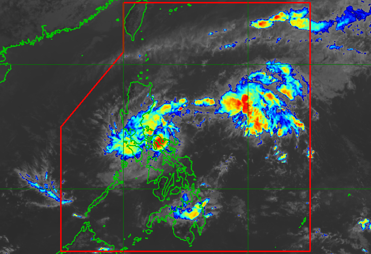
MANILA, Philippines – Tropical Depression Amang continued to maintain its strength over the coastal waters of Caramoan, Camarines Sur, early Wednesday afternoon, April 12.
Amang still has maximum sustained winds of 45 kilometers per hour and gustiness of up to 55 km/h, said the Philippine Atmospheric, Geophysical, and Astronomical Services Administration (PAGASA) in a bulletin issued at 2 pm on Wednesday.
But the tropical depression may weaken into a low pressure area by Thursday, April 13, or earlier, “due to the combined effects of land interaction, dry air intrusion, and increasing vertical wind shear.”
After being almost stationary on Wednesday morning, Amang is already moving north northwest at 10 km/h.
The tropical depression could cross eastern localities in Camarines Sur, Lamon Bay, mainland Quezon, and possibly the Polillo Islands.
PAGASA is still not ruling out “considerable changes” in Amang’s track, however, due to the tropical depression’s “weak and disorganized nature.”
Amang had made its first landfall in Panganiban, Catanduanes, at around 10 pm on Tuesday, April 11, then its second landfall in Presentacion, Camarines Sur, at 1 am on Wednesday.
PAGASA maintained its rainfall forecast for the tropical depression early Wednesday afternoon, advising affected areas to remain on alert for isolated flash floods and landslides.
Forecast accumulated rainfall for next 24 hours (Wednesday morning, April 12, to Thursday morning, April 13)
Heavy rain (50-100 millimeters)
- Camarines Norte
- Camarines Sur
- Quezon
Forecast accumulated rainfall for next three days (Wednesday morning, April 12, to Saturday morning, April 15)
Heavy rain (50-100 mm)
- Calabarzon
- Metro Manila
- Tarlac
- Pampanga
- Bulacan
- southern part of Aurora
- Camarines Norte
- Camarines Sur

As of 2 pm on Wednesday, Signal No. 1 is raised in fewer areas:
- Catanduanes
- Sorsogon (Sorsogon City, Pilar, Castilla, Donsol, Barcelona, Magallanes, Gubat, Casiguran, Juban, Prieto Diaz)
- Albay
- Camarines Sur
- Camarines Norte
- Laguna (Cavinti, Lumban, Kalayaan, Paete, Pakil, Pangil, Siniloan, Famy, Santa Maria, Mabitac)
- Aurora
- Quezon (Buenavista, Calauag, Infanta, Lopez, Guinayangan, Plaridel, Quezon, Alabat, Sampaloc, Mauban, General Nakar, Perez, Gumaca, Atimonan, Real, San Narciso, Tagkawayan) including Polillo Islands
- Rizal (Tanay, Pililla, Rodriguez, Baras, Antipolo City)
- Bulacan (Norzagaray, Doña Remedios Trinidad)
- Nueva Ecija (Gabaldon, Bongabon, Laur, General Tinio)

Moderate to rough seas may persist in these seaboards on Wednesday:
- eastern and southern seaboards of Southern Luzon – waves 1.5 to 3.5 meters high
- eastern seaboard of Central Luzon – waves 1.5 to 2.8 meters high
PAGASA advised small vessels to take precautionary measures or avoid venturing out to sea.
Amang is the Philippines’ first tropical cyclone for 2023. Around 20 tropical cyclones form within or enter the Philippine Area of Responsibility every year. – Rappler.com
Add a comment
How does this make you feel?


There are no comments yet. Add your comment to start the conversation.