SUMMARY
This is AI generated summarization, which may have errors. For context, always refer to the full article.
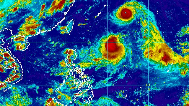
MANILA, Philippines – The low pressure area inside the Philippine Area of Responsibility developed into a tropical depression at 2 pm on Tuesday, August 30, the same time that Hinnamnor rapidly intensified from a typhoon into a super typhoon outside PAR.
The tropical depression, the Philippines’ seventh tropical cyclone for 2022, was given the local name Gardo.
In a bulletin released past 5 pm on Tuesday, the Philippine Atmospheric, Geophysical, and Astronomical Services Administration (PAGASA) said Tropical Depression Gardo was located 1,185 kilometers east of extreme Northern Luzon, moving west southwest at 15 kilometers per hour (km/h).
So far, Gardo has maximum sustained winds of 55 km/h and gustiness of up to 70 km/h.
PAGASA said the tropical depression is unlikely to directly affect weather in the Philippines or conditions in the country’s coastal waters. It is not expected to approach land.
On Wednesday, August 31, Gardo is expected to strengthen into a tropical storm. But it could weaken into a remnant low by Thursday afternoon, September 1, as it gets absorbed by Super Typhoon Hinnamnor.

Meanwhile, Hinnamnor was last spotted 1,485 kilometers east northeast of extreme Northern Luzon, still moving west at 30 km/h.
Its maximum sustained winds increased from 165 km/h to 185 km/h, while its gustiness is now up to 230 km/h from the previous 205 km/h.
“This tropical cyclone may continue to intensify over the sea south of Japan and may reach a peak intensity of 195 km/h,” PAGASA said.
Hinnamnor is still expected to enter PAR on Wednesday evening. It would be given the local name Henry once inside PAR.
Also on Wednesday, the super typhoon may start slowing down, and eventually become almost stationary on Friday, September 2, until Saturday, September 3.
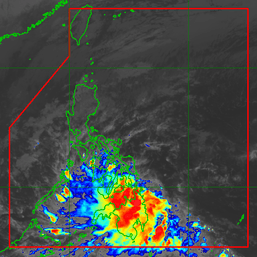
Like Gardo, Hinnamnor is not expected to make landfall in the Philippines. But tropical cyclone wind signals could be raised for extreme Northern Luzon due to the super typhoon, as its winds extend outwards up to 320 kilometers from its center.
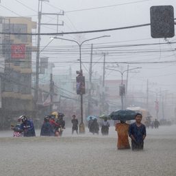
Hinnamnor might also cause rough seas in the northern and eastern seaboards of Luzon beginning late Thursday or early Friday. Conditions would be risky for small vessels.
The super typhoon could leave PAR by Sunday, September 4.

PAGASA expects 7 to 11 tropical cyclones to enter or develop inside PAR from September 2022 to February 2023. Per month, these are the weather bureau’s estimates:
- September 2022 – 2 or 3
- October 2022 – 2 to 4
- November 2022 – 2 or 3
- December 2022 – 1 or 2
- January 2023 – 0 or 1
- February 2023 – 0 or 1
– Rappler.com
Add a comment
How does this make you feel?


There are no comments yet. Add your comment to start the conversation.