SUMMARY
This is AI generated summarization, which may have errors. For context, always refer to the full article.
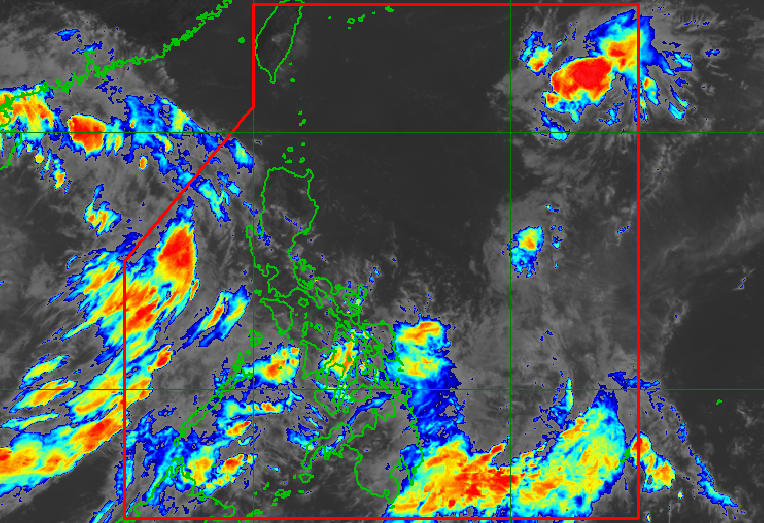
MANILA, Philippines – A low pressure area (LPA) east of extreme Northern Luzon developed into a tropical depression at 8 am on Wednesday, September 28, and was given the local name Luis.
Tropical Depression Luis is the Philippines’ 12th tropical cyclone for 2022 and the fourth for September.
In a bulletin issued at 11 am on Wednesday, the Philippine Atmospheric, Geophysical, and Astronomical Services Administration (PAGASA) said Luis is unlikely to directly affect weather or coastal conditions in the country since it will stay far from land.
That means there will be no rainfall warnings or tropical cyclone wind signals due to Luis.
As of Wednesday morning, Luis was located 1,100 kilometers east of extreme Northern Luzon, moving northwest at 25 kilometers per hour (km/h).
So far, Luis has maximum sustained winds of 55 km/h and gustiness of up to 70 km/h. PAGASA said it could intensify into a tropical storm within 24 hours and strengthen further as it moves over the sea east of Japan’s Ryukyu Islands.
Luis is projected to exit the Philippine Area of Responsibility (PAR) on Thursday, September 29, either in the morning or early afternoon.

While Luis has no effect on Philippine weather, another LPA and the southwest monsoon or hanging habagat are bringing rain on Wednesday.
The LPA was located 445 kilometers east of Guiuan, Eastern Samar, on Wednesday morning.
It is “less likely” to develop into a tropical depression within 48 hours, according to PAGASA, but it is causing light to heavy rain in the following areas:
- Eastern Visayas
- Caraga
- Davao Oriental
The southwest monsoon, meanwhile, is the source of light to heavy rain in these provinces:
- Palawan
- Occidental Mindoro
PAGASA warned that scattered to widespread floods and landslides are likely in areas affected by the LPA and the southwest monsoon.
PAGASA expects 5 to 9 tropical cyclones to enter or develop inside PAR from October 2022 to March 2023. Per month, these are the weather bureau’s estimates:
- October 2022 – 2 to 4
- November 2022 – 2 or 3
- December 2022 – 1 or 2
- January 2023 – 0 or 1
- February 2023 – 0 or 1
- March 2023 – 0 or 1
– Rappler.com
Add a comment
How does this make you feel?


There are no comments yet. Add your comment to start the conversation.