SUMMARY
This is AI generated summarization, which may have errors. For context, always refer to the full article.
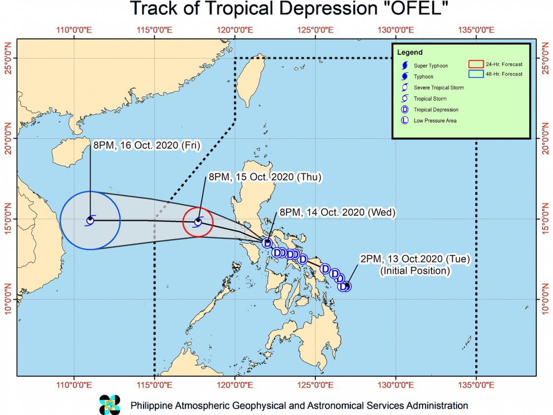
Tropical Depression Ofel turned northwest and made its 4th landfall in Torrijos, Marinduque, at 7:45 pm on Wednesday, October 14.
It was previously expected to make its 4th landfall in Oriental Mindoro.
Ofel’s first 3 landfalls, all on Wednesday too, were in these areas:
- Can-avid, Eastern Samar – 2:30 am
- Matnog, Sorsogon – 6 am
- Burias Island, Masbate – 12 pm
The Philippine Atmospheric, Geophysical, and Astronomical Services Administration (PAGASA) said in a bulletin released past 11 pm on Wednesday that Ofel is now 55 kilometers northeast of Calapan City, Oriental Mindoro, or 35 kilometers south of Tayabas, Quezon.
The tropical depression accelerated, now moving northwest at 30 kilometers per hour (km/h) from the previous 15 km/h.
PAGASA said Ofel may pass close to or over Batangas or the northern part of Oriental Mindoro and Occidental Mindoro overnight until Thursday morning, October 15. Afterwards, it is likely to emerge over the West Philippine Sea.
Ofel maintained its strength, with maximum winds of 45 km/h and gustiness of up to 55 km/h. PAGASA said it is forecast to remain a tropical depression within the next 12 to 24 hours, but it could intensify into a tropical storm over the West Philippine Sea.
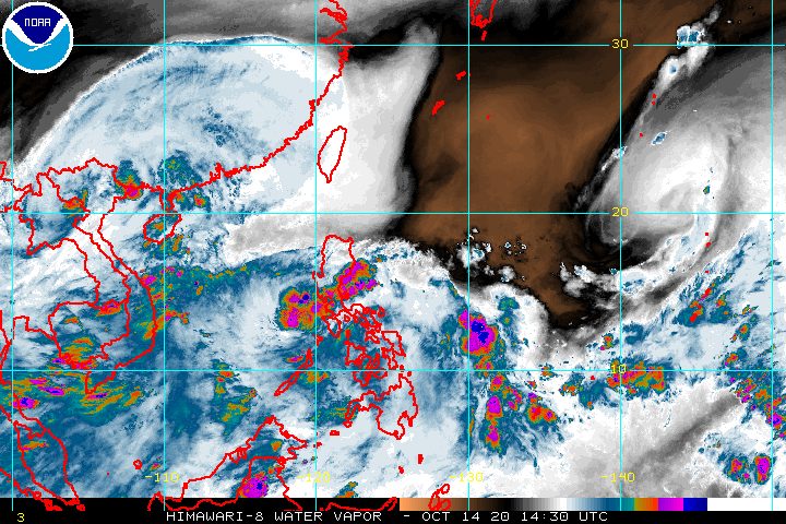
The rain from Ofel and the southwest monsoon or hanging habagat may persist until Thursday evening, so the public must stay on alert for floods and landslides.
Caused by Ofel
Moderate to heavy rain
- Metro Manila
- Cavite
- Laguna
- Rizal
- northern part of Quezon
- Aurora
- Bataan
- Bulacan
Light to moderate rain, with at times heavy rain
- rest of Calabarzon
- rest of Central Luzon
- Nueva Vizcaya
- Quirino
Caused by southwest monsoon
Light to moderate rain, with at times heavy rain
- Mimaropa
- Western Visayas
- Central Visayas
- most of Mindanao
New areas were placed under Signal No. 1 as of 11 pm, including Metro Manila. These places will experience “strong- to near gale-force winds” from Ofel.
- Batangas
- Laguna
- Cavite
- Rizal
- Quezon
- Metro Manila
- Bataan
- Calamian Islands
- Occidental Mindoro
- Oriental Mindoro
- Marinduque
- Romblon
- Camarines Norte
- western part of Camarines Sur (Cabusao, Libmanan, Pamplona, Pasacao, Sipocot, Lupi, Ragay, Del Gallego)
- Burias Island
PAGASA added that occasional gusts due to the northeasterly surface windflow may be experienced in the following areas:
- extreme Northern Luzon
- Aurora
- coastal and mountainous areas of mainland Northern Luzon
A gale warning is also in effect for the entire seaboard of Northern Luzon and the seaboard of Aurora due to the northeasterly surface windflow. PAGASA said seas are rough to very rough, with waves 2.5 to 4.5 meters high, making travel risky.
For seaboards of the areas under Signal No. 1 due to Ofel, waters are moderate to rough, with waves 2.1 to 3.7 meters high. PAGASA advised small vessels not to venture out to sea.
Ofel is forecast to exit PAR on Friday morning or afternoon, October 16. (READ: FAST FACTS: Tropical cyclones, rainfall advisories)
Ofel is the Philippines’ 15th tropical cyclone for 2020, and the 2nd for October.
An average of 20 tropical cyclones form within or enter PAR each year. (READ: LIST: PAGASA’s names for tropical cyclones in 2020)
PAGASA gave the following estimates for the number of tropical cyclones inside PAR in the next 6 months:
- October 2020 – 2 or 3
- November 2020 – 1 or 2
- December 2020 – 1 or 2
- January 2021 – 1 or 2
- February 2021 – 0 or 1
- March 2021 – 0 or 1
Last October 2, the state weather bureau warned Filipinos to expect more rain in the coming months due to the onset of La Niña. – Rappler.com
Add a comment
How does this make you feel?


There are no comments yet. Add your comment to start the conversation.