SUMMARY
This is AI generated summarization, which may have errors. For context, always refer to the full article.
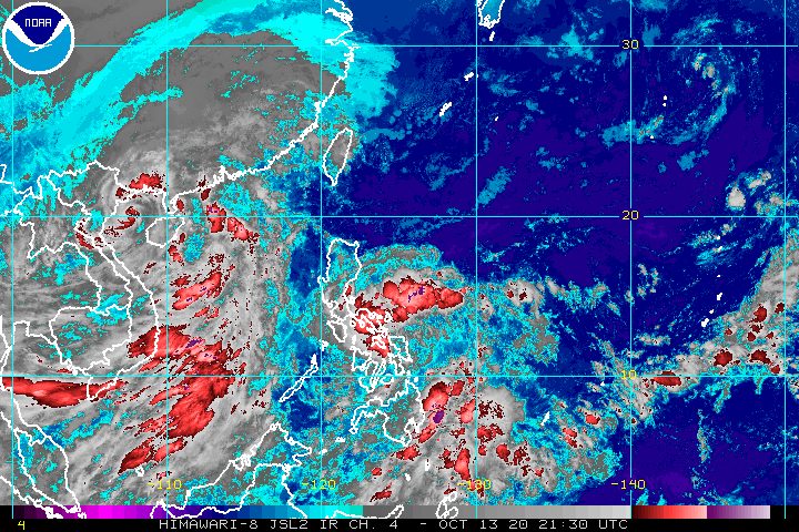
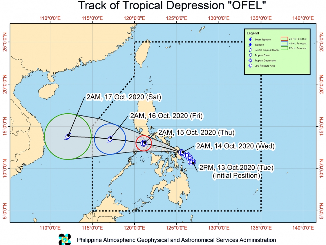
Tropical Depression Ofel made its first landfall in Can-avid, Eastern Samar, at 2:30 am on Wednesday, October 14, and started to cross Samar Island.
The Philippine Atmospheric, Geophysical, and Astronomical Services Administration (PAGASA) said in a bulletin issued 5 am on Wednesday that Ofel is already in the vicinity of Bobon, Northern Samar.
The tropical depression accelerated and is now moving west northwest at 20 kilometers per hour (km/h) from the previous 10 km/h.
PAGASA said Ofel will emerge over the Samar Sea on Wednesday morning, then head for the inland seas of Southern Luzon, possibly passing close to or over Masbate, Romblon, Oriental Mindoro, and Occidental Mindoro. After that, it is likely to emerge over the West Philippine Sea on Thursday morning, October 15.
So far, Ofel continues to have maximum winds of 45 km/h and gustiness of up to 55 km/h. The state weather bureau said it is expected to stay a tropical depression while crossing Samar Island and Southern Luzon, but may intensify into a tropical storm after passing through the Mindoro provinces.
Ofel will be bringing rain throughout Wednesday until Thursday morning, said PAGASA in its latest rainfall forecast.
Moderate to heavy rain
- Bicol
- Northern Samar
- Eastern Samar
- Samar
- Marinduque
- Romblon
- Quezon
- Batangas
- Oriental Mindoro
- Occidental Mindoro
Light to moderate rain, with at times heavy rain
- rest of Calabarzon
- Metro Manila
- Aurora
- Bataan
- Pampanga
- Bulacan
Note that most of Mindanao will also have light to moderate rain – at times heavy – but this is due to the southwest monsoon or hanging habagat, and not Ofel.
Areas affected by the tropical depression and the southwest monsoon should be on alert for possible floods and landslides.
More areas are now under Signal No. 1, with PAGASA warning of “strong- to near gale-force winds” when Ofel passes through.
- southern part of Batangas (Batangas City, Ibaan, Padre Garcia, Rosario, San Juan, Taysan, Lobo)
- southern part of Quezon (Tagkawayan, Guinayangan, Calauag, Alabat, Perez, Quezon, San Francisco, San Andres, San Narciso, Mulanay, Buenavista, Lopez, General Luna, Gumaca, Macalelon, Pitogo, Unisan, Plaridel, Atimonan, Agdangan, Padre Burgos, Lucena City, Pagbilao, Candelaria, Sariaya, Tiaong, San Antonio, Tayabas City, Dolores, Catanauan)
- Oriental Mindoro
- Marinduque
- Romblon
- Camarines Norte
- Camarines Sur
- Catanduanes
- Albay
- Sorsogon
- Masbate including Ticao and Burias Islands
- Northern Samar
- Eastern Samar
- Samar
- Biliran
- northern part of Leyte (Tabango, Leyte, San Isidro, Calubian, Capoocan, Carigara, Jaro, Pastrana, Dagami, Tabontabon, Tanauan, Palo, Santa Fe, Alangalang, Tacloban City, Babatngon, San Miguel, Barugo, Tunga)
PAGASA added that there may be occasional gusts due to the northeasterly surface windflow being enhanced by Ofel and Tropical Storm Nangka – formerly Nika when it was inside the Philippine Area of Responsibility (PAR). These areas would be affected:
- Batanes
- northern and eastern parts of Cagayan including Babuyan Islands
- northern parts of Apayao, Ilocos Norte, and Quezon
- eastern part of Isabela
- Aurora
A gale warning was issued due to rough seas, with waves 2.8 to 4 meters high, caused by the northeasterly surface windflow in the seaboards of Batanes and Ilocos Norte, as well as the northern seaboard of Cagayan including Babuyan Islands. PAGASA said travel is risky, especially for small vessels.
Moderate to rough seas, with waves 2.1 to 3.7 meters high, will be caused by Ofel in the eastern seaboards of Luzon and the Visayas in the next 24 hours. PAGASA advised small vessels not to venture out to sea.
Ofel is forecast to exit PAR on Friday afternoon, October 16. (READ: FAST FACTS: Tropical cyclones, rainfall advisories)
Ofel is the Philippines’ 15th tropical cyclone for 2020, and the 2nd for October.
An average of 20 tropical cyclones form within or enter PAR each year. (READ: LIST: PAGASA’s names for tropical cyclones in 2020)
PAGASA gave the following estimates for the number of tropical cyclones inside PAR in the next 6 months:
- October 2020 – 2 or 3
- November 2020 – 1 or 2
- December 2020 – 1 or 2
- January 2021 – 1 or 2
- February 2021 – 0 or 1
- March 2021 – 0 or 1
Last October 2, the state weather bureau warned Filipinos to expect more rain in the coming months due to the onset of La Niña. – Rappler.com
Add a comment
How does this make you feel?


There are no comments yet. Add your comment to start the conversation.