SUMMARY
This is AI generated summarization, which may have errors. For context, always refer to the full article.
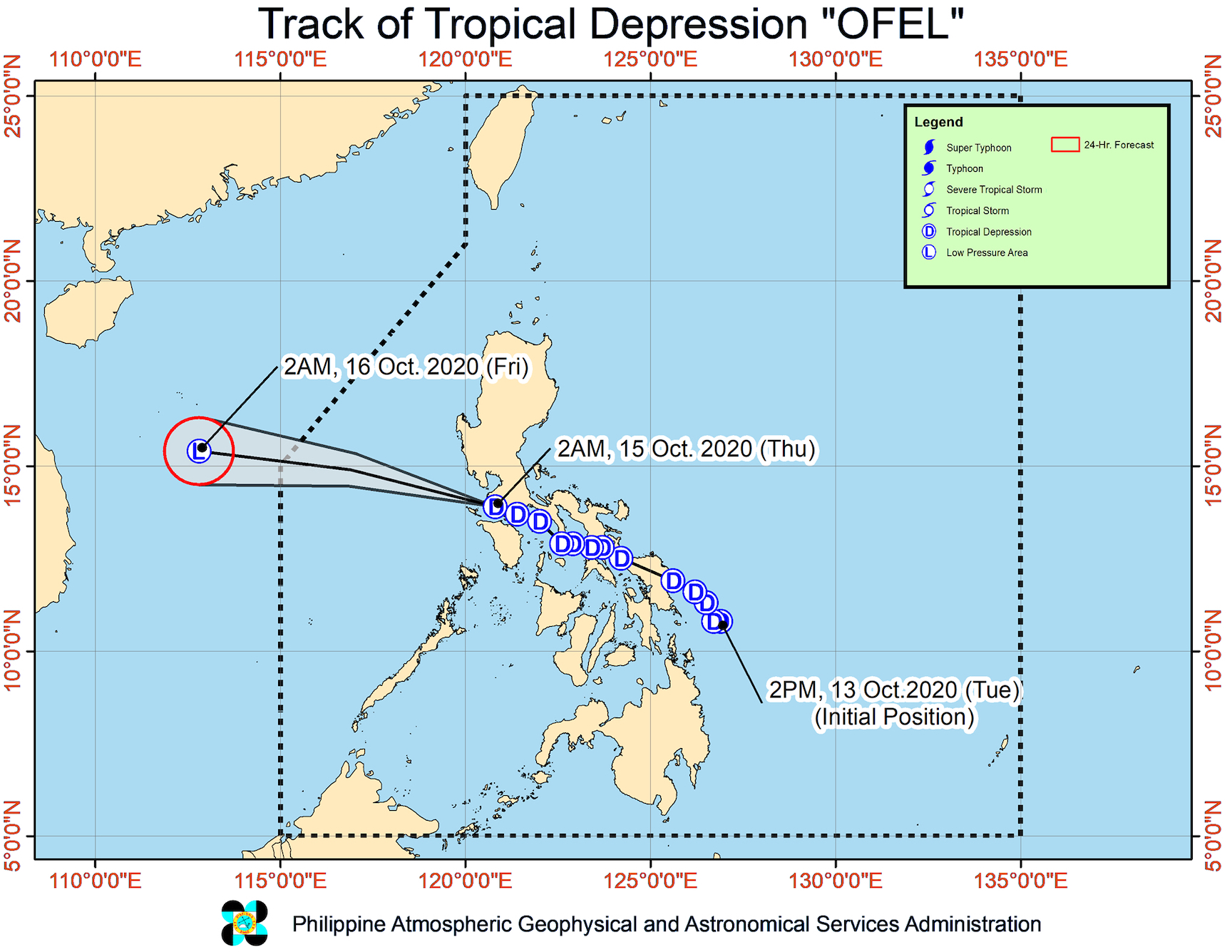
Tropical Depression Ofel left the landmass of Luzon before dawn on Thursday, October 15, exiting through the province of Batangas where it made its 5th landfall.
Ofel made landfall in these areas on Wednesday, October 14:
- Can-avid, Eastern Samar – 2:30 am
- Matnog, Sorsogon – 6 am
- Burias Island, Masbate – 12 pm
- Torrijos, Marinduque – 7:45 pm
- San Juan, Batangas – 11 pm
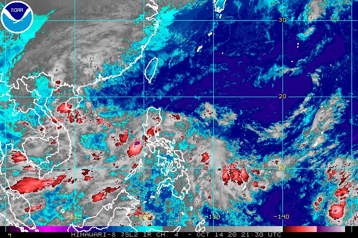
The Philippine Atmospheric, Geophysical, and Astronomical Services Administration (PAGASA) said in a bulletin at 5 am on Thursday that Ofel is already over the coastal waters of Lubang, Occidental Mindoro.
The tropical depression is moving west northwest at 20 kilometers per hour (km/h), heading for the West Philippine Sea.
It continues to have maximum winds of 45 km/h and gustiness of up to 55 km/h. Ofel was earlier expected to intensify into a tropical storm over the West Philippine Sea, but PAGASA is now saying that “there is an increasing likelihood” it will weaken into a low pressure area in the next 12 to 24 hours.
Though Ofel has left Luzon landmass, it will still trigger rain in parts of the island region. The southwest monsoon or hanging habagat is affecting parts of Luzon, too.
Caused by Ofel
Light to moderate rain, with at times heavy rain
- mainland Cagayan Valley
- Cordillera Administrative Region
- Central Luzon
Caused by southwest monsoon
Light to moderate rain, with at times heavy rain
- Occidental Mindoro
- Palawan including Calamian, Cuyo, and Kalayaan Islands
Floods and landslides remain possible in those areas. (READ: FAST FACTS: Tropical cyclones, rainfall advisories)
As for winds, these areas are still under Signal No. 1, experiencing “strong- to near gale-force winds” from Ofel:
- Batangas
- Laguna
- Cavite
- Rizal
- northern and central parts of Quezon (Real, Mauban, Sampaloc, Tayabas City, Pagbilao, Lucban, Lucena City, Sariaya, Candelaria, Tiaong, Dolores, San Antonio, General Nakar, Infanta)
- Metro Manila
- Bataan
- northern part of Occidental Mindoro (Mamburao, Abra de Ilog, Paluan, Santa Cruz)
- northern part of Oriental Mindoro (Puerto Galera, San Teodoro, Baco, Naujan, Naujan Lake, Victoria, Calapan City)
PAGASA added that gusty conditions due to the northeasterly surface windflow may be experienced in the following areas:
- Batanes
- Babuyan Islands
- Cordillera Administrative Region
- Aurora
- coastal and mountainous areas of Ilocos Norte and mainland Cagayan Valley
A gale warning remains in place for the entire seaboard of Northern Luzon and the seaboard of Aurora due to the northeasterly surface windflow. PAGASA said seas are rough to very rough, with waves 2.5 to 4.5 meters high, making travel risky.
For seaboards of the areas under Signal No. 1 due to Ofel, as well as the seaboards of Zambales and Polillo Island, waters are moderate to rough. PAGASA advised small vessels not to venture out to sea, as waves are 2.1 to 3.5 meters high.
Ofel is the Philippines’ 15th tropical cyclone for 2020, and the 2nd for October.
An average of 20 tropical cyclones form within or enter PAR each year. (READ: LIST: PAGASA’s names for tropical cyclones in 2020)
PAGASA gave the following estimates for the number of tropical cyclones inside PAR in the next 6 months:
- October 2020 – 2 or 3
- November 2020 – 1 or 2
- December 2020 – 1 or 2
- January 2021 – 1 or 2
- February 2021 – 0 or 1
- March 2021 – 0 or 1
Last October 2, the state weather bureau warned Filipinos to expect more rain in the coming months due to the onset of La Niña. – Rappler.com
Add a comment
How does this make you feel?


There are no comments yet. Add your comment to start the conversation.