SUMMARY
This is AI generated summarization, which may have errors. For context, always refer to the full article.
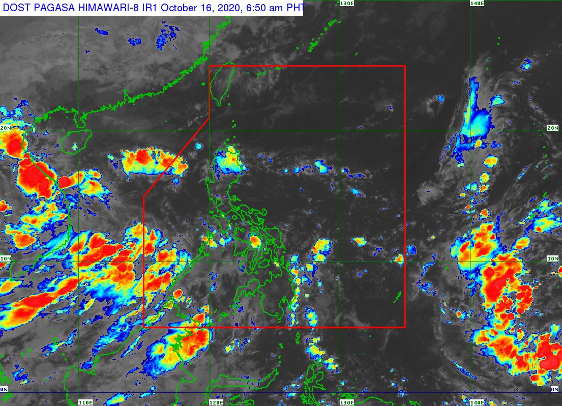
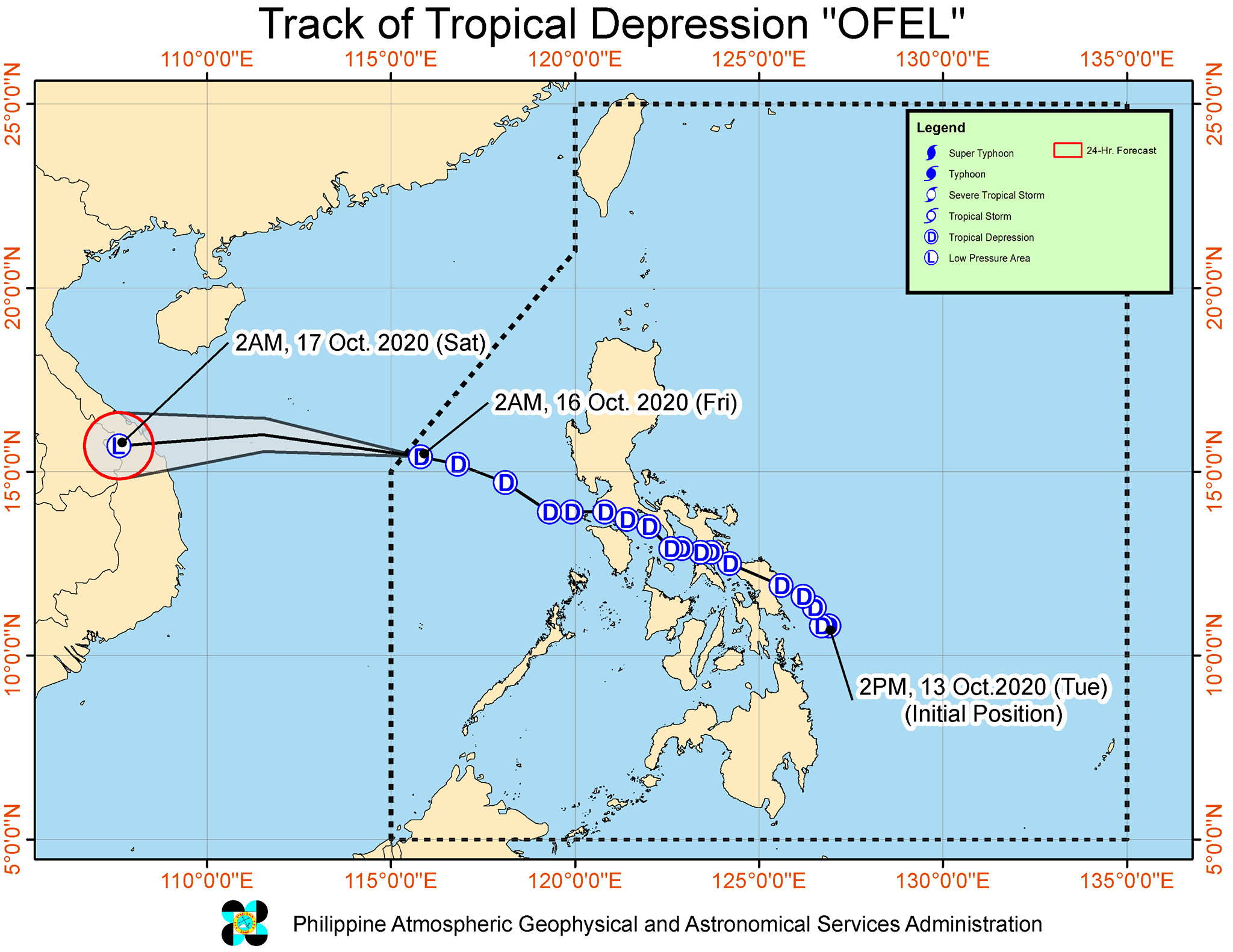
Tropical Depression Ofel left the Philippine Area of Responsibility (PAR) at 4 am on Friday, October 16.
Ofel had made landfall in the country 5 times, all on Wednesday, October 14.
- Can-avid, Eastern Samar – 2:30 am
- Matnog, Sorsogon – 6 am
- Burias Island, Masbate – 12 pm
- Torrijos, Marinduque – 7:45 pm
- San Juan, Batangas – 11 pm
The Philippine Atmospheric, Geophysical, and Astronomical Services Administration (PAGASA) said in its 5 am bulletin on Friday that Ofel is already 500 kilometers west of Iba, Zambales, outside PAR.
The tropical depression is moving west northwest over the West Philippine Sea at 20 kilometers per hour (km/h).
It is heading for the central part of Vietnam, said PAGASA, where it may make landfall between Friday evening and early Saturday morning, October 17.
As Ofel left PAR, it maintained maximum winds of 45 km/h and gustiness of up to 55 km/h. PAGASA said it could weaken into a “remnant low” after hitting Vietnam.
Though Ofel is already outside PAR, the southwest monsoon or hanging habagat will bring rain to parts of the country on Friday.
Light to moderate rain, with at times heavy rain
- Mimaropa
- Western Visayas
- Central Visayas
- Northern Mindanao
- Bangsamoro Autonomous Region in Muslim Mindanao
- Zamboanga Peninsula
PAGASA warned that in cases of heavy or prolonged rainfall, floods and landslides are possible.
The northeasterly surface wind flow will also trigger strong- to gale-force winds with occasional gusts in these areas:
- Batanes
- Babuyan Islands
- northern coastal and/or mountainous areas of mainland Cagayan, Apayao, and Ilocos Norte
There will be strong-force winds with occasional gusts, meanwhile, due to the southwest monsoon here:
- Kalayaan Islands
- coastal and mountainous areas of the southern part of Palawan
In addition, PAGASA issued a gale warning for the seaboards of 3 provinces, due to rough to very rough seas linked to the northeasterly surface wind flow. Travel is risky, especially for small vessels, as waves are 2.8 to 4.5 meters high.
- Batanes
- Cagayan
- Ilocos Norte
The southwest monsoon and the northeasterly surface wind flow are also causing moderate to rough seas, with waves 2.1 to 3.5 meters high, in the:
- remaining seaboards of Northern Luzon
- eastern and western seaboards of Central Luzon and Southern Luzon
PAGASA advised small vessels to take precautionary measures.
Ofel was the Philippines’ 15th tropical cyclone for 2020, and the 2nd for October.
An average of 20 tropical cyclones form within or enter PAR each year. (READ: LIST: PAGASA’s names for tropical cyclones in 2020)
PAGASA gave the following estimates for the number of tropical cyclones inside PAR in the next 6 months:
- October 2020 – 2 or 3
- November 2020 – 1 or 2
- December 2020 – 1 or 2
- January 2021 – 1 or 2
- February 2021 – 0 or 1
- March 2021 – 0 or 1
Last October 2, the state weather bureau warned Filipinos to expect more rain in the coming months due to the onset of La Niña. – Rappler.com
Add a comment
How does this make you feel?


There are no comments yet. Add your comment to start the conversation.