SUMMARY
This is AI generated summarization, which may have errors. For context, always refer to the full article.
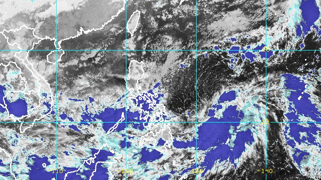
MANILA, Philippines – The shear line and the trough or extension of Tropical Depression Paeng will continue to trigger rain on Thursday, October 27.
The Philippine Atmospheric, Geophysical, and Astronomical Services Administration (PAGASA) provided the following rainfall forecast for the shear line and Paeng’s trough in an advisory at 11 pm on Wednesday, October 26:
Moderate to heavy rain
- Mimaropa
- Visayas
Light to moderate rain, with at times heavy rain
- Quezon
- Bicol
- Northern Mindanao
- Caraga
- Zamboanga Peninsula
Classes have been suspended for some areas on Thursday.
Paeng was last spotted 725 kilometers east of Borongan City, Eastern Samar, on Wednesday evening.
The tropical depression is moving west southwest over the Philippine Sea at a slightly faster 15 kilometers per hour from the previous 10 km/h.
It is projected to move west until Thursday morning or noon, then turn west northwest or northwest for the rest of Thursday until Sunday afternoon, October 30, as it heads for Northern Luzon.
“A landfall scenario is possible within any of the coastal areas along the eastern portion of mainland Cagayan Valley or the northern portion of Aurora on Sunday,” PAGASA said.
As of Wednesday evening, Paeng still had maximum sustained winds of 45 km/h and gustiness of up to 55 km/h.
It is seen to intensify into a tropical storm on Thursday, a severe tropical storm on Friday, October 28, and a typhoon by Saturday, October 29.
“Landfall at or near peak intensity is increasingly likely,” the weather bureau warned.
Meanwhile, rain from Paeng – not just its trough – is expected to be felt starting Friday. Here is PAGASA’s updated rainfall forecast as of 11 pm on Wednesday:
Friday, October 28, to early Saturday morning, October 29
Moderate to heavy rain, with at times intense rain
- Bicol
- Eastern Visayas
Light to moderate rain, with at times heavy rain
- Mimaropa
- Quezon
- Cagayan
- Isabela
- rest of Visayas
- Bangsamoro Autonomous Region in Muslim Mindanao
- Zamboanga Peninsula
Early Saturday morning, October 29, to early Sunday morning, October 30
Heavy to torrential rain
- Bicol
- Northern Samar
- Samar
- Eastern Samar
- Biliran
Moderate to heavy rain, with at times intense rain
- Calabarzon
- Metro Manila
- Aurora
- Bulacan
- Occidental Mindoro
- Oriental Mindoro
- Marinduque
- Romblon
- eastern part of Isabela
- eastern part of Cagayan
- rest of Eastern Visayas
- Western Visayas
Light to moderate rain, with at times heavy rain
- Cordillera Administrative Region
- rest of Central Luzon
- rest of Mimaropa
- rest of mainland Cagayan Valley
- rest of Visayas
- Zamboanga Peninsula
- mainland Bangsamoro Autonomous Region in Muslim Mindanao
The weather bureau warned that floods and landslides are expected.

PAGASA may raise tropical cyclone wind signals for some areas in Eastern Visayas and Bicol as early as Thursday morning, to warn the public that Paeng will bring strong winds.
The highest possible wind signal is Signal No. 4, assuming that Paeng eventually reaches typhoon status.
Even before the arrival of tropical cyclone winds, however, strong winds due to the surge of the northeast monsoon or hanging amihan have hit parts of Luzon. On Thursday, these areas will be affected:
- Batanes
- Babuyan Islands
- northern part of mainland Cagayan
- northern part of Apayao
- northern part of Ilocos Norte
- Quezon
- Camarines Norte
- northern part of Camarines Sur
- northern part of Catanduanes
Also due to the surge of the northeast monsoon, a gale warning issued at 5 pm on Wednesday remains in effect. Rough to very rough seas are seen in these seaboards:
- seaboards of Northern Luzon and eastern seaboard of Central Luzon (Batanes, Cagayan including Babuyan Islands, Isabela, Ilocos Norte, Ilocos Sur, Aurora) – waves 2.8 to 5.5 meters high
- eastern seaboard of Southern Luzon (Camarines Norte, northern coast of Camarines Sur, Catanduanes, coast of northern Quezon including northern and eastern coasts of Polillo Islands) – waves 2.8 to 4.5 meters high
PAGASA advised fishing boats and other small vessels not to sail, and larger vessels to watch out for big waves.
The surge of the northeast monsoon and Paeng may also trigger moderate to rough seas in the eastern seaboards of the Visayas and Mindanao. Waves could be 1.5 to 3.5 meters high, which may be risky for small vessels.
Paeng is the Philippines’ 16th tropical cyclone for 2022 and the fourth for October. PAGASA earlier said there may be up to four tropical cyclones during the month. – Rappler.com
Add a comment
How does this make you feel?


There are no comments yet. Add your comment to start the conversation.