SUMMARY
This is AI generated summarization, which may have errors. For context, always refer to the full article.
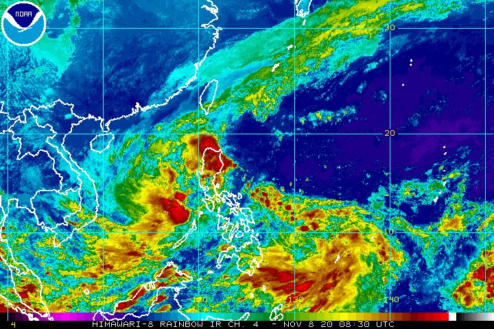
The low pressure area (LPA) that entered the Philippine Area of Responsibility (PAR) on Sunday, November 8, may develop into a tropical depression within 24 to 36 hours.
If it becomes a tropical depression, it would be given the local name Ulysses. (READ: LIST: PAGASA’s names for tropical cyclones in 2020)
In an online briefing at 5 pm on Sunday, the Philippine Atmospheric, Geophysical, and Astronomical Services Administration (PAGASA) said the LPA is located 920 kilometers east of Hinatuan, Surigao del Sur.
The LPA is seen to move north-northwest on Sunday until Monday evening, November 9, then northwest to west-northwest toward the Central Luzon-Southern Luzon area.
The tropical cyclones in the past month also hit parts of Luzon – Ofel, Pepito (Saudel), Quinta (Molave), Rolly (Goni), Siony (Atsani), and the current one inside PAR, Tonyo.
PAGASA said the LPA has no direct effect on any part of the Philippines at the moment.
But the state weather bureau warned that as the LPA moves closer to land, it could bring rain to the eastern parts of Luzon and the Visayas beginning Monday afternoon.
More detailed forecasts are expected in the coming days. (READ: FAST FACTS: Tropical cyclones, rainfall advisories)
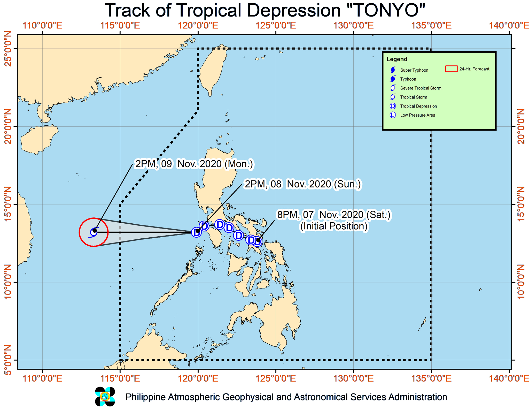
Meanwhile, Tropical Depression Tonyo is now 185 kilometers west of Calapan City, Oriental Mindoro.
The tropical depression slightly slowed down, moving southwest at 25 kilometers per hour (km/h) from the previous 30 km/h.
It continues to head for the PAR’s western boundary, where it may exit on Monday morning.
Tonyo continues to have maximum sustained winds of 45 km/h, but its gustiness slightly decreased from 60 km/h to 55 km/h. It is still forecast to intensify into a tropical storm within 24 hours.
Though Tonyo is starting to move away, parts of Luzon will still have rain on Sunday evening.
Light to moderate rain, with at times heavy rain
- Ilocos Region
- Cordillera Administrative Region
- Cagayan Valley
- Aurora
- Palawan including Calamian and Kalayaan Islands
But Signal No. 1 has been completely lifted as of 5 pm on Sunday.
The northeast monsoon or hanging amihan is the source of “strong breeze to near gale conditions” in the following areas:
- Batanes
- Babuyan Islands
- Ilocos Norte
- Apayao
- northern part of mainland Cagayan
The northeast monsoon is also causing rough to very rough seas, with waves 2.5 to 4.5 meters high, in these seaboards:
- seaboards of Batanes, Ilocos Norte, and Ilocos Sur
- northern seaboard of Cagayan including Babuyan Islands
Travel remains risky, particularly for small vessels.
Moderate to rough seas due to Tonyo and the easterlies, with waves 1.5 to 3.5 meters high, will continue in the following seaboards as well:
- eastern seaboards of Cagayan Valley, Aurora, and northern part of Quezon
- northern and eastern seaboards of Catanduanes
PAGASA advised small vessels to take precautionary measures and “inexperienced mariners” to “avoid navigating in these conditions.”
Tonyo is the Philippines’ 20th tropical cyclone for 2020, while the potential Ulysses would be the 21st – above the yearly average of 20.
For the next 6 months, these are PAGASA’s estimates for tropical cyclones inside PAR:
- November 2020 – 1 to 3
- December 2020 – 2 or 3
- January 2021 – 0 or 1
- February 2021 – 0 or 1
- March 2021 – 0 or 1
- April 2021 – 0 or 1
Since October, La Niña has been underway, which means there is more rain than usual.
Then in November, the northeast monsoon began, signaling “surges of cold temperatures.”
PAGASA warned that La Niña may enhance the northeast monsoon, which could trigger floods and landslides. – Rappler.com
Add a comment
How does this make you feel?


There are no comments yet. Add your comment to start the conversation.