SUMMARY
This is AI generated summarization, which may have errors. For context, always refer to the full article.
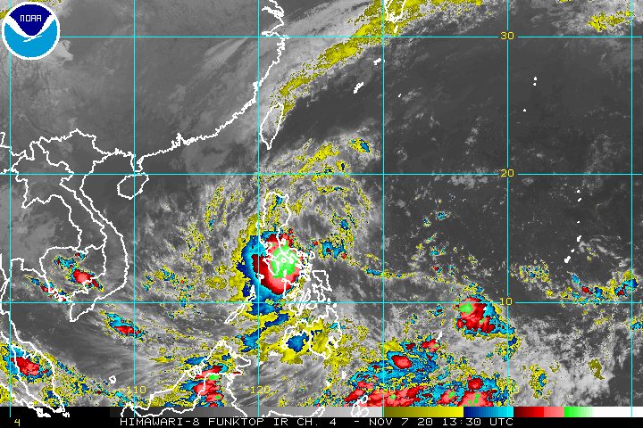
The low pressure area (LPA) bringing rain to parts of the Philippines developed into a tropical depression at 8 pm on Saturday, November 7.
It was given the local name Tonyo, as the Philippines’ 20th tropical cyclone for 2020.
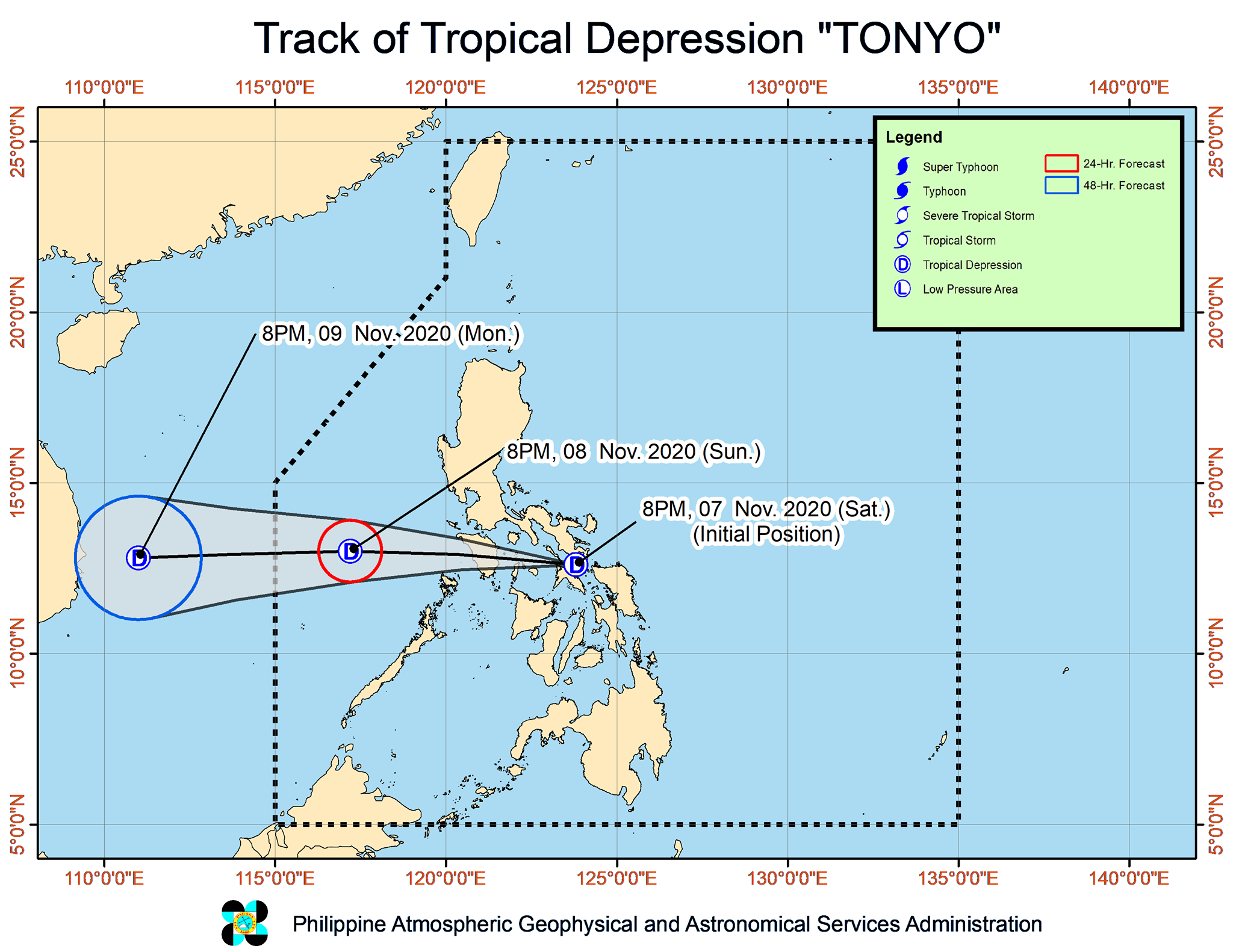
The Philippine Atmospheric, Geophysical, and Astronomical Services Administration (PAGASA) said in a bulletin issued 11 pm on Saturday that Tropical Depression Tonyo made landfall over the northern part of Ticao Island in Masbate province at around 9 pm.
As of 10 pm, Tonyo was already in the vicinity of Monreal, Masbate.
It is moving west at 25 kilometers per hour (km/h), with its center likely to pass close to or over the rest of Masbate and then Romblon, Oriental Mindoro, and Occidental Mindoro in the coming hours. (READ: FAST FACTS: Tropical cyclones, rainfall advisories)
Tonyo currently has maximum sustained winds of 45 km/h and gustiness of up to 75 km/h. It is expected to stay a tropical depression.
Signal No. 1 is now raised in these areas:
- Catanduanes
- Camarines Norte
- Camarines Sur
- Albay
- Sorsogon
- Masbate including Ticao and Burias Islands
- central and southern parts of Quezon (Mauban, Sampaloc, Lucban, Dolores, Tiaong, San Antonio, Candelaria, Sariaya, Tayabas City, Lucena City, Pagbilao, Atimonan, Padre Burgos, Agdangan, Unisan, Plaridel, Pitogo, Macalelon, General Luna, Catanauan, Mulanay, San Francisco, San Andres, San Narciso, Buenavista, Guinayangan, Tagkawayan, Calauag, Lopez, Gumaca, Alabat, Quezon, Perez)
- central and southern parts of Cavite (Dasmariñas City, General Trias City, Tanza, Naic, Ternate, Maragondon, Magallanes, General Emilio Aguinaldo, Alfonso, Mendez, Trece Martires City, Indang, Amadeo, Silang, Tagaytay City, Carmona, General Mariano Alvarez)
- central and southern parts of Laguna (San Pedro, Biñan, Santa Rosa City, Cabuyao, Calamba City, Los Baños, Bay, Calauan, Alaminos, San Pablo City, Rizal, Nagcarlan, Victoria, Pila, Santa Cruz, Pagsanjan, Lumban, Kalayaan, Cavinti, Luisiana, Majayjay, Liliw, Magdalena)
- Batangas
- Marinduque
- Romblon
- Oriental Mindoro
- Occidental Mindoro including Lubang Island
- Calamian Islands
- western part of Northern Samar (Silvino Lobos, Pambujan, San Roque, Mondragon, Lope de Vega, Catarman, Bobon, San Jose, Rosario, Lavezares, Allen, Victoria, San Isidro, Biri, San Antonio, Capul, San Vicente)
- northern part of Samar (Pagsanghan, Gandara, Santa Margarita, Calbayog City, Santo Niño, Almagro, Tagapul-an)
- northwestern part of Aklan (Ibajay, Tangalan, Makato, Numancia, Nabas, Malay)
- northern part of Antique (Pandan, Libertad, Caluya)
PAGASA said areas under Signal No. 1 are “currently experiencing or will be experiencing strong breeze to near gale conditions with occasional gusts throughout the passage of Tonyo.”
The northeast monsoon or hanging amihan will also bring strong breeze to near gale conditions to these areas:
- Batanes
- Babuyan Islands
- Ilocos Norte
- Apayao
- northern part of mainland Cagayan
In addition to strong winds, Tonyo will trigger more rain across the Philippines overnight until Sunday, November 8. Floods and landslides may occur.
Moderate to heavy rain, with at times intense rain
- Bicol
- Calabarzon
- Marinduque
- Romblon
- Oriental Mindoro
- Occidental Mindoro
- Aurora
- eastern part of mainland Cagayan
- eastern part of Isabela
Light to moderate rain, with at times heavy rain
- rest of the country
The tropical depression and the easterlies are causing moderate to rough seas as well, with waves 1.5 to 3.5 meters high, in the following seaboards:
- seaboards of areas under Signal No. 1
- eastern seaboards of Cagayan Valley, Aurora, and northern part of Quezon
There will also be moderate to rough seas, with waves 2 to 3 meters high, due to the northeast monsoon here:
- seaboards of Batanes, Babuyan Islands, Ilocos Norte, and Ilocos Sur
- northern seaboard of mainland Cagayan
Tonyo is expected to emerge over the West Philippine Sea on Sunday morning, then exit the Philippine Area of Responsibility (PAR) on Monday morning, November 9.
An average of 20 tropical cyclones form within or enter PAR each year. The average has been reached with Tonyo. (READ: LIST: PAGASA’s names for tropical cyclones in 2020)
For the next 6 months, these are PAGASA’s estimates for tropical cyclones inside PAR:
- November 2020 – 1 to 3
- December 2020 – 2 or 3
- January 2021 – 0 or 1
- February 2021 – 0 or 1
- March 2021 – 0 or 1
- April 2021 – 0 or 1
La Niña has been underway since October, which means “above normal rainfall” in the coming months.
The northeast monsoon began in November, signaling “surges of cold temperatures.”
PAGASA warned that La Niña may enhance the northeast monsoon, which could trigger floods and landslides. – Rappler.com
Add a comment
How does this make you feel?


There are no comments yet. Add your comment to start the conversation.