SUMMARY
This is AI generated summarization, which may have errors. For context, always refer to the full article.
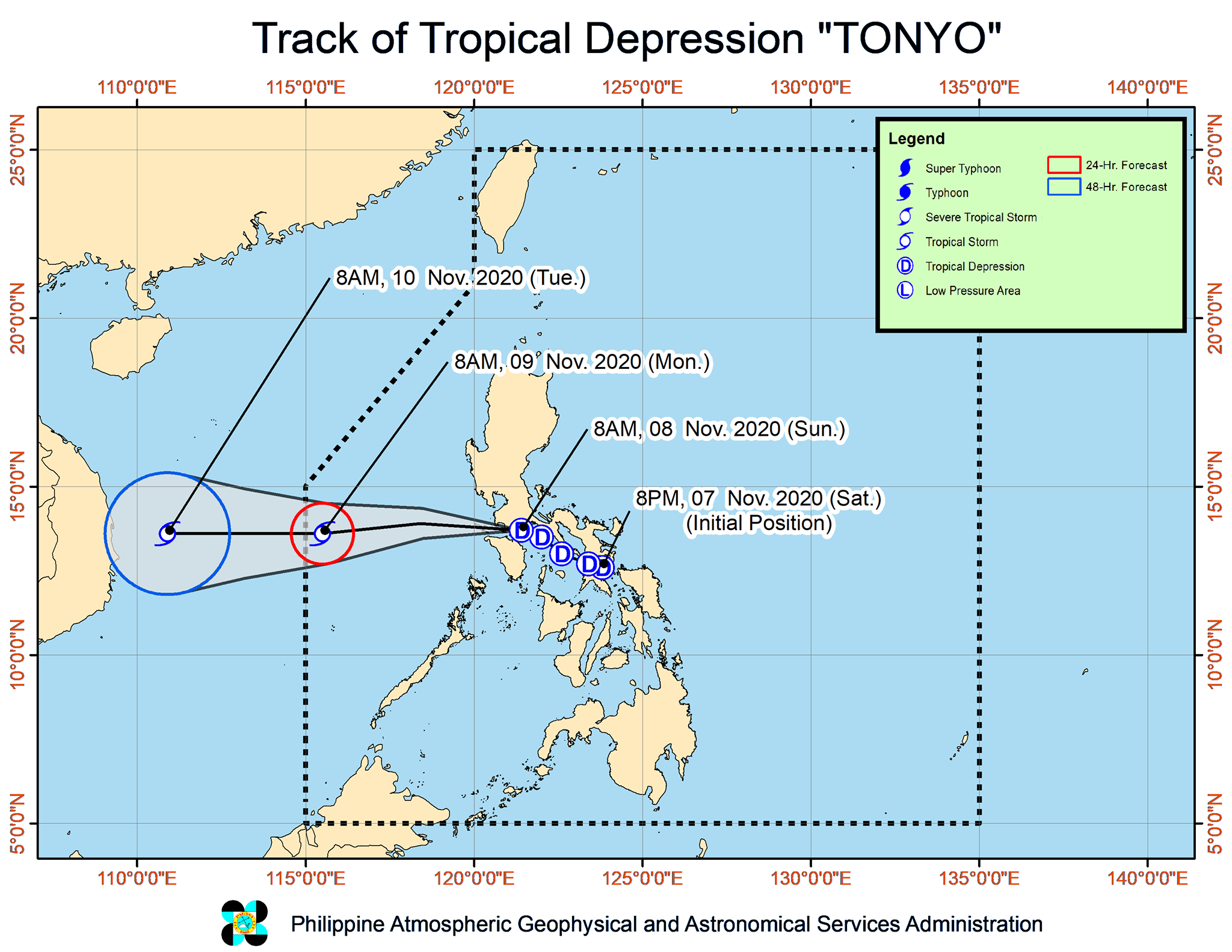
Tropical Depression Tonyo made landfall for the 3rd time in Luzon, this time in San Juan, Batangas, at 8 am on Sunday, November 8.
Its previous two landfalls were in the following areas:
- Ticao Island, Masbate – 9 pm, Saturday, November 7
- Torrijos, Marinduque – 4:30 am, Sunday, November 8
In an online briefing past 11 am on Sunday, the Philippine Atmospheric, Geophysical, and Astronomical Services Administration (PAGASA) said Tonyo is now in the vicinity of Lobo, Batangas.
The tropical depression is still moving west northwest at 25 kilometers per hour (km/h), crossing the Batangas-Cavite area. (READ: FAST FACTS: Tropical cyclones, rainfall advisories)
Tonyo also maintained its strength late Sunday morning, with maximum sustained winds of 45 km/h and gustiness of up to 60 km/h. But PAGASA said it might intensify into a tropical storm within 24 hours.
Fewer areas remain under Signal No. 1 as of 11 am on Sunday, as Tonyo is projected to leave landmass and emerge over the West Philippine Sea in the next few hours.
- northern and central parts of Quezon (Gumaca, Pitogo, Quezon, Alabat, Perez, Unisan, Plaridel, Atimonan, Agdangan, Padre Burgos, Pagbilao, Mauban, Tayabas City, Lucena City, Sariaya, Candelaria, Tiaong, San Antonio, Dolores, Lucban, Sampaloc, Real, Infanta, General Nakar) including Polillo Island
- Cavite
- Laguna
- Rizal
- Batangas
- Metro Manila
- Bataan
- Bulacan
- Pampanga
- southern part of Aurora (Dingalan)
- southern part of Zambales (San Marcelino, San Felipe, San Narciso, San Antonio, Castillejos, Subic, Olongapo City)
- Marinduque
- northern part of Romblon (Romblon, San Andres, Calatrava, San Agustin, Corcuera, Banton, Concepcion)
- northern and central parts of Oriental Mindoro (Bongabong, Bansud, Gloria, Pinamalayan, Socorro, Pola, Naujan, Victoria, Calapan City, Baco, San Teodoro, Puerto Galera)
- northern and central parts of Occidental Mindoro (Sablayan, Santa Cruz, Mamburao, Paluan, Abra de Ilog) including Lubang Island
Areas under Signal No. 1 may continue to have “strong breeze to near gale conditions with occasional gusts throughout the passage of Tonyo,” said PAGASA.
Similar windy conditions will persist in some areas due to the northeast monsoon or hanging amihan.
- Batanes
- Babuyan Islands
- Ilocos Norte
- Apayao
- northern part of mainland Cagayan
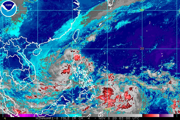
The rain from Tonyo also continues in parts of Luzon.
Light to moderate rain, with at times heavy rain
- Ilocos Region
- Cordillera Administrative Region
- Cagayan Valley
- Aurora
- northern part of Quezon including Polillo Island
- Rizal
- Laguna
- Cavite
- Batangas
- Oriental Mindoro
- Occidental Mindoro
- Palawan including Calamian and Kalayaan Islands
Moderate to rough seas due to Tonyo and the easterlies, with waves 1.5 to 3.5 meters high, are still being experienced in the following seaboards:
- seaboards of areas under Signal No. 1
- eastern seaboards of Cagayan Valley, Aurora, and northern part of Quezon
- northern and eastern seaboards of Catanduanes
PAGASA advised small vessels to take precautionary measures and “inexperienced mariners” to “avoid navigating in these conditions.”
There are also rough to very rough seas, with waves 2.5 to 4.5 meters high, due to the northeast monsoon here:
- seaboards of Batanes, Ilocos Norte, and Ilocos Sur
- northern seaboard of Cagayan including Babuyan Islands
Travel remains risky, particularly for small vessels.
Tonyo is expected to leave the Philippine Area of Responsibility (PAR) on Monday morning, November 9.
Even before Tonyo’s projected exit from PAR, there is already a low pressure area (LPA) right outside, located 980 kilometers east of Mindanao as of late Sunday morning.
This LPA has no effect on any part of the Philippines yet, but it could enter PAR on Sunday.
It may also develop into a tropical depression within 36 to 48 hours, according to PAGASA Senior Weather Specialist Chris Perez.
If the LPA becomes a tropical depression inside PAR, it would be given the local name Ulysses. (READ: LIST: PAGASA’s names for tropical cyclones in 2020)
It would also be the Philippines’ 21st tropical cyclone for 2020, already above the yearly average of 20.
For the next 6 months, these are PAGASA’s estimates for tropical cyclones inside PAR:
- November 2020 – 1 to 3
- December 2020 – 2 or 3
- January 2021 – 0 or 1
- February 2021 – 0 or 1
- March 2021 – 0 or 1
- April 2021 – 0 or 1
Since October, La Niña has been underway, which means there is more rain than usual.
Then in November, the northeast monsoon began, signaling “surges of cold temperatures.”
PAGASA warned that La Niña may enhance the northeast monsoon, which could trigger floods and landslides. – Rappler.com
Add a comment
How does this make you feel?


There are no comments yet. Add your comment to start the conversation.