SUMMARY
This is AI generated summarization, which may have errors. For context, always refer to the full article.
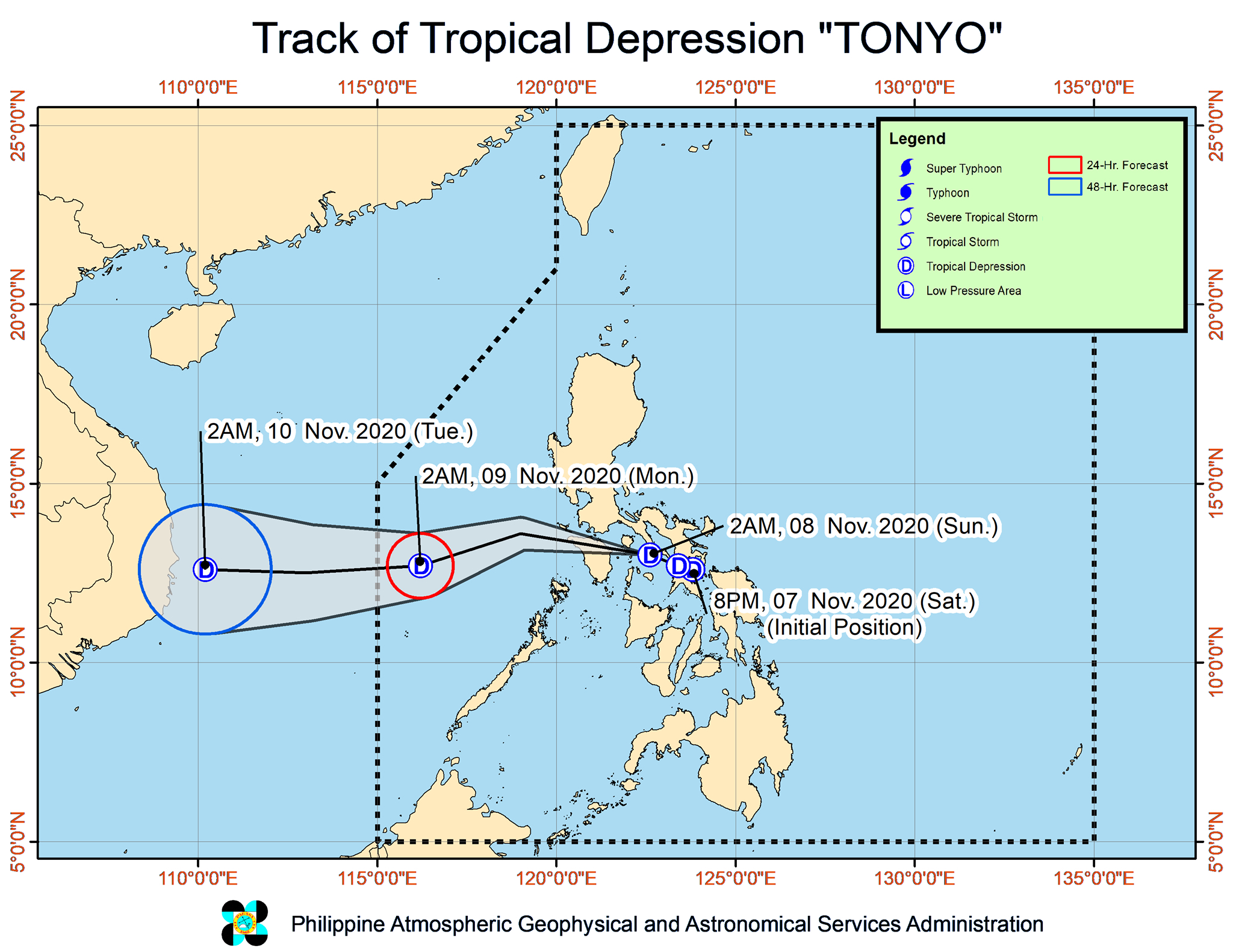
Tropical Depression Tonyo was expected to pass close to or over Marinduque, Oriental Mindoro, and Occidental Mindoro early Sunday, November 8.
But the Philippine Atmospheric, Geophysical, and Astronomical Services Administration (PAGASA) said that “given the recent shift” in Tonyo’s direction, “there is an increasing likelihood that its center will make landfall in the vicinity of southern Quezon or Batangas.”
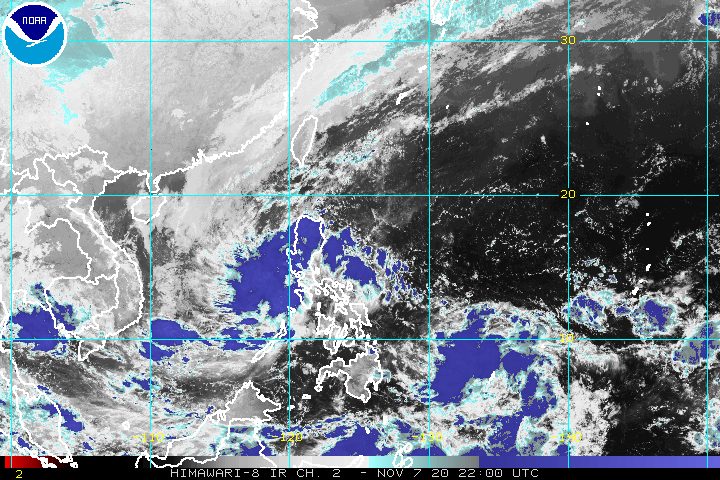
PAGASA said in its 5 am bulletin on Sunday that Tonyo was located 90 kilometers south southeast of Alabat, Quezon, moving west northwest at 25 kilometers per hour (km/h).
The tropical depression continues to have maximum sustained winds of 45 km/h, while its gustiness is now at 60 km/h.
Below is the latest list of areas under Signal No. 1 as of 5 am on Sunday, which now includes Metro Manila.
- Camarines Norte
- Camarines Sur
- western part of Albay (Polangui, Oas, Ligao City, Pio Duran, Libon)
- western part of Masbate (Aroroy, Mandaon, Balud) including Burias Island
- Quezon including Polillo Island
- Cavite
- Laguna
- Rizal
- Batangas
- Metro Manila
- Bataan
- Marinduque
- Romblon
- Oriental Mindoro
- Occidental Mindoro including Lubang Island
- Calamian Islands
- northwestern part of Aklan (Buruanga, Ibajay, Tangalan, Makato, Numancia, Nabas, Malay)
- northern part of Antique (Pandan, Libertad, Caluya)
PAGASA said areas under Signal No. 1 are “currently experiencing or will be experiencing strong breeze to near gale conditions with occasional gusts throughout the passage of Tonyo.”
The northeast monsoon or hanging amihan will also bring strong breeze to near gale conditions to these areas:
- Batanes
- Babuyan Islands
- Ilocos Norte
- Apayao
- northern part of mainland Cagayan
In terms of rainfall, PAGASA provided this updated outlook for Sunday:
Moderate to heavy rain
- Oriental Mindoro
- Occidental Mindoro
- northern part of Quezon including Polillo Island
- Aurora
- eastern part of mainland Cagayan
- eastern part of Isabela
Light to moderate rain, with at times heavy rain
- rest of Mimaropa
- rest of Calabarzon
- rest of Central Luzon
- Ilocos Region
- Cordillera Administrative Region
- Metro Manila
Residents of those areas must continue to watch out for possible floods and landslides. (READ: FAST FACTS: Tropical cyclones, rainfall advisories)
The tropical depression and the easterlies are causing moderate to rough seas as well, with waves 1.5 to 3.5 meters high, in the following seaboards:
- seaboards of areas under Signal No. 1
- eastern seaboards of Cagayan Valley, Aurora, and northern part of Quezon
- northern and eastern seaboards of Catanduanes
PAGASA advised small vessels to take precautionary measures and “inexperienced mariners” to “avoid navigating in these conditions.”
There will also be rough to very rough seas, with waves 2.5 to 3.5 meters high, due to the northeast monsoon here:
- seaboards of Batanes, Ilocos Norte, and Ilocos Sur
- northern seaboard of Cagayan including Babuyan Islands
Travel is risky, especially for small vessels.
Tonyo is expected to emerge over the West Philippine Sea on Sunday morning, then exit the Philippine Area of Responsibility (PAR) on Monday morning, November 9.
Tonyo is the Philippines’ 20th tropical cyclone for 2020. An average of 20 tropical cyclones form within or enter PAR each year, which means the figure for 2020 will likely be above average with almost two months still left in the year. (READ: LIST: PAGASA’s names for tropical cyclones in 2020)
For the next 6 months, these are PAGASA’s estimates for tropical cyclones inside PAR:
- November 2020 – 1 to 3
- December 2020 – 2 or 3
- January 2021 – 0 or 1
- February 2021 – 0 or 1
- March 2021 – 0 or 1
- April 2021 – 0 or 1
La Niña has been underway since October, which means “above normal rainfall” in the coming months.
The northeast monsoon began in November, signaling “surges of cold temperatures.”
PAGASA warned that La Niña may enhance the northeast monsoon, which could trigger floods and landslides. – Rappler.com
Add a comment
How does this make you feel?


There are no comments yet. Add your comment to start the conversation.