SUMMARY
This is AI generated summarization, which may have errors. For context, always refer to the full article.
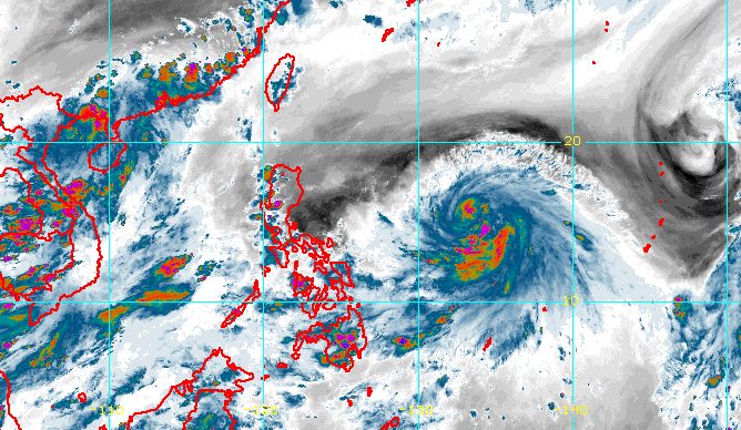
MANILA, Philippines – Tropical Storm Chedeng (Guchol) slightly intensified on Wednesday afternoon, June 7, while slowly moving west northwest over the Philippine Sea.
In a bulletin issued at 5 pm on Wednesday, the Philippine Atmospheric, Geophysical, and Astronomical Services Administration (PAGASA) said Chedeng now has maximum sustained winds of 85 kilometers per hour from the previous 75 km/h.
The tropical storm’s gustiness increased to 105 km/h from 90 km/h.
It was last spotted 1,150 kilometers east of southeastern Luzon, too far to affect the country.
Given Chedeng’s distance from Philippine landmass, it is not expected to directly bring rain to any part of the country in the next three to five days.
The raising of tropical cyclone wind signals also remains unlikely, and coastal waters are not affected.
But PAGASA is monitoring Chedeng’s possible enhancement of the southwest monsoon or habagat, which would depend on the tropical cyclone’s movement and intensity in the coming days.
The timing and intensity of monsoon rain, as well as the likelihood of gusts or sudden and strong winds, will be determined by the extent of the possible enhancement.
If PAGASA sees “an increasing chance” of heavy monsoon rain in the next three days, a weather advisory would be released.
In the meantime, the southwest monsoon will still trigger rain showers and thunderstorms in Palawan until Thursday, June 8.
Other parts of the country will only have isolated rain showers or localized thunderstorms.

PAGASA sees Chedeng moving northwest or west northwest from Wednesday to Saturday morning, June 10, before shifting more toward the north or north northeast for the rest of the weekend.
Chedeng is also expected to strengthen further in the next three to four days.
It could become a severe tropical storm on Wednesday evening or Thursday, and a typhoon late Thursday or Friday, June 9.
“Rapid intensification is not ruled out,” PAGASA said, adding that Chedeng might reach its peak intensity by Friday or Saturday.
Chedeng is the Philippines’ third tropical cyclone for 2023 and the first for June. PAGASA earlier estimated there would be one or two tropical cyclones during the month.
The weather bureau announced the start of the rainy season last Friday, June 2. – Rappler.com
Add a comment
How does this make you feel?


There are no comments yet. Add your comment to start the conversation.