SUMMARY
This is AI generated summarization, which may have errors. For context, always refer to the full article.
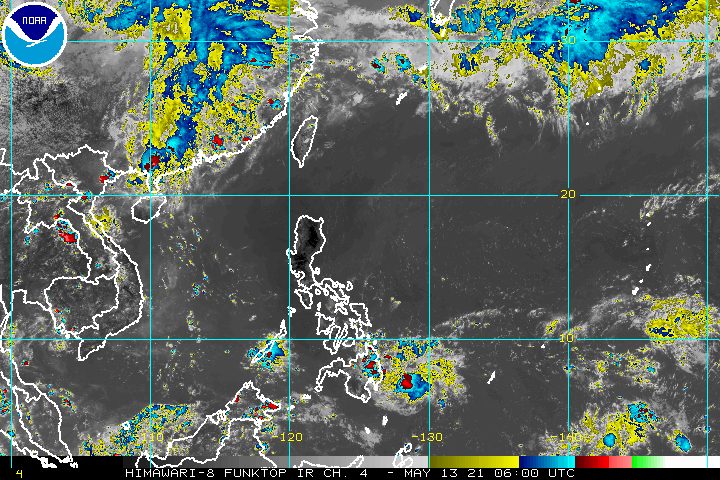
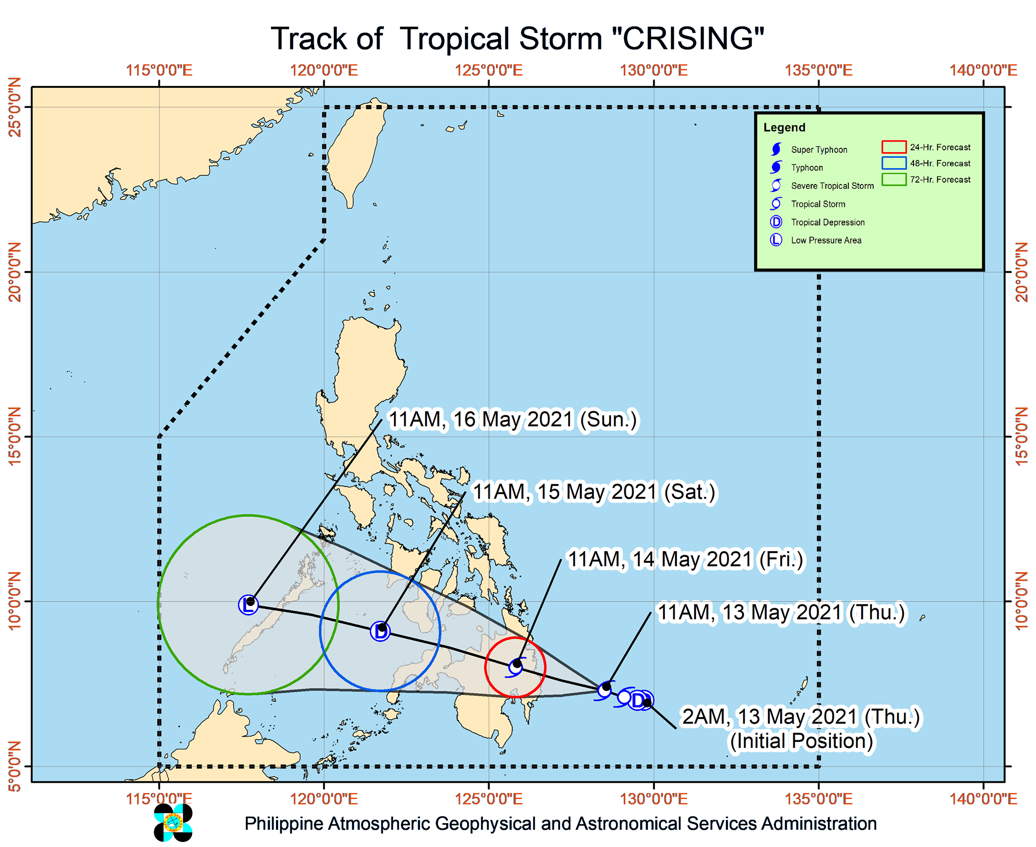
Tropical Storm Crising accelerated while heading for the provinces of Davao Oriental and Surigao del Sur in Mindanao early Thursday afternoon, May 13.
In a bulletin issued 2 pm on Thursday, the Philippine Atmospheric, Geophysical, and Astronomical Services Administration (PAGASA) said Crising was already 250 kilometers east of Davao City, Davao del Sur.
The tropical storm is moving west northwest at 25 kilometers per hour, more than double its previous speed of 10 km/h.
It maintained its strength, with maximum sustained winds of 65 km/h and gustiness of up to 80 km/h.
As Crising approaches, more areas have been placed under tropical cyclone wind signals as of 2 pm on Thursday.
Signal No. 2 (61 to 120 km/h)
- southern part of Surigao del Sur (Lingig, Bislig City)
- southern part of Agusan del Sur (Loreto, Trento, Bunawan, Santa Josefa, Veruela)
- northern part of Davao Oriental (Boston, Cateel, Baganga)
- northern part of Davao de Oro (Laak, Monkayo, Montevista, Compostela, New Bataan, Nabunturan, Mawab)
- northern part of Davao del Norte (Kapalong, San Isidro, Asuncion, New Corella, Talaingod)
Signal No. 1 (30 to 60 km/h)
- rest of Surigao del Sur
- rest of Agusan del Sur
- Agusan del Norte
- rest of Davao Oriental
- rest of Davao de Oro
- rest of Davao del Norte
- Davao City
- Bukidnon
- Lanao del Sur
- Lanao del Norte
- Misamis Occidental
- Misamis Oriental
- Camiguin
- eastern part of Zamboanga del Sur (Josefina, Molave, Tambulig, Aurora)
PAGASA said gale-force winds are expected in areas under Signal No. 2, while strong breeze to near-gale conditions will be experienced in areas under Signal No. 1.
The state weather bureau also maintained its rainfall forecast for Crising, warning that it could cause isolated to scattered floods and landslides between Thursday and Friday morning, May 14.
Moderate to heavy rain
- Surigao del Sur
- Agusan del Sur
- Davao Oriental
- Davao de Oro
- Davao del Norte
As for coastal conditions, moderate to rough waters are expected in the eastern seaboard of Mindanao for the next 24 hours, with waves 1.2 to 3 meters high.
PAGASA advised small vessels and “inexperienced mariners” not to venture out to sea.
Crising remains likely to make landfall in the Davao Oriental-Surigao del Sur area between Thursday night and early Friday morning.
Though it may strengthen a bit, Crising is forecast to maintain its tropical storm status as it hits land, according to PAGASA.
It will gradually lose strength as it crosses Mindanao’s rugged landmass on Friday, however, and could weaken into a tropical depression.
The state weather bureau expects Crising to emerge over the Sulu Sea early Saturday morning, May 15, then weaken further into a remnant low early Sunday morning, May 16, as it crosses Palawan. Shortly after that, it could dissipate. (READ: FAST FACTS: Tropical cyclones, rainfall advisories)
Crising is the Philippines’ third tropical cyclone for 2021 and the first for May.
For the next 6 months, PAGASA estimates the following number of tropical cyclones inside the Philippine Area of Responsibility:
- May – 0 or 1
- June – 1 or 2
- July – 1 to 3
- August – 2 or 3
- September – 2 or 3
- October – 2 or 3
The Philippines gets around 20 tropical cyclones each year. (READ: LIST: PAGASA’s names for tropical cyclones in 2021) – Rappler.com
Add a comment
How does this make you feel?


There are no comments yet. Add your comment to start the conversation.