SUMMARY
This is AI generated summarization, which may have errors. For context, always refer to the full article.
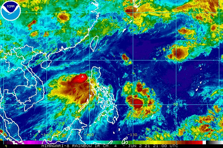
After hitting Batangas, Tropical Storm Dante (Choi-wan) moved over the coastal waters of Cavite, Bataan, and Zambales, said the state weather bureau before dawn on Thursday, June 3.
In a briefing past 5 am on Thursday, the Philippine Atmospheric, Geophysical, and Astronomical Services Administration (PAGASA) said Dante was already over the coastal waters of Santa Cruz, Zambales.
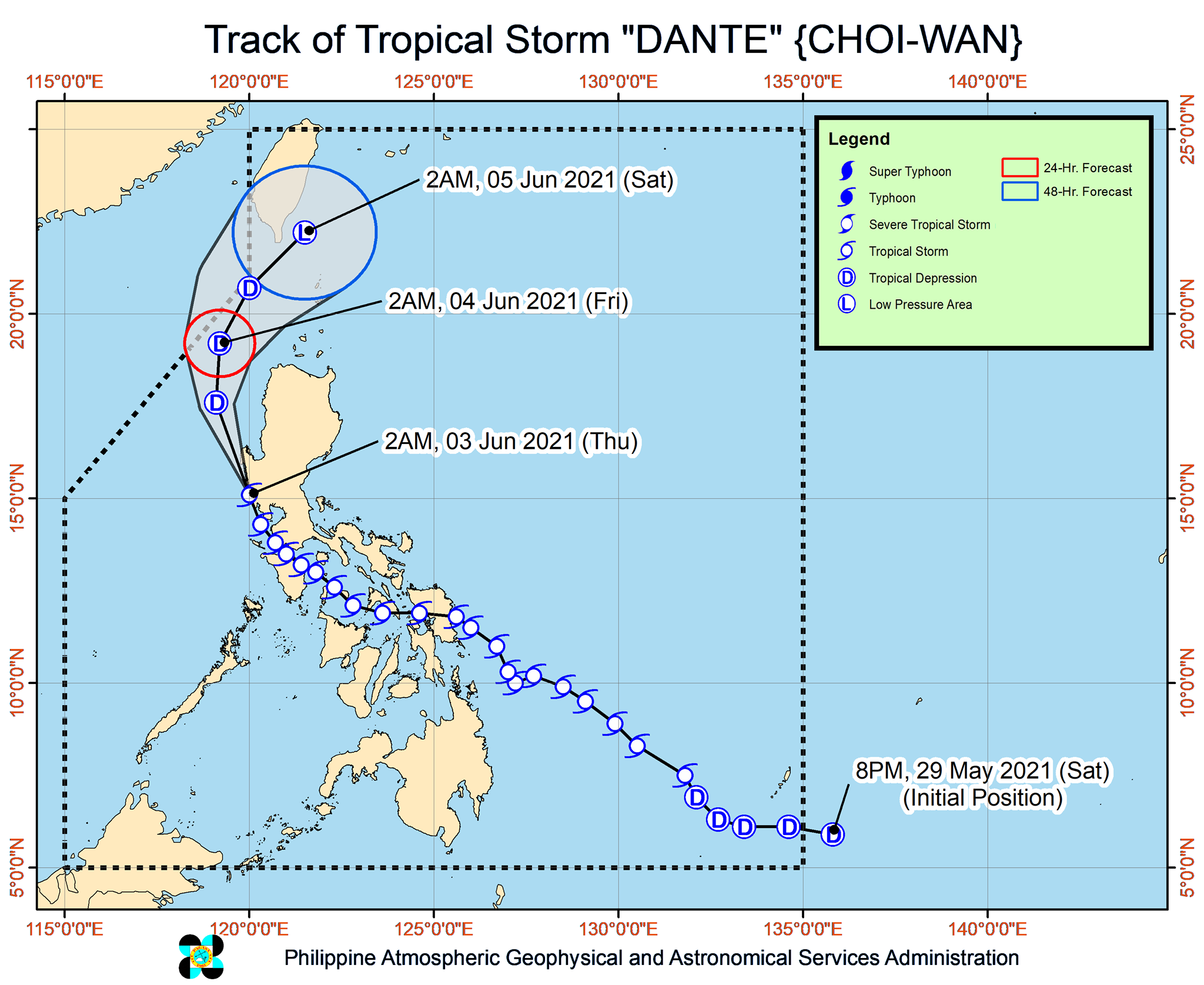
The tropical storm accelerated in the early hours of Thursday and is now moving north northwest at 25 kilometers per hour (km/h).
PAGASA said Dante will continue moving north northwest over the coastal waters of Zambales and Pangasinan, then shift more to the north over the West Philippine Sea.
Then it could turn northeast on Friday morning, June 4, moving over the Bashi Channel in the Luzon Strait near Taiwan’s southern coast.
PAGASA Weather Specialist Benison Estareja said a ninth landfall is now unlikely. Dante earlier made landfall eight times, in these areas:
Tuesday, June 1
- Sulat, Eastern Samar – 8:30 pm
Wednesday, June 2
- Cataingan, Masbate – 1 am
- Balud, Masbate – 3:30 am
- Romblon, Romblon – 8 am
- San Agustin, Romblon – 8:50 am
- Pola, Oriental Mindoro – 2 pm
- Maricaban Island, Tingloy, Batangas – 7:20 pm
- Calatagan, Batangas – 8 pm
Dante again maintained its strength early Thursday, with maximum sustained winds of 65 km/h and gustiness of up to 90 km/h.
But PAGASA said Dante is likely to weaken into a tropical depression in the next 12 hours – Thursday morning or afternoon – and into a remnant low by Saturday morning, June 5. (READ: FAST FACTS: Tropical cyclones, rainfall advisories)
Parts of Luzon will still have rain from Dante on Thursday. PAGASA noted that there remains the risk of scattered floods, which may become widespread in areas that have already seen significant rain in the past few days. Landslides are also possible.
Moderate to heavy rain
- Pangasinan
- Zambales
- Bataan
- Occidental Mindoro including Lubang Islands
- northern part of Palawan including Calamian Islands
Light to moderate rain, with at times heavy rain
- Ilocos Region
- Cordillera Administrative Region
- Nueva Ecija
- Tarlac
- Pampanga
- Bulacan
- Metro Manila
- Calabarzon
- Oriental Mindoro
- rest of Palawan including Cuyo and Kalayaan Islands
But with Dante moving over water, there are considerably fewer areas under tropical cyclone wind signals as of 5 am on Thursday.
Signal No. 2
Damaging gale-force winds prevailing or expected within 24 hours
- Zambales
- western part of Pangasinan (Infanta, Mabini, Sual, Labrador, Alaminos City, Anda, Bolinao, Bani, Agno, Burgos, Dasol)
Signal No. 1
Strong winds prevailing or expected within 36 hours
- central part of Pangasinan (Mangatarem, Aguilar, Bugallon, Lingayen, Binmaley, San Carlos City, Urbiztondo, Bayambang, Bautista, Alcala, Malasiqui, Basista, Santa Barbara, Mangaldan, San Fabian, Mapandan, San Jacinto, Dagupan City, Calasiao)
- Bataan
- Tarlac
- Pampanga
- western part of Bulacan (Malolos City, Calumpit, Paombong, Hagonoy, Bulacan, Pulilan, Plaridel, Guiguinto)
- western part of Cavite (Tanza, Trece Martires City, Indang, Alfonso, Rosario, Cavite City, Noveleta, General Trias City, Naic, Maragondon, General Emilio Aguinaldo, Magallanes, Ternate)
- western part of Batangas (Calatagan, Lian, Nasugbu, Tuy, Balayan)
- Lubang Island
PAGASA said winds in areas under Signal No. 2 could bring “generally light to moderate damage to structures and vegetation,” while winds in areas under Signal No. 1 may cause “generally very light damage.”
Dante is also continuing to trigger moderate to very rough seas in parts of Luzon on Thursday.
Rough to very rough seas (waves 2.5 to 4 meters high)
Travel is risky for small vessels, while “mariners without the proper experience should immediately seek safe harbor”
- seaboards of areas under Signal No. 2
Moderate to rough seas (waves 1.2 to 3 meters high)
Small vessels must take precautionary measures, while inexperienced mariners should avoid venturing out to sea
- seaboards of areas under Signal No. 1
- remaining seaboards of Northern Luzon
- eastern seaboard of Central Luzon
- remaining seaboards of Calabarzon
- remaining seaboards of Occidental Mindoro and Oriental Mindoro
- seaboard of Marinduque
- western seaboard of Romblon
Meanwhile, the low pressure area (LPA) that PAGASA has been monitoring entered the Philippine Area of Responsibility (PAR) at 2 am on Thursday.
The LPA was last spotted 1,135 kilometers east of Southern Luzon. It is still too far to affect the country.
Estareja said the LPA only has a slim chance of becoming a tropical cyclone, so far.
Dante is the Philippines’ fourth tropical cyclone for 2021. The country has an average of 20 tropical cyclones every year. (READ: LIST: PAGASA’s names for tropical cyclones in 2021)
For June to November, PAGASA estimates the following number of tropical cyclones inside PAR:
- June – 1 to 3
- July – 2 to 4
- August – 2 or 3
- September – 2 or 3
- October – 2 or 3
- November – 2 or 3
The state weather bureau is expected to declare the onset of the rainy season and the southwest monsoon or hanging habagat within the first half of June. – Rappler.com
Add a comment
How does this make you feel?


There are no comments yet. Add your comment to start the conversation.