SUMMARY
This is AI generated summarization, which may have errors. For context, always refer to the full article.
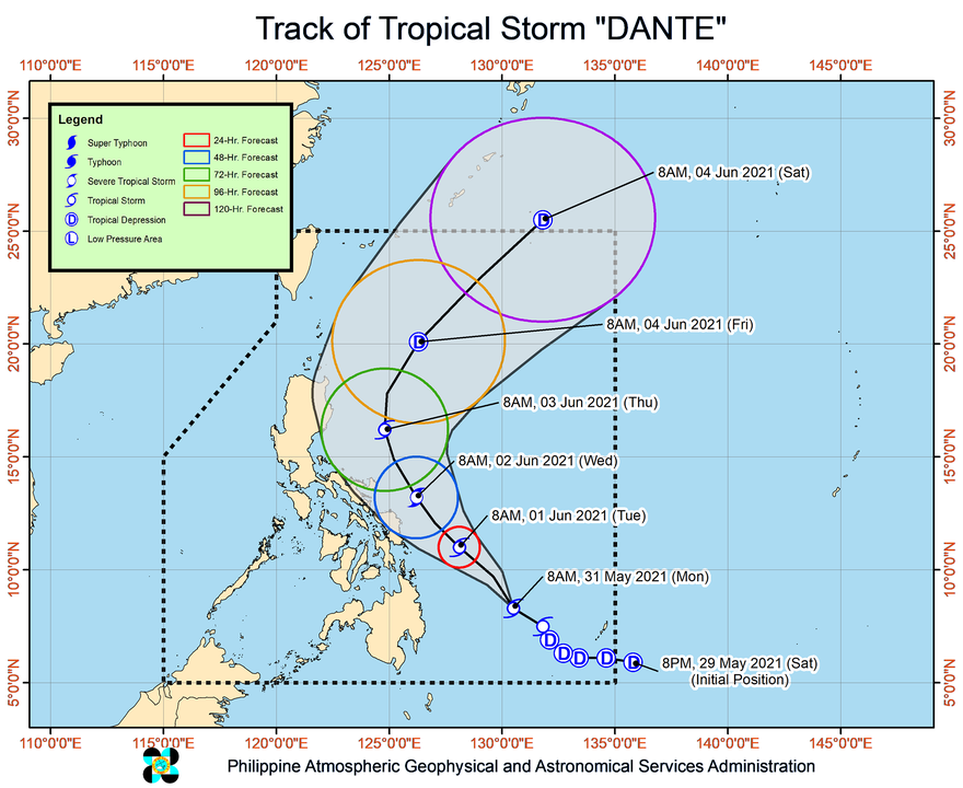
The state weather bureau advised parts of Mindanao to stay on alert for possible floods or landslides from Tropical Storm Dante, which was given the international name Choi-wan on Monday morning, May 31.
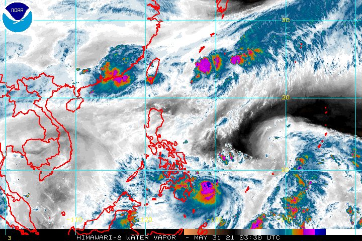
In a briefing past 11 am on Monday, the Philippine Atmospheric, Geophysical, and Astronomical Services Administration (PAGASA) said Dante was located 515 kilometers east northeast of Davao City or 445 kilometers east of Hinatuan, Surigao del Sur.
The tropical storm slightly accelerated, moving northwest over the Philippine Sea at 20 kilometers per hour from the previous 15 km/h.
Dante also slightly intensified. Its maximum sustained winds increased from 65 km/h to 75 km/h, while its gustiness rose from 80 km/h to 90 km/h. (READ: FAST FACTS: Tropical cyclones, rainfall advisories)
There is now a possibility of Dante reaching severe tropical storm status by Wednesday morning, June 2.
PAGASA emphasized that Dante could cause floods or landslides, despite its forecast track showing it is not expected to make landfall. The rain is due to the tropical storm’s outer rainbands.
Below is the rainfall forecast for Monday.
Light to moderate rain, with at times heavy rain
- Caraga
- Davao Region
- Soccsksargen
- Bukidnon
- Misamis Oriental
PAGASA also said gale-force winds extend outward up to 80 kilometers from the tropical storm’s center, or still over the Philippine Sea.
There are no areas under tropical cyclone wind signals due to Dante’s distance from land and projected path. But PAGASA said eastern parts of the Philippines could be placed under wind signals if Dante shifts west toward land or its wind radius expands.
The state weather bureau expects Dante to continue moving northwest in the next two days. Then it may turn north northwest on Thursday, June 3, and northeast on Friday, June 4.
Dante could leave the Philippine Area of Responsibility (PAR) on Saturday morning, June 5.
PAGASA said in its briefing on Monday that the criteria to declare the onset of the rainy season have not yet been met.
The normal onset of the Philippines’ rainy season is within the second half of May to the first half of June. It is also around this time that the southwest monsoon or hanging habagat usually gets underway.
For June to November, PAGASA estimates the following number of tropical cyclones inside PAR:
- June – 1 to 3
- July – 2 to 4
- August – 2 or 3
- September – 2 or 3
- October – 2 or 3
- November – 2 or 3
Dante is the Philippines’ fourth tropical cyclone for 2021. The country has an average of 20 tropical cyclones every year. (READ: LIST: PAGASA’s names for tropical cyclones in 2021) – Rappler.com
Add a comment
How does this make you feel?


There are no comments yet. Add your comment to start the conversation.