SUMMARY
This is AI generated summarization, which may have errors. For context, always refer to the full article.
Fabian intensified from a tropical depression into a tropical storm at 2 am on Sunday, July 18, and was given the international name In-fa.
In its 5 am bulletin on Sunday, the Philippine Atmospheric, Geophysical, and Astronomical Services Administration (PAGASA) said Fabian now has maximum sustained winds of 65 kilometers per hour and gustiness of up to 80 km/h.
It previously had maximum sustained winds of 55 km/h and gustiness of up to 70 km/h.
PAGASA expects Fabian to strengthen further into a severe tropical storm by Monday afternoon, July 19, and into a typhoon by Tuesday evening, July 20. Its intensity could peak at 140 km/h.
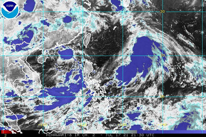
The tropical storm was last spotted 1,090 kilometers east northeast of extreme Northern Luzon. It slightly slowed down, moving north northwest at only 10 km/h from the previous 15 km/h. (READ: FAST FACTS: Tropical cyclones, rainfall advisories)
Fabian is not expected to approach Philippine landmass, so it will not bring rain to the country and there no areas under tropical cyclone wind signals. It is not affecting coastal waters, too.
But Fabian and a low pressure area (LPA), which is located outside the Philippine Area of Responsibility (PAR), will continue to enhance the southwest monsoon or hanging habagat.
The LPA was 630 kilometers west of Calayan, Cagayan, before dawn on Sunday.
The southwest monsoon, meanwhile, is affecting Southern Luzon, the Visayas, and Mindanao on Sunday.
PAGASA warned of monsoon rain in these areas:
- Palawan
- Occidental Mindoro
- Western Visayas
The following may also have scattered rain and thunderstorms due to the southwest monsoon:
- Metro Manila
- Ilocos Region
- rest of Mimaropa
- Bicol
- Zambales
- Bataan
- Cavite
- Batangas
- Laguna
- rest of Visayas
- Zamboanga Peninsula
- Tawi-Tawi
- Sulu
- Basilan
The rest of the country could experience localized thunderstorms.
Fabian is seen to maintain a north northwest or northwest direction until Monday evening, when it is expected to leave PAR.
Outside PAR, Fabian will move west northwest starting Tuesday. Then it could pass close to or make landfall in the vicinity of Japan’s Okinawa Islands on Tuesday afternoon and reach the East China Sea on Tuesday evening.
Fabian may eventually make landfall in mainland China on Friday morning, July 23, said PAGASA.
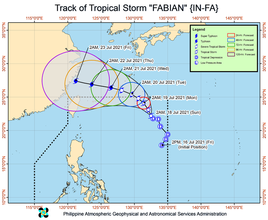
Fabian is the Philippines’ sixth tropical cyclone for 2021 and the second for July.
Around 20 tropical cyclones form within or enter PAR each year. (READ: LIST: PAGASA’s names for tropical cyclones in 2021)
For the rest of 2021, these are PAGASA’s estimates per month:
- July – 1 to 3
- August – 2 or 3
- September – 2 or 3
- October – 2 or 3
- November – 2 or 3
- December – 1 or 2
The rainy season has been underway since early June. – Rappler.com
Add a comment
How does this make you feel?


There are no comments yet. Add your comment to start the conversation.