SUMMARY
This is AI generated summarization, which may have errors. For context, always refer to the full article.
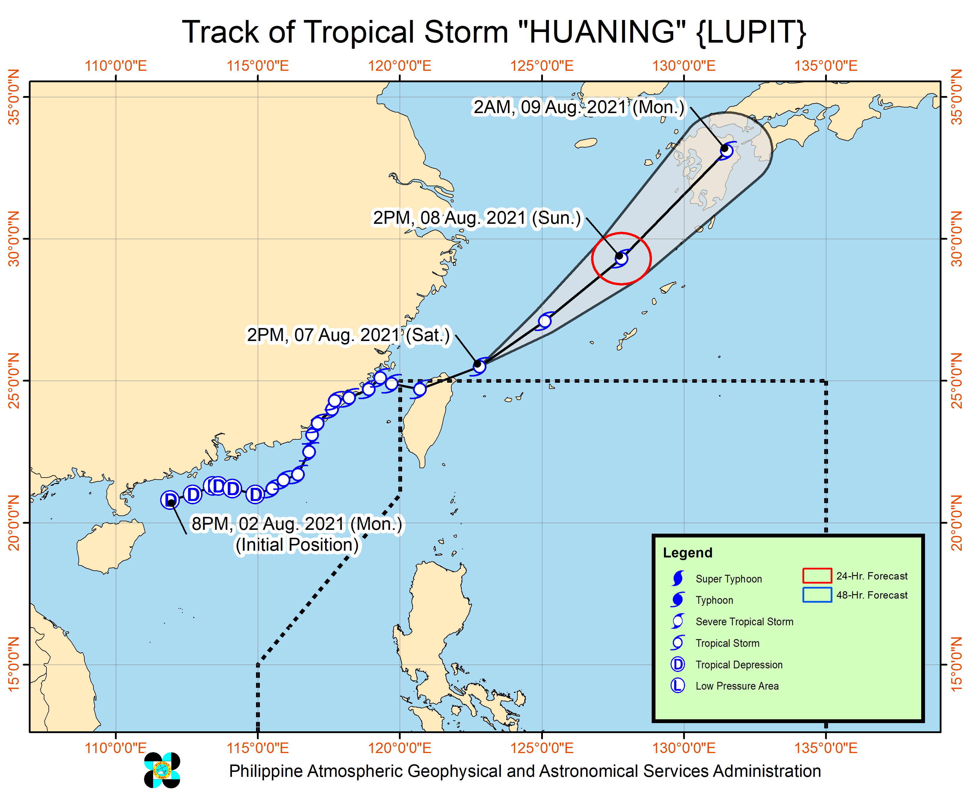
Tropical Storm Huaning (Lupit) left the Philippine Area of Responsibility (PAR) at 11 am on Saturday, August 7, only six hours after its entry at 5 am.
The Philippine Atmospheric, Geophysical, and Astronomical Services Administration (PAGASA) said in its 5 pm bulletin that Huaning was already 585 kilometers north northeast of Itbayat, Batanes.
The tropical storm accelerated, moving east northeast at 40 kilometers per hour from the previous 15 km/h.
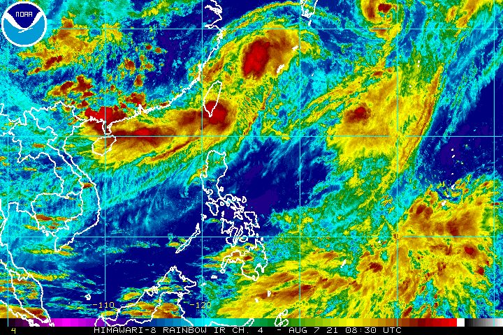
It is over the East China Sea, heading toward Kyushu in the southern part of Japan.
Earlier on Saturday, Huaning made landfall in Taiwan, which is located within PAR. (READ: FAST FACTS: Tropical cyclones, rainfall advisories)
Huaning did not bring rain to the Philippines and tropical cyclone wind signals were not raised.
So far, Huaning continues to have maximum sustained winds of 65 km/h, while its gustiness is up to 80 km/h. It is likely to stay a tropical storm.
Despite Huaning’s exit, it is still slightly enhancing the southwest monsoon or hanging habagat.
PAGASA said the enhanced southwest monsoon will continue to bring strong winds to the following areas:
- Batanes
- Babuyan Islands
- Ilocos Norte
- Ilocos Sur
- Apayao
- Abra
Rough to very rough seas, with waves 2.5 to 4.5 meters high, are also expected in these seaboards due to the southwest monsoon:
- northern seaboard of Northern Luzon
- western seaboards of Northern Luzon and Central Luzon
The state weather bureau warned that travel would be risky for small vessels.
Huaning was the Philippines’ eighth tropical cyclone for 2021 and the second for August.
The next tropical cyclone could come soon, as PAGASA is monitoring a new low pressure area (LPA) outside PAR, at 1,485 kilometers east of Mindanao.
The LPA might enter PAR on Sunday, August 8, and possibly develop into a tropical cyclone.
If it becomes a tropical cyclone, it would be given the local name Isang. (READ: LIST: PAGASA’s names for tropical cyclones in 2021)
PAGASA said the LPA or potential Isang is likely to move northwest toward Northern Luzon, but for now, a landfall scenario is unlikely.
Forecasts can still change in the coming days.
An average of 20 tropical cyclones form within or enter PAR each year. These are PAGASA’s latest available estimates per month:
2021
- August – 2 or 3
- September – 2 or 3
- October – 2 or 3
- November – 2 or 3
- December – 1 or 2
2022
- January – 0 or 1
The rainy season has been underway since early June. – Rappler.com
Add a comment
How does this make you feel?


There are no comments yet. Add your comment to start the conversation.