SUMMARY
This is AI generated summarization, which may have errors. For context, always refer to the full article.
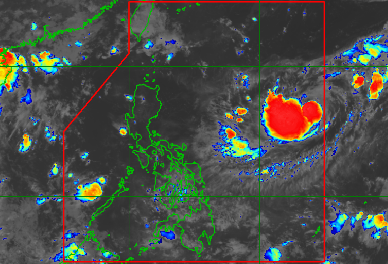
MANILA, Philippines – A tropical storm entered the Philippine Area of Responsibility (PAR) at 7 pm on Wednesday, September 7, and was given the local name Inday.
Tropical Storm Inday is the country’s ninth tropical cyclone for 2022 and the first for September.
In a bulletin issued at 10:45 pm on Wednesday, the Philippine Atmospheric, Geophysical, and Astronomical Services Administration (PAGASA) said Inday was located 1,355 kilometers east of Central Luzon.
The tropical storm is moving southwest at only 10 kilometers per hour (km/h).
It has maximum sustained winds of 75 km/h and gustiness of up to 90 km/h.
PAGASA said Inday is not expected to make landfall in the Philippines. There are no rainfall warnings or tropical cyclone wind signals in effect due to the tropical storm.
But Inday could trigger moderate to rough seas in the seaboards of extreme Northern Luzon during the weekend, according to the weather bureau. Waves may be 1.2 to 4 meters high, making conditions risky for small vessels.
PAGASA said Inday may head west northwest, then further northwest, on Thursday, September 8.
It could also intensify into a severe tropical storm on Thursday and into a typhoon by Friday, September 9.
Based on Inday’s latest forecast track, it might leave PAR on Monday, September 12.

PAGASA expects 7 to 11 tropical cyclones to enter or develop inside PAR from September 2022 to February 2023. Per month, these are the weather bureau’s estimates:
- September 2022 – 2 or 3
- October 2022 – 2 to 4
- November 2022 – 2 or 3
- December 2022 – 1 or 2
- January 2023 – 0 or 1
- February 2023 – 0 or 1
– Rappler.com
Add a comment
How does this make you feel?


There are no comments yet. Add your comment to start the conversation.