SUMMARY
This is AI generated summarization, which may have errors. For context, always refer to the full article.
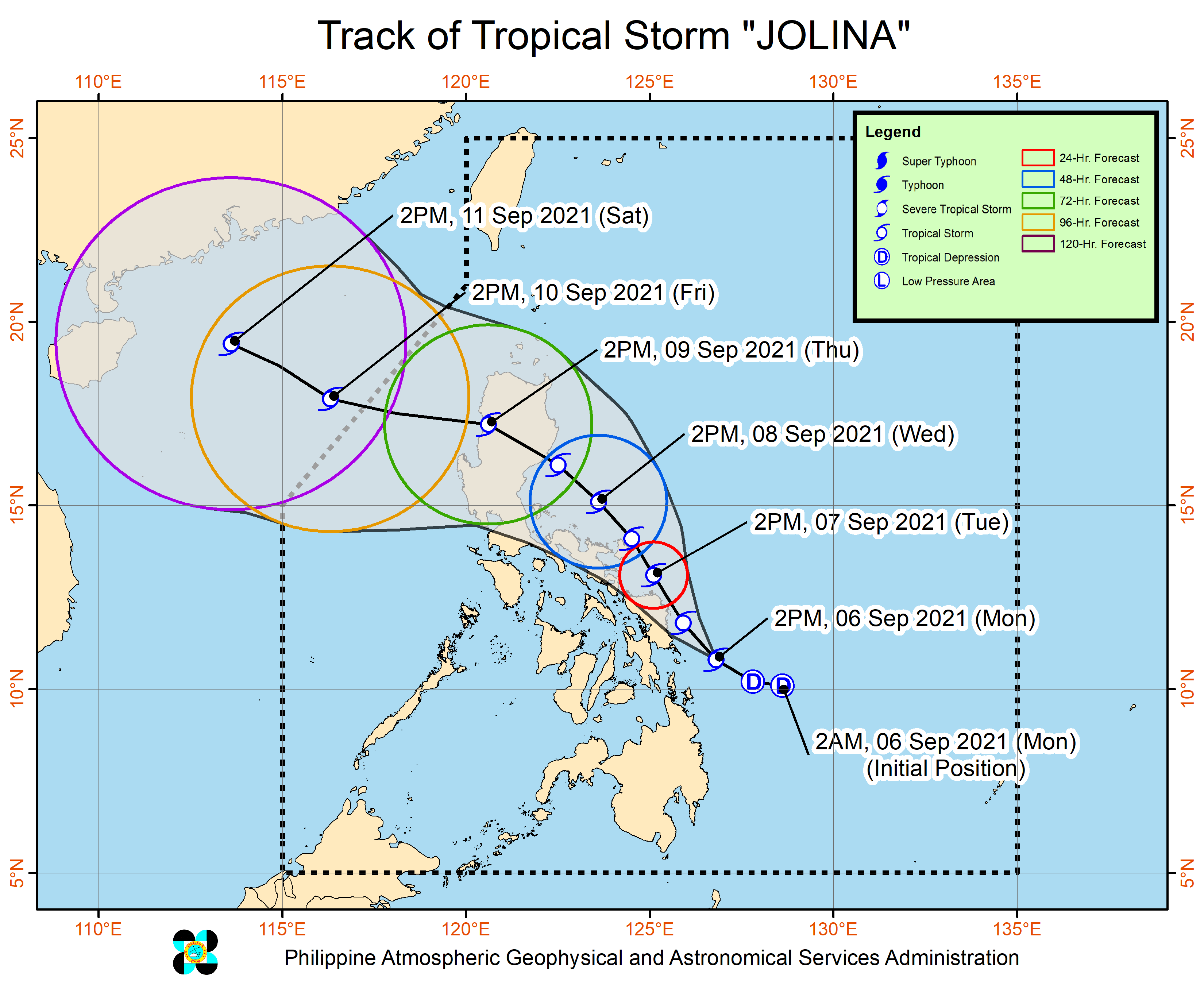
Jolina intensified from a tropical depression into a tropical storm at 2 pm on Monday, September 6, and was given the international name Conson.
Jolina now has maximum sustained winds of 75 kilometers per hour and gustiness of up to 90 km/h, the Philippine Atmospheric, Geophysical, and Astronomical Services Administration (PAGASA) said in a bulletin released past 5 pm on Monday.
It previously had maximum sustained winds of 55 km/h and gustiness of up to 70 km/h.
PAGASA said Jolina may continue to strengthen over the Philippine Sea and reach its peak intensity of 85 km/h, referring to maximum sustained winds, by Wednesday, September 8.
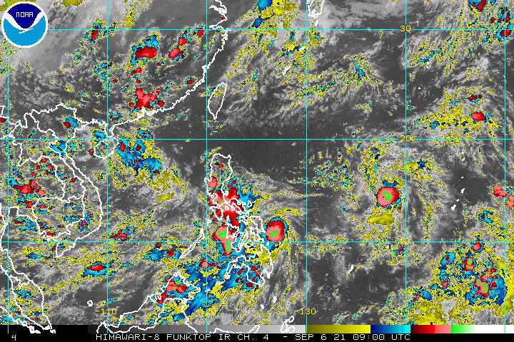
As of Monday afternoon, Jolina was last spotted 95 kilometers east of Guiuan, Eastern Samar.
The tropical storm is moving west northwest at a slightly faster 20 km/h from the previous 15 km/h.
Here is the updated rainfall forecast for Jolina, covering the next 24 hours:
Moderate to heavy rain, with at times intense rain
- Northern Samar
- Eastern Samar
- Sorsogon
Moderate to heavy rain
- rest of Visayas
- Bicol
PAGASA again warned that isolated to scattered flash floods and landslides could occur.
With Jolina becoming a tropical storm, Signal No. 2 has been declared and more areas have been placed under Signal No. 1. Below is the complete list of areas under tropical cyclone wind signals as of 5 pm on Monday.
Signal No. 2 (strong to gale-force winds)
- Eastern Samar
- eastern part of Northern Samar (Palapag, Mapanas, Gamay, Lapinig, Laoang, Catubig, Las Navas, Pambujan)
- northeastern part of Samar (Matuguinao)
Signal No. 1 (strong winds with occasional gusts)
- eastern part of Camarines Sur (Calabanga, Bombon, Magarao, Canaman, Camaligan, Gainza, Naga City, Milaor, Pili, Minalabac, Bula, Balatan, Nabua, Bato, Iriga City, Buhi, Baao, Ocampo, Sagñay, Tigaon, Goa, Tinambac, Siruma, Lagonoy, San Jose, Garchitorena, Presentacion, Caramoan, San Fernando)
- Catanduanes
- Albay
- Sorsogon
- Biliran
- eastern part of Leyte (Babatngon, San Miguel, Barugo, Alangalang, Tacloban City, Palo, Santa Fe, Pastrana, Dagami, Tanauan, Tabontabon, Tolosa, Dulag, Julita, Mayorga, MacArthur, Abuyog, Javier, La Paz, Burauen, Calubian, Leyte, Capoocan, Carigara, Jaro, Kananga, Ormoc City)
- eastern part of Southern Leyte (Silago, Hinunangan, Hinundayan, Anahawan)
- rest of Samar
- rest of Northern Samar
- Dinagat Islands
- Siargao and Bucas Grande in Surigao del Norte
Jolina will also continue to cause moderate to rough seas in the eastern seaboards of the Visayas and Mindanao in the next 24 hours. Small vessels should take precautionary measures, with waves 1.2 to 2.8 meters high.
PAGASA expects Jolina to move generally northwest, parallel to the Philippines’ east coast, until it makes landfall in the Northern Luzon-Central Luzon area by Thursday morning, September 9.
Then the tropical storm could cross the Northern Luzon-Central Luzon area and emerge over the West Philippine Sea by Thursday evening. At this point, it may slightly weaken due to the rugged terrain.
The state weather bureau noted, however, that Jolina might make landfall in Eastern Samar or Northern Samar if its track shifts toward the west.
Jolina is likely to leave the Philippine Area of Responsibility (PAR) by Friday morning, September 10.
Aside from Jolina, PAGASA is still monitoring a tropical depression outside PAR.
The tropical depression was located 1,530 kilometers east of Southern Luzon on Monday afternoon, slowly moving north northwest.
It slightly intensified and now has maximum sustained winds of 55 km/h and gustiness of up to 70 km/h.
PAGASA earlier said this tropical depression may enter PAR on Wednesday morning, but it is not projected to make landfall. If it enters, it would be given the local name Kiko. (READ: FAST FACTS: Tropical cyclones, rainfall advisories)
Jolina is the Philippines’ 10th tropical cyclone for 2021 and the first for September.
For the next six months, these are PAGASA’s estimates for the number of tropical cyclones inside PAR:
2021
- September – 2 or 3
- October – 2 or 3
- November – 2 or 3
- December – 1 or 2
2022
- January – 0 or 1
- February – 0 or 1
An average of 20 tropical cyclones form within or enter PAR each year. (READ: LIST: PAGASA’s names for tropical cyclones in 2021) – Rappler.com
Add a comment
How does this make you feel?


There are no comments yet. Add your comment to start the conversation.