SUMMARY
This is AI generated summarization, which may have errors. For context, always refer to the full article.
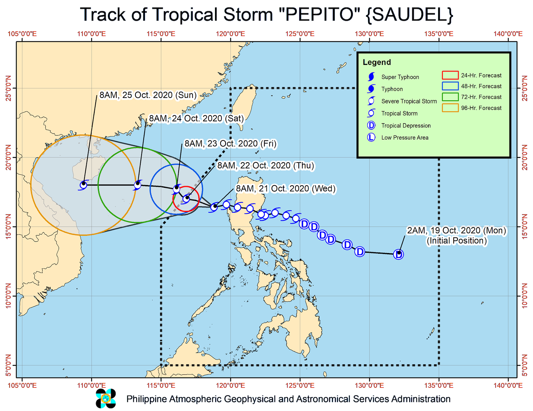
There are no more areas under Signal No. 2 and most areas were removed from Signal No. 1 as of late Wednesday morning, October 21, with Tropical Storm Pepito (Saudel) gradually moving away from land.
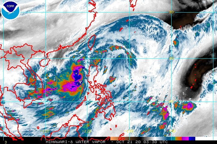
In a bulletin issued 11 am on Wednesday, the Philippine Atmospheric, Geophysical, and Astronomical Services Administration (PAGASA) said Pepito is already 210 kilometers west of Dagupan City, Pangasinan.
It is moving west over the West Philippine Sea at the same speed of 30 kilometers per hour (km/h).
Pepito had made landfall in San Ildefonso Peninsula in Casiguran, Aurora, at 9 pm on Tuesday, October 20.
On Wednesday morning, Pepito slightly intensified, with maximum winds of 85 km/h from the previous 75 km/h and gustiness of up to 105 km/h from the previous 90 km/h.
It is likely to continue strengthening, and may reach severe tropical storm category on Wednesday evening or on Thursday morning, October 22. (READ: FAST FACTS: Tropical cyclones, rainfall advisories)
Only the western part of Pangasinan remains under Signal No. 1, covering Bolinao, Anda, Bani, Agno, Alaminos City, Mabini, Burgos, Dasol, Sual, Labrador, and Infanta.
PAGASA said “strong- to near gale-force winds” will persist in the western part of Pangasinan.
“High to gale-force winds” due to the northeasterly surface windflow are also expected in the rest of Northern Luzon, especially in coastal and mountainous areas.
For the rest of Wednesday, parts of Luzon will still have rain – mostly light to moderate, but may be heavy at times:
- Batanes
- Babuyan Islands
- Zambales
- Bataan
- Occidental Mindoro
- Palawan
Rough to very rough seas, with waves 2.5 to 5.5 meters high, also persist in areas where Signal No. 1 and a gale warning are in effect. Travel remains risky, especially for small vessels, in these seaboards:
- entire seaboards of Northern Luzon and Central Luzon
- seaboard of northern Quezon including Polillo Island
- western seaboards of Batangas, Occidental Mindoro (including Lubang Islands), and Palawan (including Calamian and Kalayaan Islands)
Moderate to rough seas, with waves 1.5 to 3 meters high, are seen in the eastern seaboards of the following:
- southern part of Quezon
- Bicol
- Eastern Visayas
- Caraga
- Davao Region
PAGASA reminded small vessels to take precautionary measures. It added that “inexperienced mariners should avoid navigating in these conditions.”
Pepito could exit the Philippine Area of Responsibility (PAR) on Thursday morning or afternoon.
Beginning Friday, October 23, it may accelerate and turn west toward the central part of Vietnam, said PAGASA.
Meanwhile, a tropical depression remains outside PAR, at 1,895 kilometers east northeast of extreme Northern Luzon as of late Wednesday morning.
It still has maximum winds of 55 km/h and gustiness of up to 70 km/h.
PAGASA said the tropical depression remains almost stationary or hardly moving, and is still unlikely to enter PAR.
Pepito is the Philippines’ 16th tropical cyclone for 2020, and the 3rd for October.
An average of 20 tropical cyclones form within or enter PAR each year. (READ: LIST: PAGASA’s names for tropical cyclones in 2020)
PAGASA gave the following estimates for the number of tropical cyclones inside PAR in the next 6 months:
- October 2020 – 2 or 3
- November 2020 – 1 or 2
- December 2020 – 1 or 2
- January 2021 – 1 or 2
- February 2021 – 0 or 1
- March 2021 – 0 or 1
Last October 2, the state weather bureau warned Filipinos to expect more rain in the coming months due to the onset of La Niña. – Rappler.com
Add a comment
How does this make you feel?


There are no comments yet. Add your comment to start the conversation.