SUMMARY
This is AI generated summarization, which may have errors. For context, always refer to the full article.
What’s the weather like in your area? Tweet us at @rapplerdotcom.
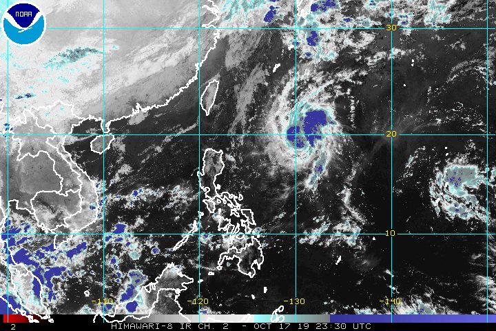
MANILA, Philippines – Perla intensified from a tropical depression into a tropical storm at 2 am on Friday, October 18. It has been given the international name Neoguri.
In a briefing at 5 am on Friday, the Philippine Atmospheric, Geophysical, and Astronomical Services Administration (PAGASA) said Tropical Storm Perla (Neoguri) now has maximum winds of 65 kilometers per hour (km/h) from the previous 55 km/h and gustiness of up to 80 km/h from the previous 70 km/h.
But Perla is seen to return to being a tropical depression, and then eventually into a low pressure area, while still inside the Philippine Area of Responsibility.
It is already 790 kilometers east of Basco, Batanes, almost stationary or hardly moving at the moment.
PAGASA Weather Specialist Ezra Bulquerin noted that Perla has significantly shifted direction, and is now expected to move northeast and then north. Landfall is unlikely given this track.
There are no areas under tropical cyclone wind signals, too. (READ: FAST FACTS: Tropical cyclones, rainfall advisories)
But Perla could trigger scattered rain and thunderstorms in the following areas beginning Saturday, October 19, or Sunday, October 20:
- Batanes
- Cagayan including Babuyan Group of Islands
- Apayao
Light rain is already expected in Batanes and Cagayan on Friday because of the northeasterly surface windflow. But PAGASA said the rain will have “no significant impact.”
Also due to the northeasterly surface windflow, travel is risky in the seaboards of Northern Luzon, especially for small vessels.
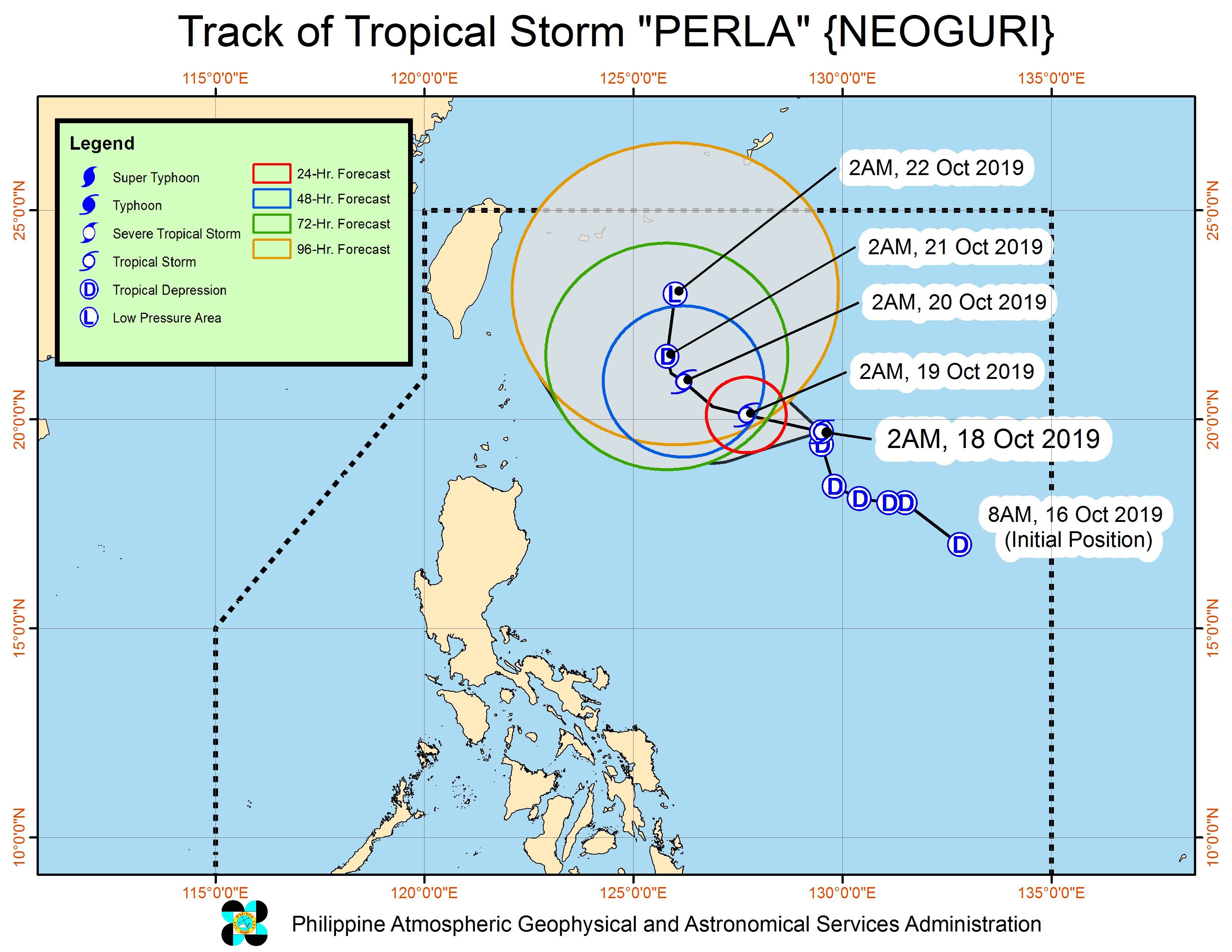
Perla is the Philippines’ 16th tropical cyclone for 2019, and the 1st for October. (READ: LIST: PAGASA’s names for tropical cyclones in 2019)
The country gets an average of 20 tropical cyclones annually, but since 2019 is an El Niño year, only 14 to 18 tropical cyclones are expected.
Below is the estimated number of tropical cyclones from October to December:
- October – 2 or 3
- November – 1 or 2
- December – 0 or 1
Meanwhile, the intertropical convergence zone (ITCZ) will bring scattered rainshowers and thunderstorms to these areas on Friday:
- Zamboanga Peninsula
- Western Visayas
- Palawan
PAGASA defines the ITCZ as a “series of low pressure areas brought about by converging northeast and southeast winds that cause thunderstorms and rainshowers.”
Other parts of the country, not affected by the ITCZ or the northeasterly surface windflow, will continue to have fair weather. There may just be isolated rainshowers or localized thunderstorms, mostly in the afternoon or evening.
PAGASA declared the start of the rainy season last June 14. – Rappler.com
Add a comment
How does this make you feel?
There are no comments yet. Add your comment to start the conversation.