SUMMARY
This is AI generated summarization, which may have errors. For context, always refer to the full article.
More parts of Bicol, Eastern Visayas, and Calabarzon were placed under Signal No. 1 before dawn on Tuesday, November 10, due to the slower Tropical Storm Ulysses (Vamco).
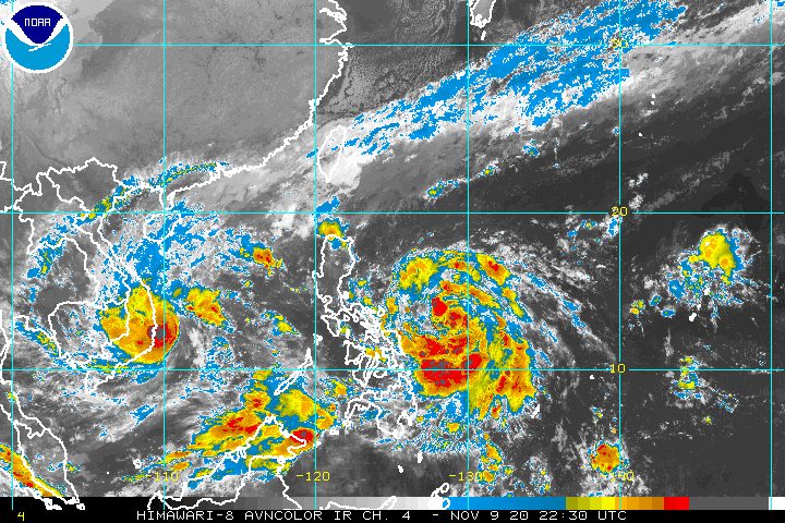
The Philippine Atmospheric, Geophysical, and Astronomical Services Administration (PAGASA) said in its 5 am bulletin on Tuesday that Ulysses is now 555 kilometers east of Virac, Catanduanes, slowly moving northwest.
The tropical storm continues to have maximum sustained winds of 65 kilometers per hour (km/h) and gustiness of up to 80 km/h. (READ: FAST FACTS: Tropical cyclones, rainfall advisories)
Below are the areas under Signal No. 1 as of 5 am on Tuesday. These areas should watch out for “strong breeze to near gale conditions.”
- Catanduanes
- Camarines Norte
- Camarines Sur
- Albay
- Sorsogon
- eastern part of Masbate (Aroroy, Pio V. Corpuz, Cataingan, Palanas, Uson, Dimasalang, Masbate City, Mobo, Baleno) including Ticao and Burias Islands
- southeastern part of Quezon (Guinayangan, Tagkawayan, Buenavista, San Andres, San Narciso)
- Northern Samar
- northern part of Samar (Santo Niño, Almagro, Tagapul-an, Tarangnan, Calbayog City, Santa Margarita, Gandara, Pagsanghan, San Jorge, San Jose de Buan, Matuguinao)
- northern part of Eastern Samar (Maslog, Dolores, Oras, San Policarpo, Arteche, Jipapad)
Light to moderate rain from Ulysses, as well as the tail-end of a cold front, will be experienced on Tuesday. The rain may be heavy at times, so the public must be on alert for possible floods and landslides.
Due to Ulysses
- Aurora
- Quezon
- Bicol
- Eastern Visayas
- Caraga
- Davao Region
Due to tail-end of a cold front
- Cagayan including Babuyan Islands
- Isabela
- Apayao
Meanwhile, travel is risky in the next 24 hours, especially for small vessels, in the seaboards listed below.
Rough to very rough seas (waves 2.5 to 5 meters high)
Due to surge of northeast monsoon
- seaboards of Northern Luzon
- seaboards of Kalayaan Islands
Rough to very rough seas (waves 2.5 to 4.5 meters high)
Due to Ulysses
- seaboards of areas under Signal No. 1, Aurora, and northern Quezon (including the northern and eastern coastal waters of Polillo Island)
- eastern seaboard of Eastern Samar (parts not under Signal No. 1)
Small vessels must take precautionary measures when venturing out to sea in the areas below, added PAGASA.
Moderate to rough seas
- western seaboards of Central Luzon and Southern Luzon
- eastern seaboard of Mindanao
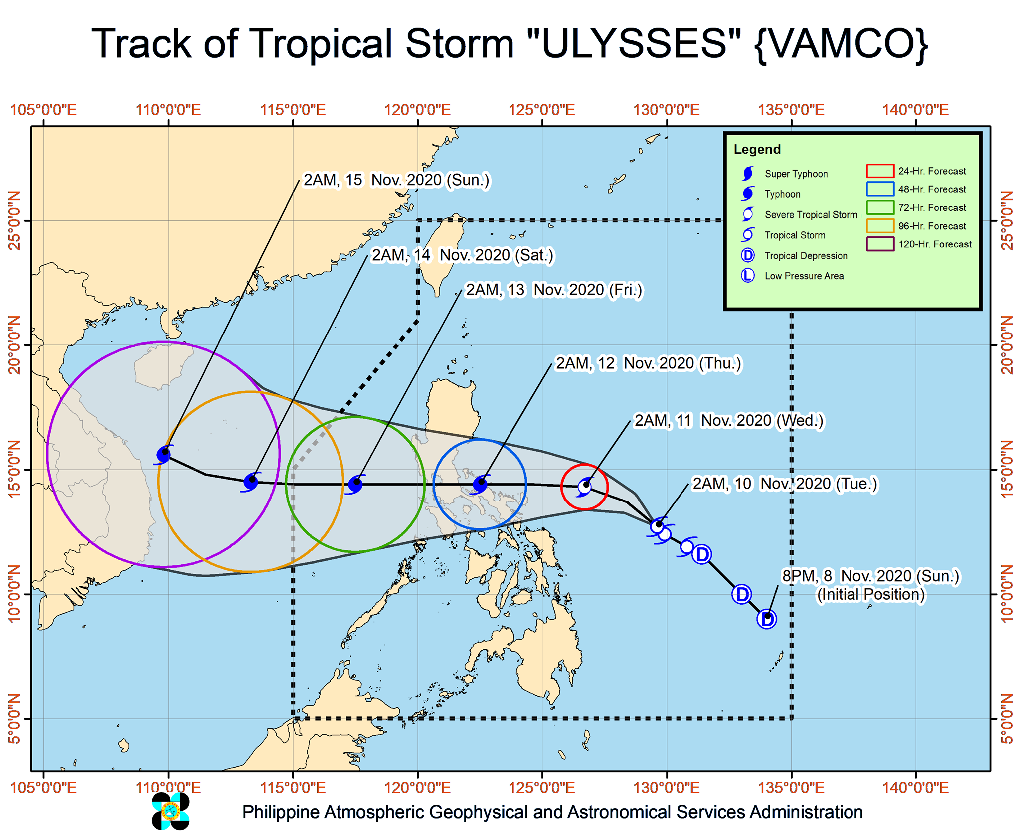
PAGASA said Ulysses may intensify into a severe tropical storm on Tuesday evening, then into a typhoon by Wednesday morning, November 11.
As a typhoon, it may reach its peak intensity of 140 to 155 km/h on Wednesday afternoon or evening.
“Landfall at or near peak intensity is highly likely,” warned PAGASA.
There are still two scenarios for Ulysses’ landfall.
The first is that it could make landfall in Quezon on Thursday morning, November 12, after going very near two provinces in the region of Bicol – Catanduanes on Wednesday afternoon and Camarines Norte on Wednesday evening.
The second is that it may make landfall in Bicol on Wednesday afternoon or evening. There is an “increasing likelihood” of this happening, according to PAGASA, due to the “slight shift” in Ulysses’ projected track.
Catanduanes was severely affected by Super Typhoon Rolly (Goni) just over a week ago, and now faces another threat.
The state weather bureau said more areas will be included under Signal No. 1 in its next bulletin at 11 am on Tuesday. As early as Tuesday evening, Signal No. 2 may also be raised in parts of Bicol.
The highest possible tropical cyclone wind signal that could be raised due to Ulysses is Signal No. 3.
Ulysses could exit the Philippine Area of Responsibility (PAR) on Friday, November 13.
Ulysses is the Philippines’ 21st tropical cyclone for 2020 – already above the yearly average of 20. (READ: LIST: PAGASA’s names for tropical cyclones in 2020)
For the next 6 months, these are PAGASA’s estimates for tropical cyclones inside PAR:
- November 2020 – 1 to 3
- December 2020 – 2 or 3
- January 2021 – 0 or 1
- February 2021 – 0 or 1
- March 2021 – 0 or 1
- April 2021 – 0 or 1
Since October, La Niña has been underway, which means there is more rain than usual.
Then in November, the northeast monsoon began, signaling “surges of cold temperatures.”
PAGASA warned that La Niña may enhance the northeast monsoon, which could trigger floods and landslides. – Rappler.com
Add a comment
How does this make you feel?


There are no comments yet. Add your comment to start the conversation.